MyTopo
Leakesville SW Mississippi US Topo Map
Couldn't load pickup availability
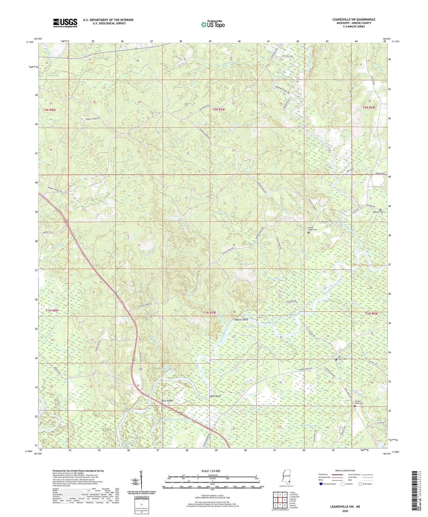
2024 topographic map quadrangle Leakesville SW in the state of Mississippi. Scale: 1:24000. Based on the newly updated USGS 7.5' US Topo map series, this map is in the following counties: Greene. The map contains contour data, water features, and other items you are used to seeing on USGS maps, but also has updated roads and other features. This is the next generation of topographic maps. Printed on high-quality waterproof paper with UV fade-resistant inks.
Quads adjacent to this one:
West: McLain
Northwest: Neely
North: Jonathan
Northeast: Leakesville
East: Vernal
Southeast: Lucedale
South: Merrill
Southwest: Avent
This map covers the same area as the classic USGS quad with code o31088a6.
Contains the following named places: Ard Branch, Bear Pond Branch, Big Creek, Brushy Creek, Colemans Ferry, Colonel Merrill Lake, Congregational Church, Conn Creek, Cowans Dead River, Coward Place Cemetery, Denny Branch, Dressler Hammond Dead River, Evans Creek, Gatling Creek, Grace Church, Green Lodge Cemetery, Hammill Creek, Hogan Creek, Lige Branch, Little Creek, Long Lake, McInnis Creek, McManus Post Office, Midway Church, Miller Bridge, Mount Zion Church, New Hope Church, Pine Grove Cemetery, Pine Grove Church, Rattlesnake Lake, Redbird Lake, Roberts Bluff, Roberts Lake, Round Lake, Shell Bluff, Skinner Creek, Spring Lake, Vernal School, Williams Cemetery