MyTopo
Morgantown Mississippi US Topo Map
Couldn't load pickup availability
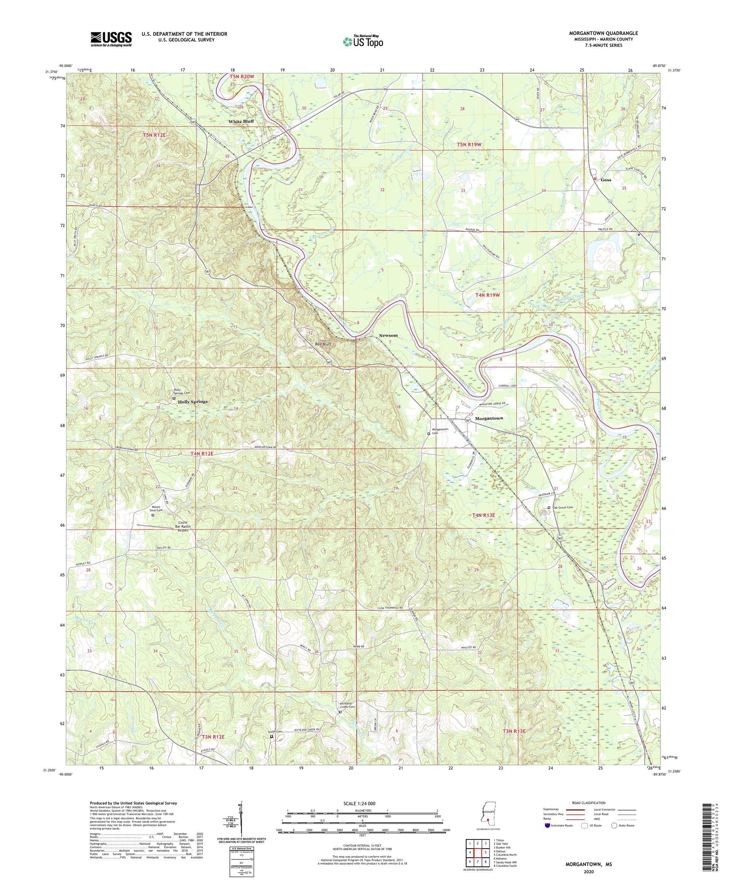
2020 topographic map quadrangle Morgantown in the state of Mississippi. Scale: 1:24000. Based on the newly updated USGS 7.5' US Topo map series, this map is in the following counties: Marion. The map contains contour data, water features, and other items you are used to seeing on USGS maps, but also has updated roads and other features. This is the next generation of topographic maps. Printed on high-quality waterproof paper with UV fade-resistant inks.
Quads adjacent to this one:
West: Darbun
Northwest: Tilton
North: Oak Vale
Northeast: Bunker Hill
East: Columbia North
Southeast: Columbia South
South: Sandy Hook NW
Southwest: Kokomo
Contains the following named places: Buford Consolidated School, Circle Bar Ranch Airport, Cypress Creek, Dry Creek, Fenny Creek, Goss, Goss Baptist Church, Goss School, Greens Creek Oil Field, Holiday Creek, Holly Springs, Holly Springs Cemetery, Holly Springs Church, Lightville, Morgantown, Morgantown Cemetery, Morgantown Church of God, Morgantown High School, Morgantown Oil Field, Mount Sinai Cemetery, Mount Sinai Church, Newsom, Newson Oil Field, Oak Grove Cemetery, Oak Grove Church, Pierce Creek, Red Bluff, Richland Creek Cemetery, Richland Creek Church, Smith Cemetery, Supervisor District 3, Tri Community Volunteer Fire Department Station 2, Twitty Creek, White Bluff, White Bluff Church