MyTopo
Darbun Mississippi US Topo Map
Couldn't load pickup availability
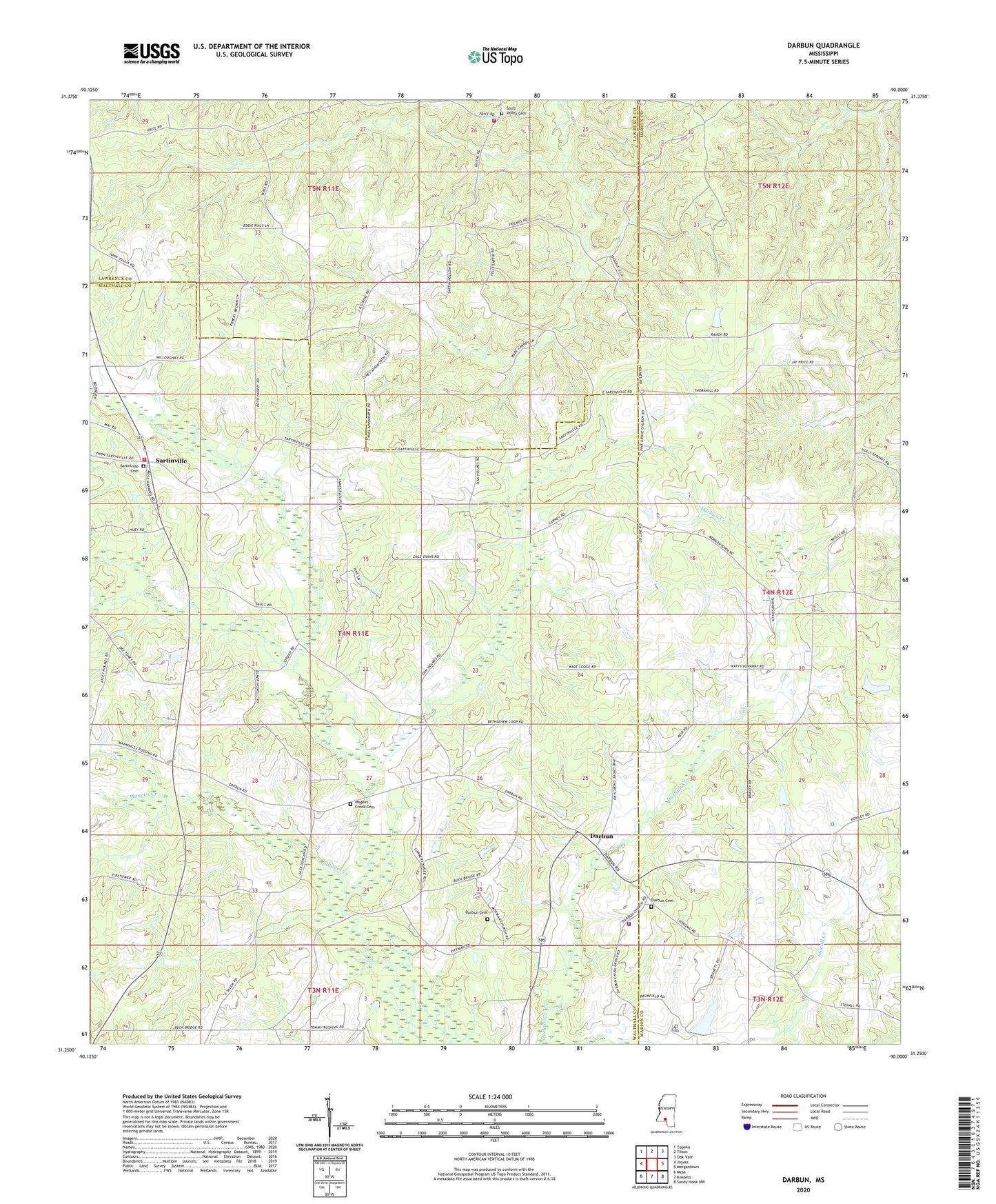
2024 topographic map quadrangle Darbun in the state of Mississippi. Scale: 1:24000. Based on the newly updated USGS 7.5' US Topo map series, this map is in the following counties: Walthall, Marion, Lawrence. The map contains contour data, water features, and other items you are used to seeing on USGS maps, but also has updated roads and other features. This is the next generation of topographic maps. Printed on high-quality waterproof paper with UV fade-resistant inks.
Quads adjacent to this one:
West: Jayess
Northwest: Topeka
North: Tilton
Northeast: Oak Vale
East: Morgantown
Southeast: Sandy Hook NW
South: Kokomo
Southwest: Mesa
This map covers the same area as the classic USGS quad with code o31090c1.
Contains the following named places: 3J Poultry Ranch, 4th District Volunteer Fire Department Station 1, 4th District Volunteer Fire Department Station 3, Bethehelm Baptist Church, Bucking Spur Ranch, Darbun, Darbun Cemetery, Durban Mennonite Church, Latter Day Saints Church, Magees Creek Cemetery, Magees Creek Church, Pine Grove United Pentecostal Church, Rials Farms, Salem Church, Sartinville, Sartinville Cemetery, Sartinville Church, Sauls Valley Cemetery, Tilton Volunteer Fire Department