MyTopo
Bunker Hill Mississippi US Topo Map
Couldn't load pickup availability
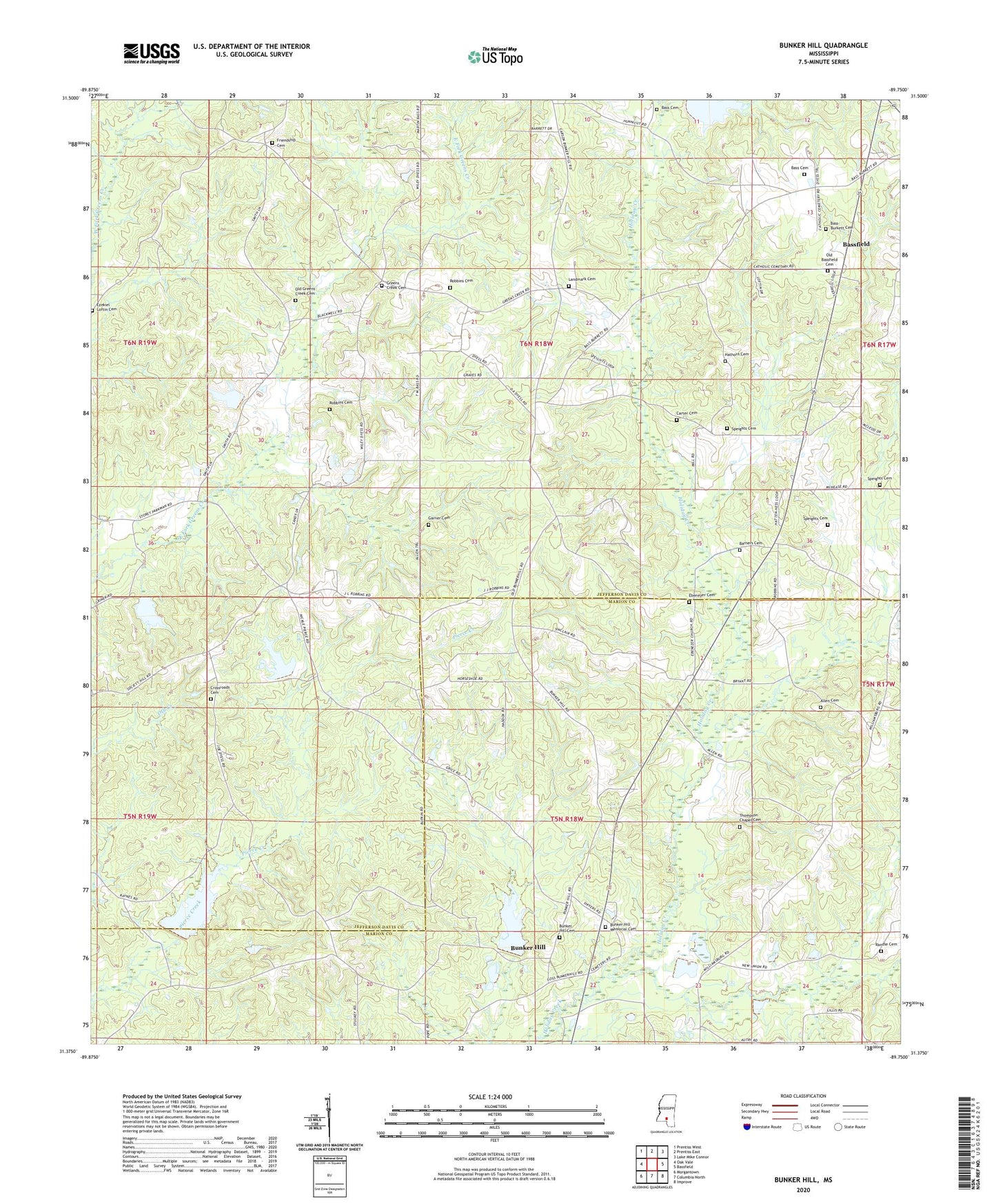
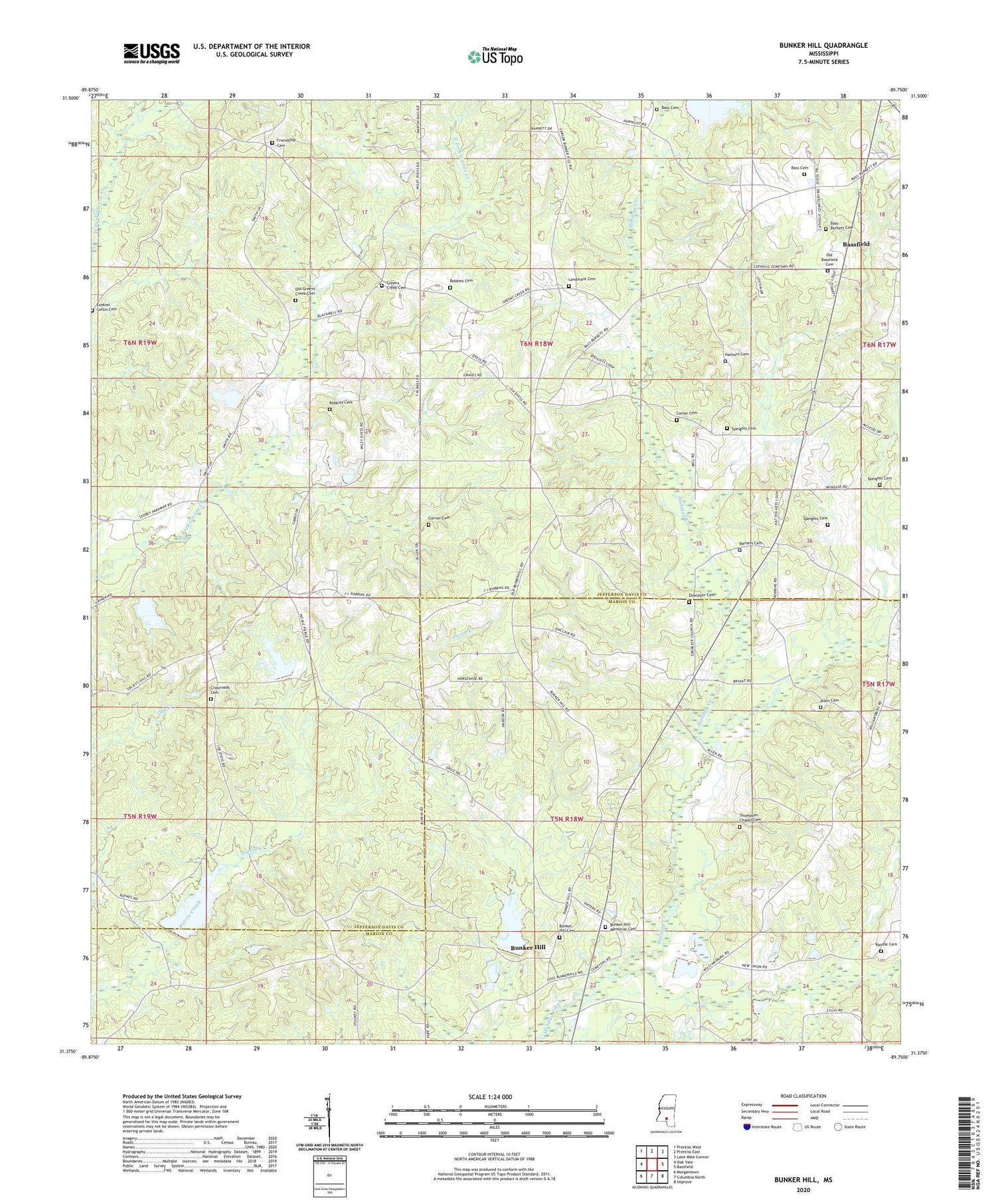
2024 topographic map quadrangle Bunker Hill in the state of Mississippi. Scale: 1:24000. Based on the newly updated USGS 7.5' US Topo map series, this map is in the following counties: Jefferson Davis, Marion. The map contains contour data, water features, and other items you are used to seeing on USGS maps, but also has updated roads and other features. This is the next generation of topographic maps. Printed on high-quality waterproof paper with UV fade-resistant inks.
Quads adjacent to this one:
West: Oak Vale
Northwest: Prentiss West
North: Prentiss East
Northeast: Lake Mike Connor
East: Bassfield
Southeast: Improve
South: Columbia North
Southwest: Morgantown
This map covers the same area as the classic USGS quad with code o31089d7.
Contains the following named places: Allen Cemetery, Armstrong School, Barners Cemetery, Bass Cemetery, Bass-Burkett Cemetery, Bunker Hill, Bunker Hill Baptist Church, Bunker Hill Cemetery, Bunker Hill Memorial Cemetery, Bunker Hill School, Carter Cemetery, Choctaw Creek, Cross Roads School, Crossroads Cemetery, Crossroads Church, Dean Griner Lake Dam, Dyess Mill, Ebenezer, Ebenezer Baptist Church, Ebenezer Cemetery, Ezekiel Loftin Cemetery, Floyd Dyess Lake Dam, Friendship Cemetery, Friendship Church, Garner Cemetery, Greens Creek Baptist Church, Greens Creek Cemetery, Greens Creek Lookout Tower, Greens Creek School, Hathorn Cemetery, Holiday Creek Structure 4 Dam, Holiday Creek Watershed Structure 3 Dam, Landmark Cemetery, Old Bassfield, Old Bassfield Cemetery, Old Greens Creek Cemetery, Randle Cemetery, Robbins Cemetery, Shaw Ponds Dam, Shorts Chapel, Speights Cemetery, Supervisor District 2, Thompson Chapel Cemetery, Wilkes Mill, ZIP Code: 39427