MyTopo
Pleasant Grove Mississippi US Topo Map
Couldn't load pickup availability
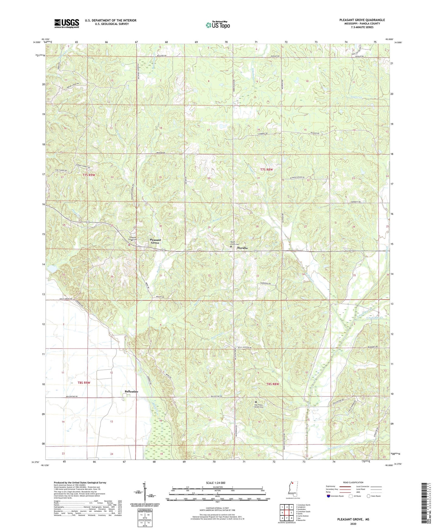
2020 topographic map quadrangle Pleasant Grove in the state of Mississippi. Scale: 1:24000. Based on the newly updated USGS 7.5' US Topo map series, this map is in the following counties: Panola. The map contains contour data, water features, and other items you are used to seeing on USGS maps, but also has updated roads and other features. This is the next generation of topographic maps. Printed on high-quality waterproof paper with UV fade-resistant inks.
Quads adjacent to this one:
West: Crenshaw South
Northwest: Crenshaw North
North: Longtown
Northeast: Senatobia
East: Sardis
Southeast: Batesville
South: Asa
Southwest: Curtis Station
Contains the following named places: Ballentine, Beach Creek, Black Church, Braham Chapel, Browns School, Cedar Grove Church, Crooked Creek, Davidson Creek, Davis Creek, East Floyd Creek, Harmonious Church, Harmonious School, Hayes School, Horatio, Howard Chapel, Indian Creek Watershed Y-9a-4 Dam, Kings Corner, Lake Creswell, McIvor Drainage Canal, Melrose School, North Fork Bear Creek, Peach Creek, Peach Creek Cemetery, Peach Creek Church, Peterson Creek, Pleasant Grove, Pleasant Grove Baptist Church, Pleasant Grove Cemetery, Pleasant Grove School, Pleasant Grove Volunteer Fire Department, Rocky Creek, Shiloh Church, Shiloh School, South Fork Bear Creek, Star Place, Star Place - Shiloh Cemetery, Supervisor District 2