MyTopo
Crenshaw North Mississippi US Topo Map
Couldn't load pickup availability
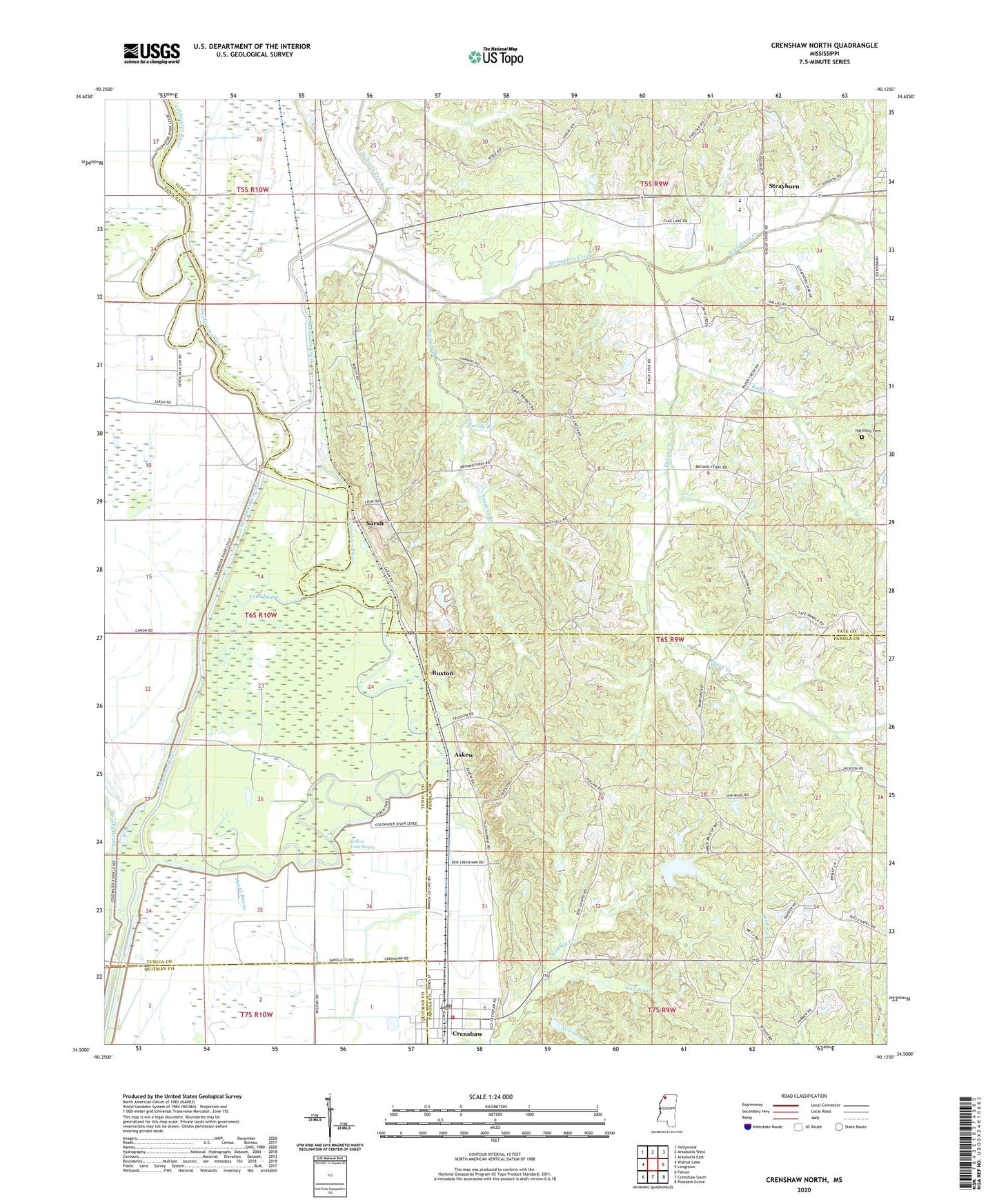
2024 topographic map quadrangle Crenshaw North in the state of Mississippi. Scale: 1:24000. Based on the newly updated USGS 7.5' US Topo map series, this map is in the following counties: Tate, Panola, Tunica, Quitman. The map contains contour data, water features, and other items you are used to seeing on USGS maps, but also has updated roads and other features. This is the next generation of topographic maps. Printed on high-quality waterproof paper with UV fade-resistant inks.
Quads adjacent to this one:
West: Walnut Lake
Northwest: Hollywood
North: Arkabutla West
Northeast: Arkabutla East
East: Longtown
Southeast: Pleasant Grove
South: Crenshaw South
Southwest: Falcon
This map covers the same area as the classic USGS quad with code o34090e2.
Contains the following named places: Arkabutla Creek, Askew, Askew Refuge, Big Dog Bayou, Browns Ferry, Brushy Bayou, Buxton, Coleman School, Coon Bayou, Coon Bayou Cut-Off, Crenshaw, Crenshaw Elementary School, Crenshaw Police Department, Crenshaw Post Office, Egypt Creek, Flag Lake, Goode, Harmony Cemetery, Harold Meek Pond Dam, Indian Creek Watershed Y-19a-20 Dam, Indian Creek Watershed Y-9a-17 Dam, Indian Creek Watershed Y-9a-21 Dam, Indian Creek Watershed Y-9a-7 Dam, Indian Creek Watershed Y-9a-8 Dam, J O Stuart Pond Dam, Kirksey Creek, KJirksey, Lambert Chapel, Lambert School, Matthews Ferry, Mississippi No Name 217 Dam, Mrs Francis Fulkson Pond Dam, Nelson Branch, Patent Creek, Porter and Blankenships Store, Rader Creek, Riverside School, Saint Mary Church, Sanders Branch, Sandy Branch, Sarah, Sarah Post Office, Sees Chapel, Spring Hill Church, Spring Hill School, Strayhorn, Strayhorn Baptist Church, Strayhorn Census Designated Place, Strayhorn Creek, Strayhorn Elementary School, Town of Crenshaw, Trinity Church, Truslow Church, Whitsells Box, Yellow Lake Bayou, ZIP Code: 38665