MyTopo
Queens Hill Lake Mississippi US Topo Map
Couldn't load pickup availability
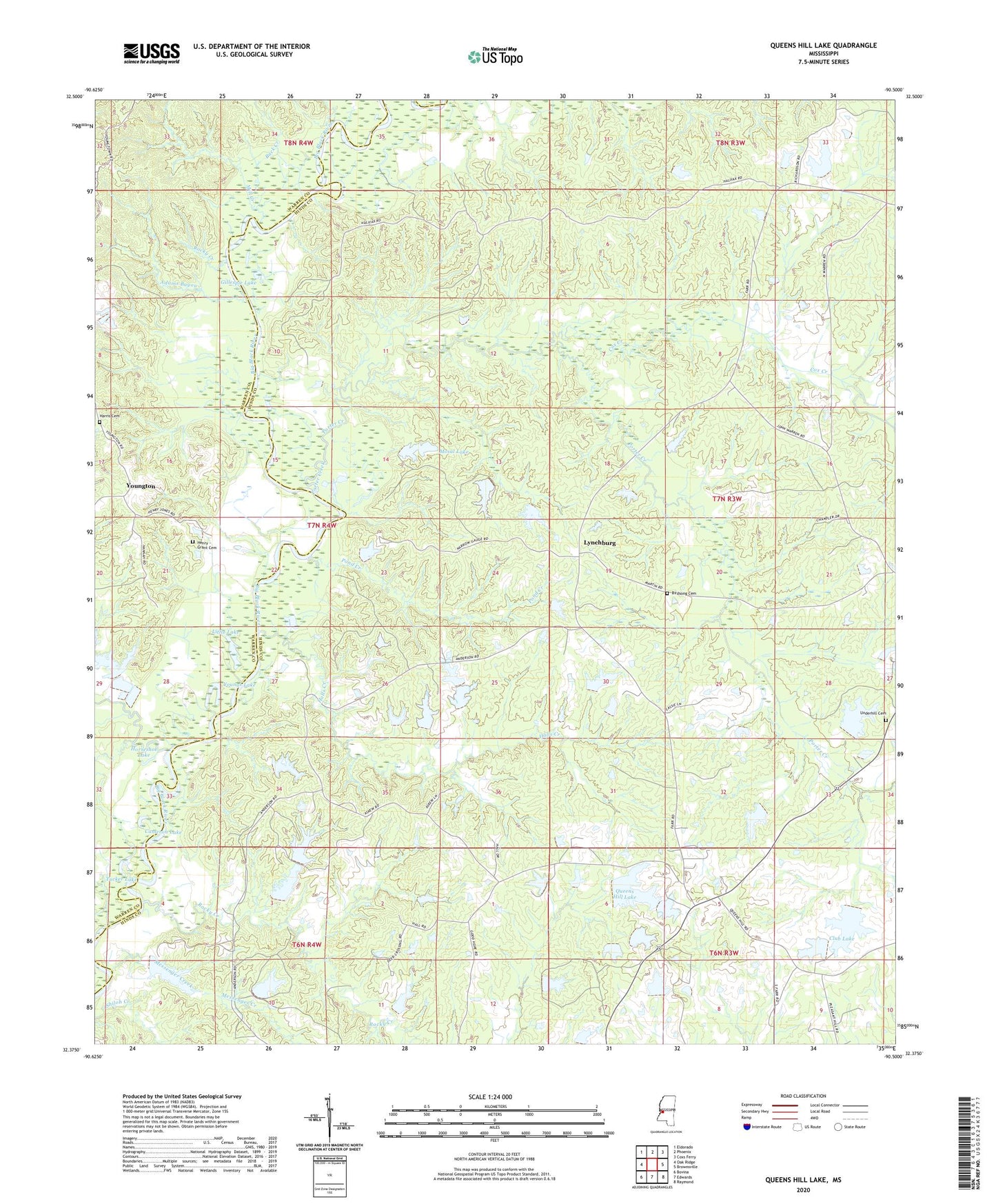
2020 topographic map quadrangle Queens Hill Lake in the state of Mississippi. Scale: 1:24000. Based on the newly updated USGS 7.5' US Topo map series, this map is in the following counties: Hinds, Warren. The map contains contour data, water features, and other items you are used to seeing on USGS maps, but also has updated roads and other features. This is the next generation of topographic maps. Printed on high-quality waterproof paper with UV fade-resistant inks.
Quads adjacent to this one:
West: Oak Ridge
Northwest: Eldorado
North: Phoenix
Northeast: Coxs Ferry
East: Brownsville
Southeast: Raymond
South: Edwards
Southwest: Bovina
Contains the following named places: Adams Bayou, Anderson School, Birdsong Cemetery, Birdsong Ferry, Buck Creek, Bushs Ferry, Butts Creek, Cameron Lake, Cashmans Lake Dam, Club Lake, Cox Creek, Crossed Arrow Lakes Dam, Gaddis Farms Lake Dam, Gillespie Lake, Good Hope Church, Greers Lake Dam, Halls Creek, Harris Cemetery, Henry - Grant Cemetery, Horseshoe Lake, Ingraham, J B White Pond Dam, James Plantation, Jones Ford, Little Kingdom Come Church, Little Lake, Lynchburg, McHann Lake Dam, Messenger Creek, Mill Creek, Mosal Lake, Mosal Lake Dam, Mount Pleasant Church, Old Marley Landing, Pond Creek, Porter Creek, Queens Hill, Queens Hill Club Lake Dam, Queens Hill Lake, R L Taylor Lake Dam, Ratliff Chapel, Robinson School, Rocky Creek, Rose Hill Church, Sand Hill School, Shiloh Creek, Tucker Lake, Tye Walter Church, Underhill Cemetery, Wangborn School, West Harper Church, Youngs Lake, Youngton