MyTopo
Renfroe Mississippi US Topo Map
Couldn't load pickup availability
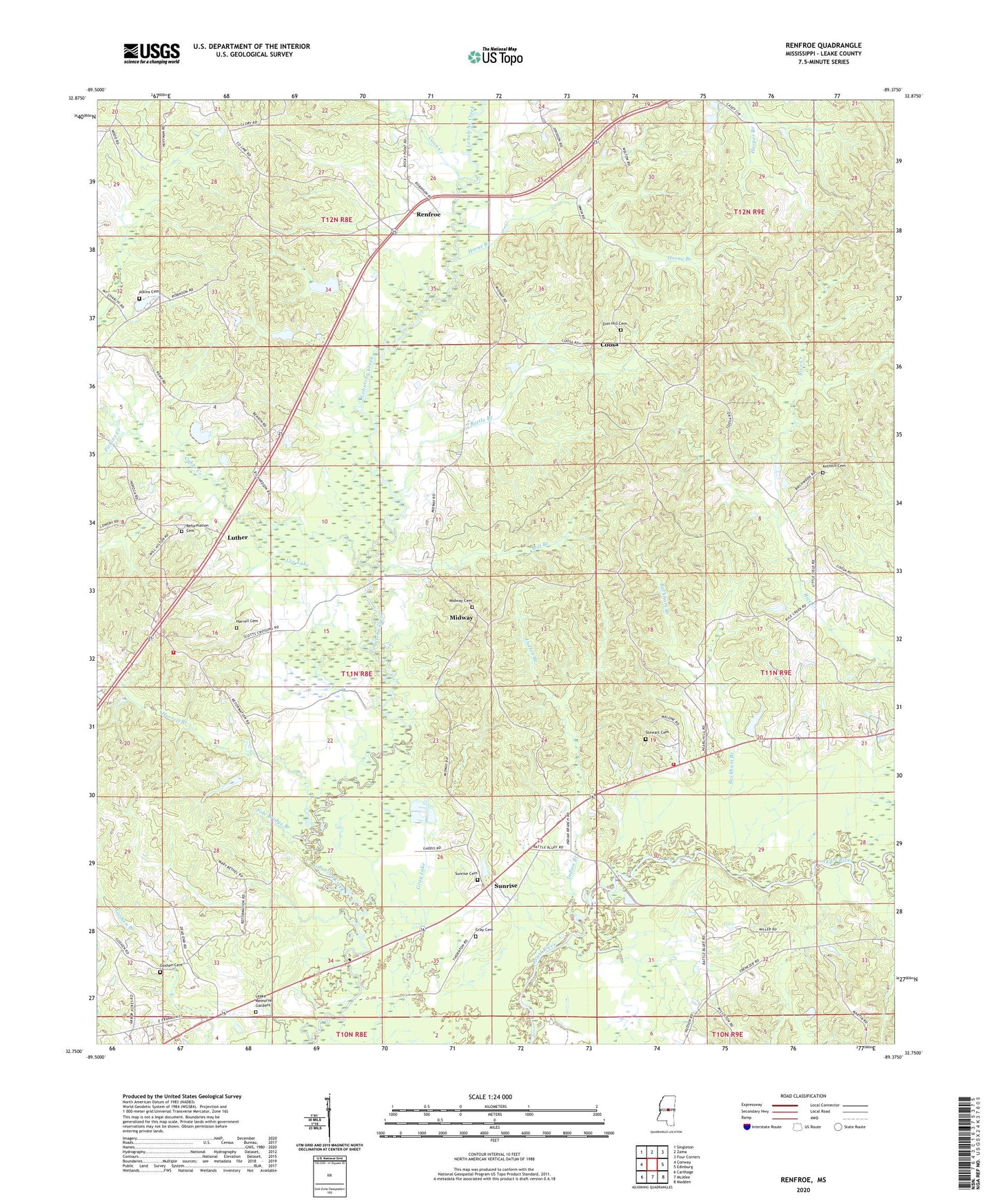
2020 topographic map quadrangle Renfroe in the state of Mississippi. Scale: 1:24000. Based on the newly updated USGS 7.5' US Topo map series, this map is in the following counties: Leake. The map contains contour data, water features, and other items you are used to seeing on USGS maps, but also has updated roads and other features. This is the next generation of topographic maps. Printed on high-quality waterproof paper with UV fade-resistant inks.
Quads adjacent to this one:
West: Conway
Northwest: Singleton
North: Zama
Northeast: Four Corners
East: Edinburg
Southeast: Madden
South: McAfee
Southwest: Carthage
Contains the following named places: Antioch Cemetery, Antioch Church, Atkins Cemetery, Battle Bluff, Battle Branch, Beckham Branch, Cobbs Creek, Collier School, Coon Creek, Coosa, County Line Church, Edinburg School, Edinburg Volunteer Fire Department, Goshen, Goshen Cemetery, Goshen Church, Goshen School, Gray Cemetery, Harrell Branch, Harrell Cemetery, Holiness Church, Horne Branch, Indian Branch, Leake Memorial Gardens, Lee Lake, Luther, Mary Bethel Church, Midway, Midway Baptist Church, Midway Cemetery, Mill Branch, Mount Charity Church, Mount Olive Church, New Prospect Church, Pearl Hill, Pearl Hill Church, Pearl Hill School, Pickins Creek, Pole Bridge Branch, R and R Farm Ponds Dam, Rance Johnston Catfish Pond Dam, Reformation Cemetery, Reformation Cumberland Presbyterian Church, Reformation School, Reformation Volunteer Fire Department, Renfroe, Renfroe Baptist Church, Renfroe Church, Renfroe School, Smith Pond Dam, Standing Cypress Creek, Stewart Cemetery, Sunrise, Sunrise Baptist Church, Sunrise Cemetery, Sunrise Church, Supervisor District 1, Williston, Zion Hill Cemetery, Zion Hill Primitive Baptist Church, ZIP Code: 39051