MyTopo
Singleton Mississippi US Topo Map
Couldn't load pickup availability
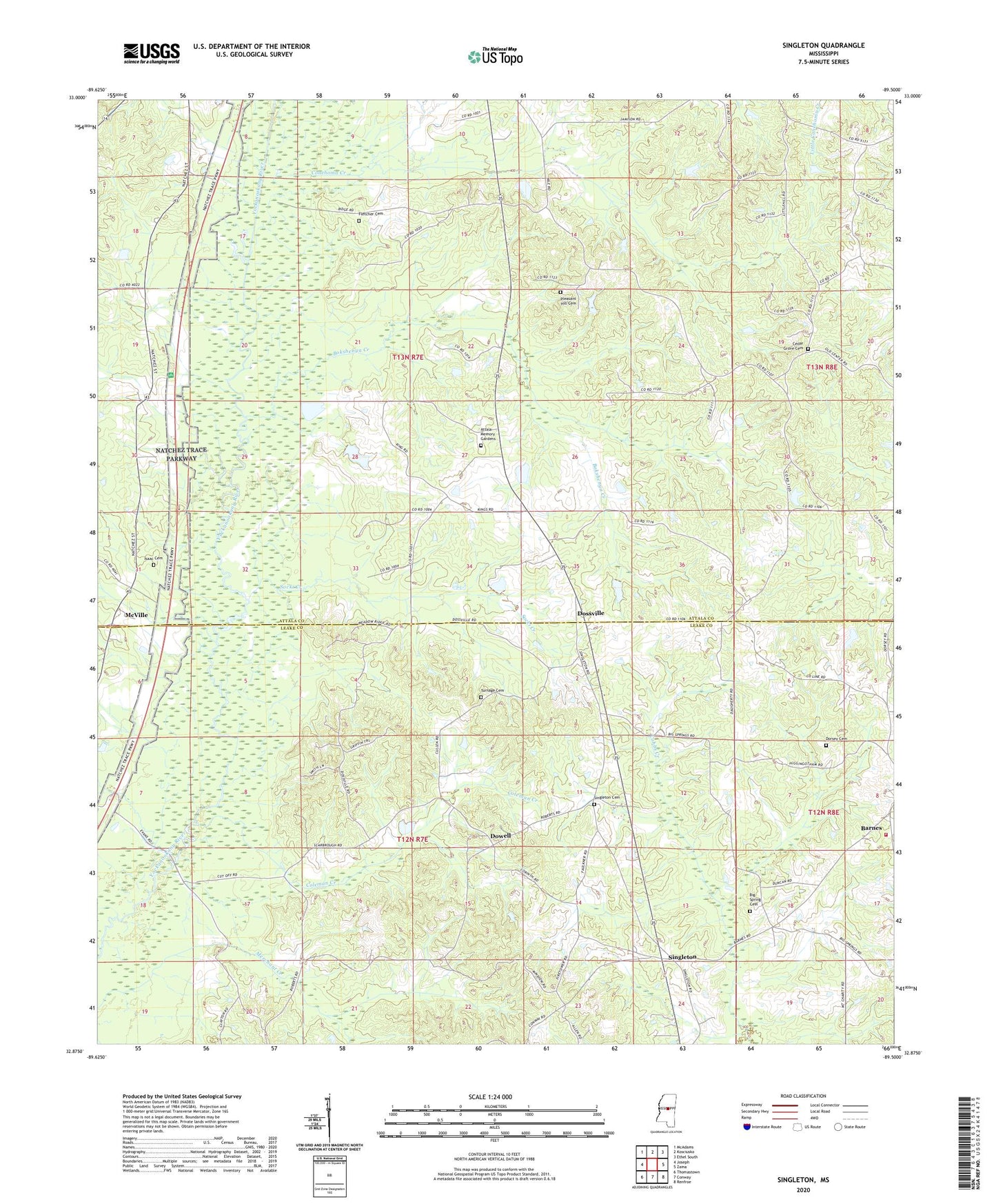
2024 topographic map quadrangle Singleton in the state of Mississippi. Scale: 1:24000. Based on the newly updated USGS 7.5' US Topo map series, this map is in the following counties: Attala, Leake. The map contains contour data, water features, and other items you are used to seeing on USGS maps, but also has updated roads and other features. This is the next generation of topographic maps. Printed on high-quality waterproof paper with UV fade-resistant inks.
Quads adjacent to this one:
West: Joseph
Northwest: McAdams
North: Kosciusko
Northeast: Ethel South
East: Zama
Southeast: Renfroe
South: Conway
Southwest: Thomastown
This map covers the same area as the classic USGS quad with code o32089h5.
Contains the following named places: Attala Memory Gardens, Barnes, Barnes School, Barnes Volunteer Fire Department, Big Spring Cemetery, Big Springs Church, Big Springs School, Bokshenya Creek, Cedar Grove Cemetery, Cedar Grove Church, Chipley Lake Dam, Coleman Creek, Conehoma Creek, Conehoma School, Corinth Baptist Church, Corinth Church, County Line Baptist Church, County Line School, Damascus Church, Delydia Hill Church, Dorsey Cemetery, Dossville, Dossville School, Dowell, Faith Temple, Fletcher Cemetery, Holly Hill Picnic Area, Isaac Cemetery, Jerusalem Baptist Church, Knox, Little Conehoma Creek, Little Hill Church, McKay Lake Dam, McVille, McVille School, New Home Church, Nile, Nile Church, Nile School, Pleasant Hill Cemetery, Pleasant Hill Church, Salem Methodist Church, Scrivner Poultry Farm, Singleton, Singleton Cemetery, Singleton School, Singleton United Methodist Church, Socki Creek, Supervisor District 1, Turnage Cemetery, Wesley Chapel, Wesley Chapel School, Yockanookany Baptist Church