MyTopo
Conway Mississippi US Topo Map
Couldn't load pickup availability
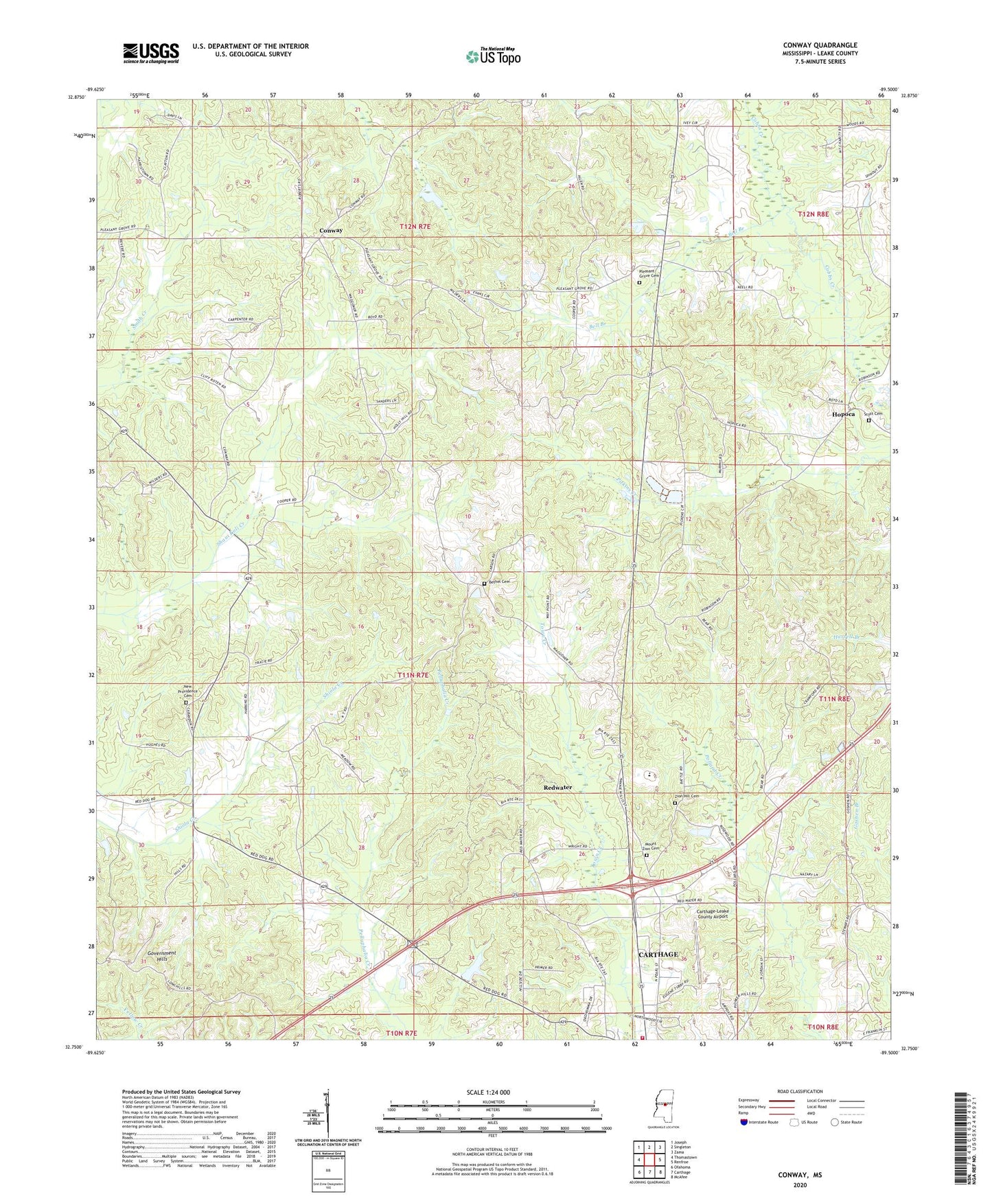
2024 topographic map quadrangle Conway in the state of Mississippi. Scale: 1:24000. Based on the newly updated USGS 7.5' US Topo map series, this map is in the following counties: Leake. The map contains contour data, water features, and other items you are used to seeing on USGS maps, but also has updated roads and other features. This is the next generation of topographic maps. Printed on high-quality waterproof paper with UV fade-resistant inks.
Quads adjacent to this one:
West: Thomastown
Northwest: Joseph
North: Singleton
Northeast: Zama
East: Renfroe
Southeast: McAfee
South: Carthage
Southwest: Ofahoma
This map covers the same area as the classic USGS quad with code o32089g5.
Contains the following named places: Bell Branch, Bethel Cemetery, Bethel Church, Bilbro Lake Dam, Carthage Fire Department, Carthage-Leake County Airport, Center Hill Church, Conway, Damascus Church, Hopoca, Indian Agency Lake Dam, Leake County, McDonald Ponds Dam, Mount Bethel Church, Mount Olive Church, Mount Zion Cemetery, Mount Zion Church, New Providence Cemetery, New Providence Church, Pleasant Grove Cemetery, Pleasant Grove Church, R and R Processing Plant Lagoon Dam, Redwater, Redwater Census Designated Place, Scott Cemetery, Supervisor District 2, Zion Hill Cemetery, Zion Hill Church