MyTopo
Rose Hill Mississippi US Topo Map
Couldn't load pickup availability
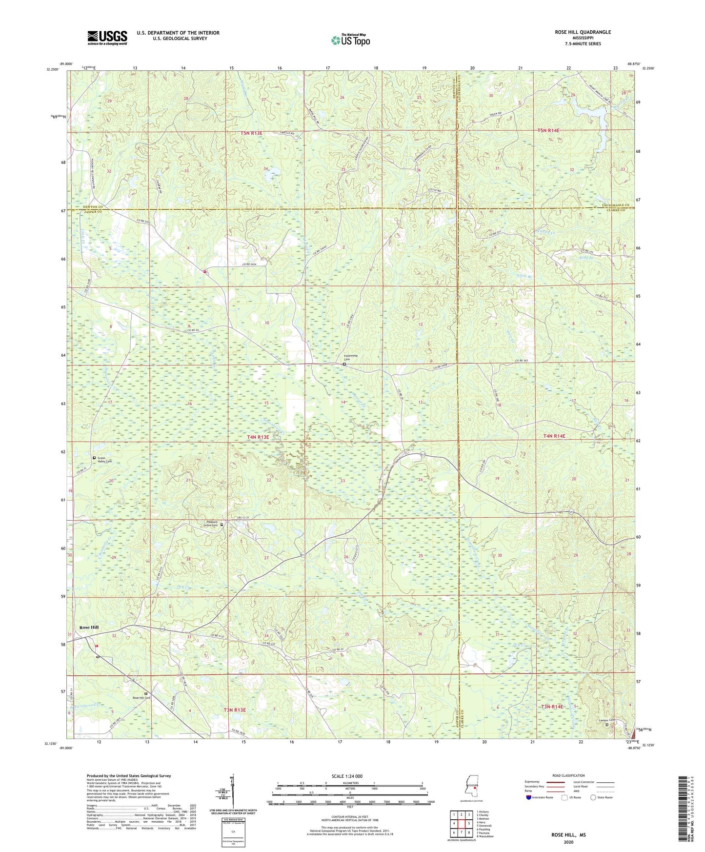
2020 topographic map quadrangle Rose Hill in the state of Mississippi. Scale: 1:24000. Based on the newly updated USGS 7.5' US Topo map series, this map is in the following counties: Jasper, Clarke, Newton, Lauderdale. The map contains contour data, water features, and other items you are used to seeing on USGS maps, but also has updated roads and other features. This is the next generation of topographic maps. Printed on high-quality waterproof paper with UV fade-resistant inks.
Quads adjacent to this one:
West: Hero
Northwest: Hickory
North: Chunky
Northeast: Meehan
East: Stonewall
Southeast: Wautubbee
South: Pachuta
Southwest: Paulding
Contains the following named places: Algood Creek, Concord Church, Dry Creek, East Galilee Church, Fellowship, Fellowship Baptist Church, Fellowship Cemetery, Fellowship Volunteer Fire Department, Green Valley Cemetery, Green Valley Church, Hopewell Church, Johnson Creek, Lawson Cemetery, Little Creek, Magnolia Church, Magnolia School, McCormick Lake Dam, Muse Mill, New Fellowship, New Fellowship Baptist Church, Parks School, Penantly Creek, Pleasant Grove Cemetery, Pleasant Grove Church, Rose Hill, Rose Hill Cemetery, Rose Hill Post Office, Rose Hill Volunteer Fire Department, Spring Hill School, Tanyard Branch, Wanita Lake, Wanita Lake Dam, Wanita Mill, Wanitka Lake, Whitman Creek