MyTopo
Pachuta Mississippi US Topo Map
Couldn't load pickup availability
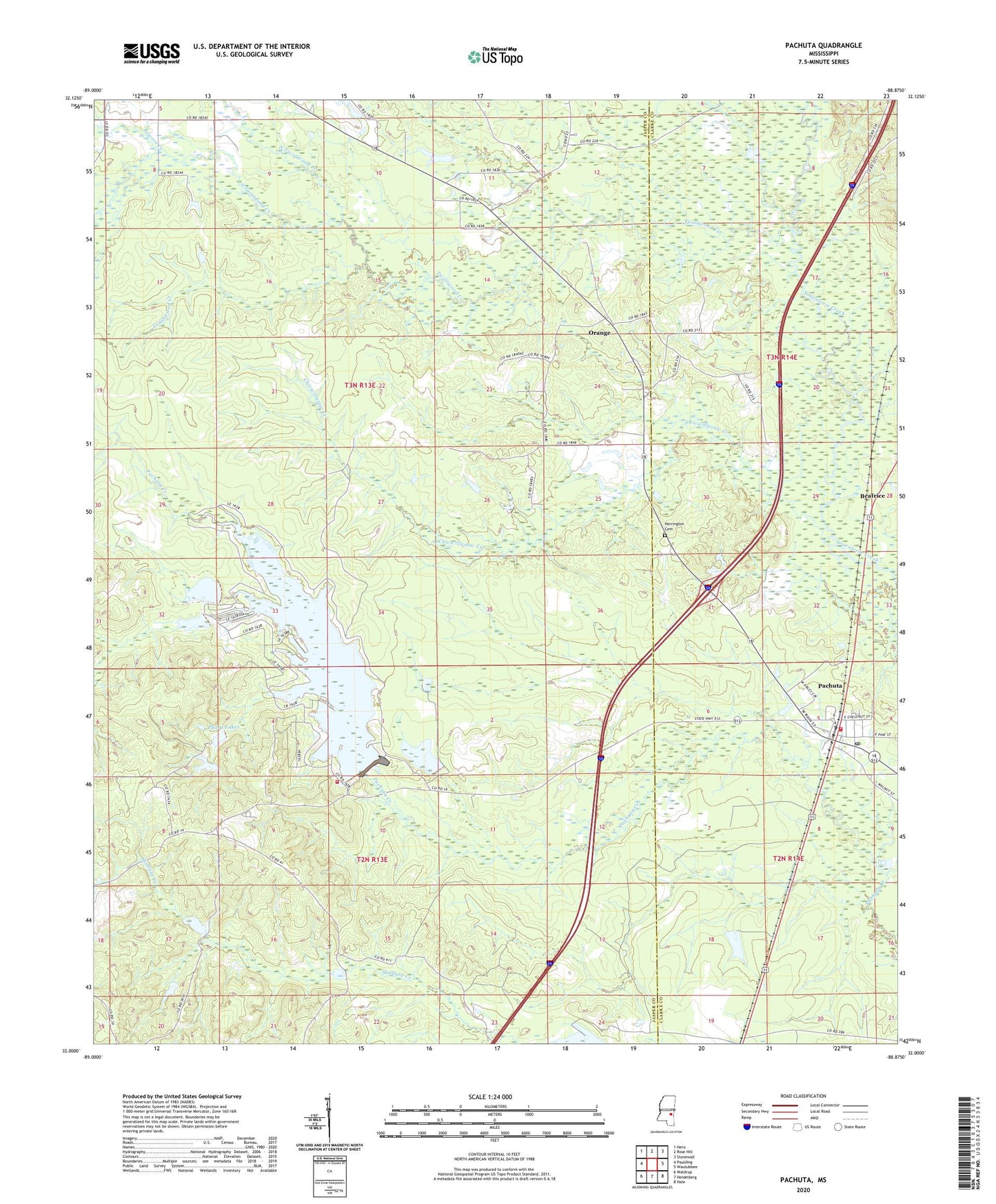
2024 topographic map quadrangle Pachuta in the state of Mississippi. Scale: 1:24000. Based on the newly updated USGS 7.5' US Topo map series, this map is in the following counties: Jasper, Clarke. The map contains contour data, water features, and other items you are used to seeing on USGS maps, but also has updated roads and other features. This is the next generation of topographic maps. Printed on high-quality waterproof paper with UV fade-resistant inks.
Quads adjacent to this one:
West: Paulding
Northwest: Hero
North: Rose Hill
Northeast: Stonewall
East: Wautubbee
Southeast: Hale
South: Heidelberg
Southwest: Waldrup
This map covers the same area as the classic USGS quad with code o32088a8.
Contains the following named places: Beatrice, Chapel Hill Church, Chicwillasaw Creek, Clark Academy, Herrington Cemetery, Homewood Church, Lake Eddins Volunteer Fire Department, Lewis Lake Dam, Mount Jordan Church, Mount Pleasant Baptist Church, North Twistwood Creek, Orange, Orange Church, Pachuta, Pachuta Volunteer Fire Department, Phalti Church, Phalti Lakes, Pine Hill Church, Powers Creek, South Twistwood Creek, Town of Pachuta, Twistwood Creek, Twistwood School, ZIP Code: 39347