MyTopo
Sable Mississippi US Topo Map
Couldn't load pickup availability
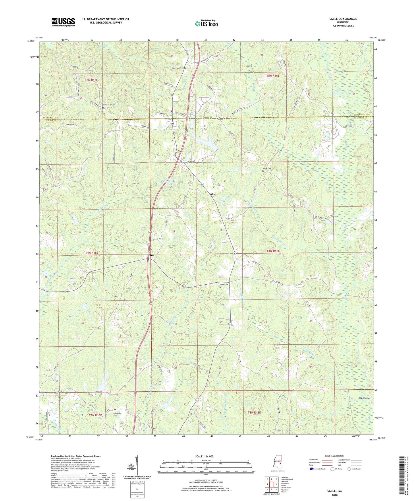
2024 topographic map quadrangle Sable in the state of Mississippi. Scale: 1:24000. Based on the newly updated USGS 7.5' US Topo map series, this map is in the following counties: Clarke, Lauderdale. The map contains contour data, water features, and other items you are used to seeing on USGS maps, but also has updated roads and other features. This is the next generation of topographic maps. Printed on high-quality waterproof paper with UV fade-resistant inks.
Quads adjacent to this one:
West: Stonewall
Northwest: Meehan
North: Meridian South
Northeast: Vimville
East: Snell
Southeast: Sykes
South: Quitman
Southwest: Wautubbee
This map covers the same area as the classic USGS quad with code o32088b6.
Contains the following named places: Beat Line School, Bently School, Briar Patch Lake, Chancellor Cemetery, Chinquapin Creek, Chinquapin Lake Dam, Clarkdale Elementary School, Clarkdale High School, Clarkdale Volunteer Fire and Rescue Department Station 1, Coker Lake, Coker Lake Dam, Devoe, Devoe Cemetery, Devoe School, Dry Creek, Francis Creek Oil Field, Gulledge School, Martin Store, New Hope Baptist Church, New Hope Cemetery, Oak Grove Cemetery, Oak Grove Church, O'Neil Bridge, Riley Mill Creek, Rolling Creek Baptist Church, Rolling Creek Volunteer Fire Department, Roy, Sable, Spring Hill Church, Thomas Lake Dam, Union Baptist Church, Union Cemetery, Union Hill Church, Union School, Walkers Mill, Wier School, Williams Store, Zion Spring Church