MyTopo
Vimville Mississippi US Topo Map
Couldn't load pickup availability
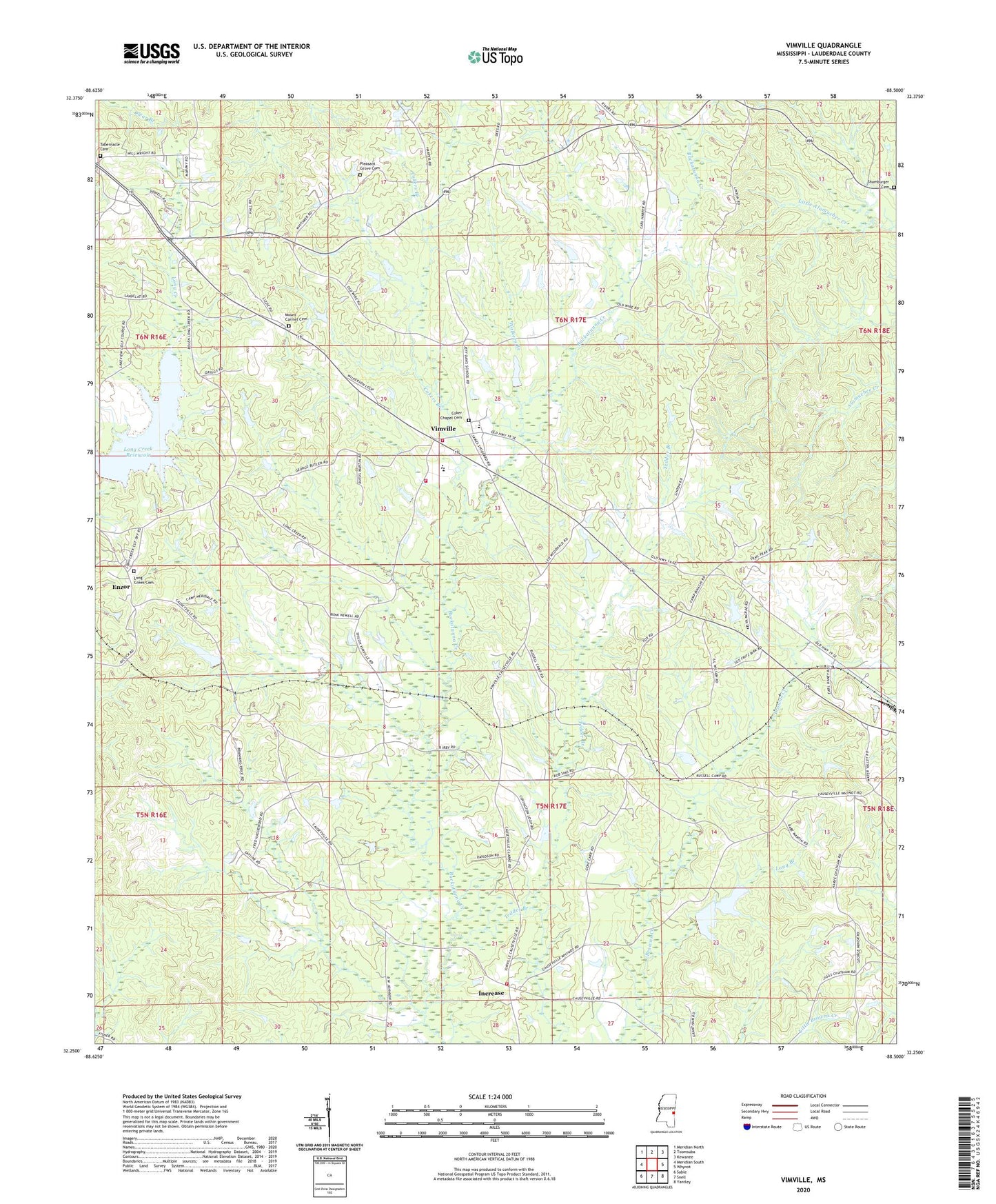
2024 topographic map quadrangle Vimville in the state of Mississippi. Scale: 1:24000. Based on the newly updated USGS 7.5' US Topo map series, this map is in the following counties: Lauderdale. The map contains contour data, water features, and other items you are used to seeing on USGS maps, but also has updated roads and other features. This is the next generation of topographic maps. Printed on high-quality waterproof paper with UV fade-resistant inks.
Quads adjacent to this one:
West: Meridian South
Northwest: Meridian North
North: Toomsuba
Northeast: Kewanee
East: Whynot
Southeast: Yantley
South: Snell
Southwest: Sable
This map covers the same area as the classic USGS quad with code o32088c5.
Contains the following named places: Boy Scout Lake Dam, Camp Binachi, Carlyle Pond Dam, Causeyville Baptist Church, Causeyville Volunteer Fire and Rescue Department, Cliff Williams, Coker Chapel, Coker Chapel Cemetery, Cokers Branch, D A Cook Pond Dam, E M Carr Pond Dam, Enzor, Fair View Church, Freedom Church, Good Hope Church, Hebron Baptist Church, Increase, J A Price Pond Dam, J B McInnis Pond Dam, Jeff Davis Academy, L W Wilson Pond Dam, Leland McInnis Castfish Pond Dam, Long Branch, Long Creek Cemetery, Long Creek Church, Long Creek Reservoir, Long Creek Reservoir Dam, Mae Hall Pond Dam, Marble Pond Dam, McDonald Pond Dam, McRae Lake, McRae Lake Dam, Meridale Camp, Morris Covington Pond Dam, Mount Carmel Cemetery, Mount Carmel Church, Mount Horem Church, New Hope Church, Old Whynot Church, Pleasant Grove Cemetery, Powell Catfish Ponds Dam, Raymond Harper Pond Dam, Shamburger Cemetery, Shiloh Church, Southeast Lauderdale Elementary School, Southeast Lauderdale High School, Southeast Lauderdale Junior High School, T E Tanner Pond Dam, Tabernacle Cemetery, Tedder Branch, Vimville, Vimville Volunteer Fire Department, Walkers Branch, ZIP Code: 39301