MyTopo
Shaw Mississippi US Topo Map
Couldn't load pickup availability
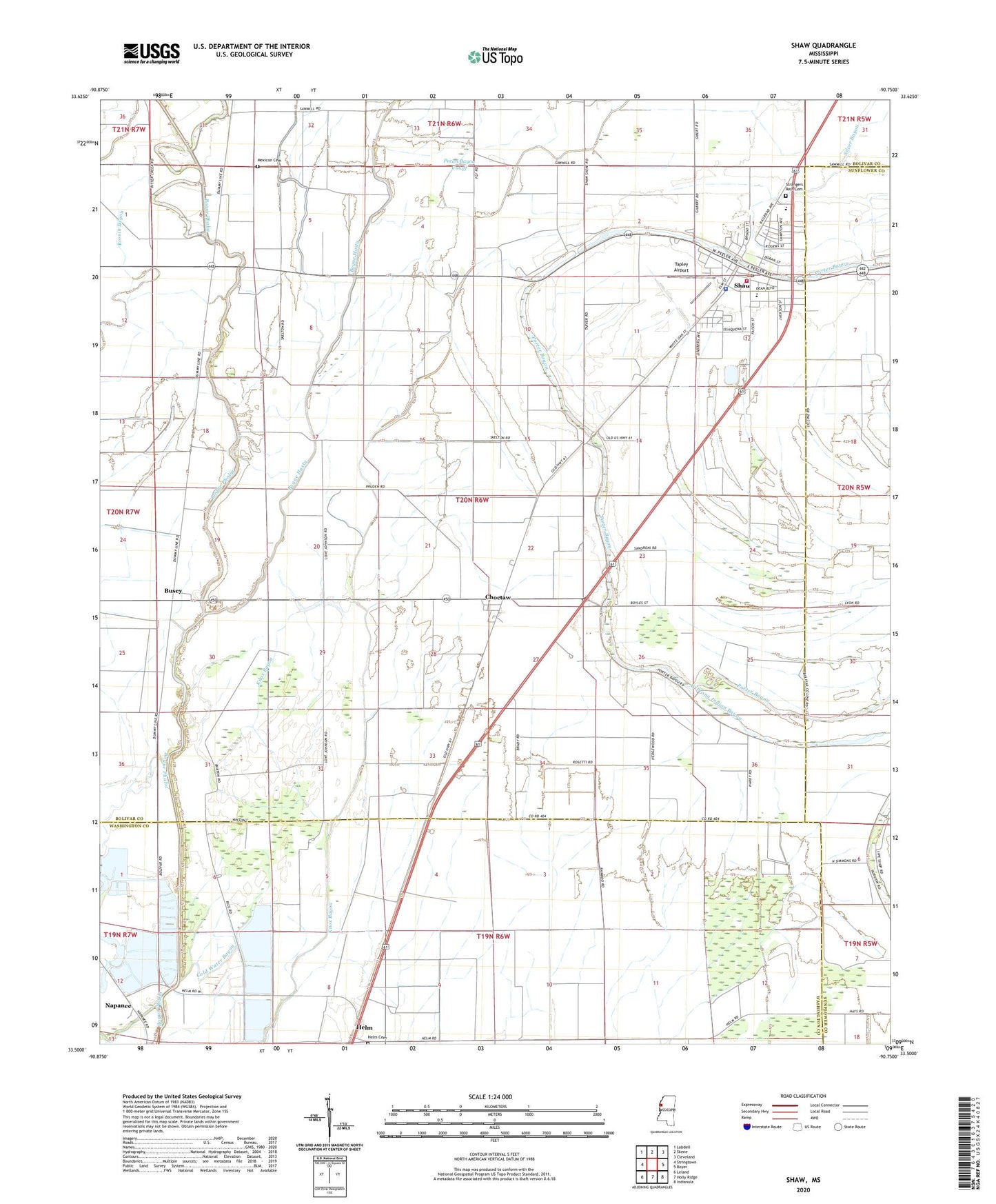
2020 topographic map quadrangle Shaw in the state of Mississippi. Scale: 1:24000. Based on the newly updated USGS 7.5' US Topo map series, this map is in the following counties: Bolivar, Washington, Sunflower. The map contains contour data, water features, and other items you are used to seeing on USGS maps, but also has updated roads and other features. This is the next generation of topographic maps. Printed on high-quality waterproof paper with UV fade-resistant inks.
Quads adjacent to this one:
West: Stringtown
Northwest: Lobdell
North: Skene
Northeast: Cleveland
East: Boyer
Southeast: Indianola
South: Holly Ridge
Southwest: Leland
Contains the following named places: Antioch Church, Bethlehem Number 1 Church, Bethlehem Number 2 Church, Bogue Hasty, Bolivar County Volunteer Fire Department District 5 Station 1 Shaw, Busey, Choctaw, City of Shaw, Clear Creek, Cold Water Bayou, Ditch Number Eight, Ditch Number Five, Ditch Number Five A, Ditch Number Nine, Ditch Number Nine A, Dowd Plantation, Fairview Church, Greengrove Church, Harris Ranch Catfish Pond Dam, Helm, Helm Cemetery, Lees Flat, McEvans School, Mexican Cemetery, Mount Galilee Church, Napanee, New Whitestone Church, Pauls Church, Pecan Bayou Cutoff, Pilgrims Rest Church, Shaw, Shaw High School, Shaw Police Department, Shaw Post Office, Shaw Sewage Lagoon Dam, Silver Bayou, Strangers Rest Cemetery, Tapley Airport, Turners Flat, ZIP Code: 38773