MyTopo
Lobdell Mississippi US Topo Map
Couldn't load pickup availability
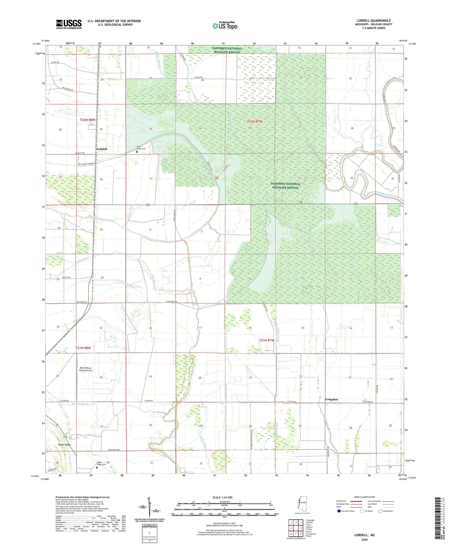
2024 topographic map quadrangle Lobdell in the state of Mississippi. Scale: 1:24000. Based on the newly updated USGS 7.5' US Topo map series, this map is in the following counties: Bolivar. The map contains contour data, water features, and other items you are used to seeing on USGS maps, but also has updated roads and other features. This is the next generation of topographic maps. Printed on high-quality waterproof paper with UV fade-resistant inks.
Quads adjacent to this one:
West: Benoit
Northwest: Rosedale
North: Beulah
Northeast: Pace
East: Skene
Southeast: Shaw
South: Stringtown
Southwest: Scott
This map covers the same area as the classic USGS quad with code o33090f8.
Contains the following named places: Ann Bayou, Belman Bayou, Black Bayou, Burrus Bayou, Christmas Lake Branch, Dahomey National Wildlife Refuge, Dahomy, Ditch C, Ditch E, Ditch K, Ditch Number B-4, Ditch Number C-1, Ditch Number C-10, Ditch Number C-14, Ditch Number C-3, Ditch Number C-5, Ditch Number C-6, Ditch Number C-9, Ditch Number D-2, Ditch Number D-3, Ditch Number D-6, Ditch Number D-8, Ditch Number E-10, Ditch Number E-2, Ditch Number E-4, Ditch Number E-5, Ditch Number Eight, Ditch Number Six, Egypt Ridge Cemetery, Flower Shepard Church, Good Luck Bayou, Jordan Grove Church, Lobdell, Longshot, Longshot Church, Lost Lake, Macedonia Church, Mills Brothers Catfish Ponds Dam, Polk-Royal Cemetery, Rice Chapel, Stokes Bayou, West Bolivar Flying Service