MyTopo
Success Mississippi US Topo Map
Couldn't load pickup availability
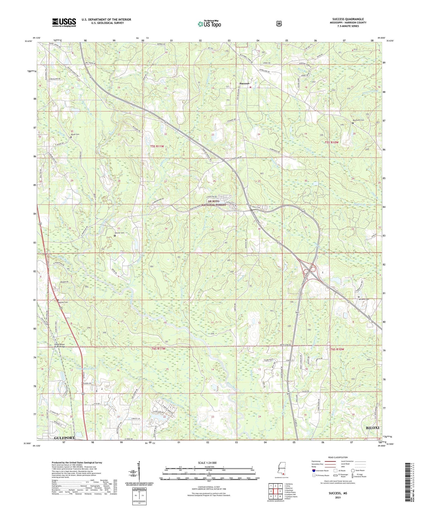
2021 topographic map quadrangle Success in the state of Mississippi. Scale: 1:24000. Based on the newly updated USGS 7.5' US Topo map series, this map is in the following counties: Harrison. The map contains contour data, water features, and other items you are used to seeing on USGS maps, but also has updated roads and other features. This is the next generation of topographic maps. Printed on high-quality waterproof paper with UV fade-resistant inks.
Quads adjacent to this one:
West: Wortham
Northwest: McHenry
North: Airey
Northeast: Beatrice
East: White Plains
Southeast: Biloxi
South: Gulfport North
Southwest: Gulfport NW
Contains the following named places: Beaver Dam Branch, Blackwell Cemetery, Dogwood Hills Golf Club, Fairley Lake Dam, Ferguson Lake Dam, Flat Branch, Fountain of Life Tabernacle Church, Grand Bear Golf Course, Harrison Central High School, Harrison County Elementary School, Harrison County Fire Rescue Station Number 9, Harrison Lookout Tower, La Cresta Mobile Home Park, Little Biloxi River Bridge, Loya Branch, Lyman Fish Hatchery, Mabry's Red Barn Trailer Park, Maul Lake Dam, Midway Cemetery, Midway Church, Mississippi Highway Patrol District 8, Mississippi No Name 65 Dam, Mississippi No Name 68 Dam, Mississippi No Name 75 Dam, Morris Hill Church, Palmer Creek, Palmer Creek Campground, Picayune Creek, Robinwood Baptist Church, Rouse Cemetery, Rudy Branch, Saucier Cemetery, Saucier Creek, Success, Success Baptist Church, Success School, Supervisor District 5, Taylor Lake Dam, Tiger Creek, West Creek, Williams Cemetery, ZIP Code: 39574