MyTopo
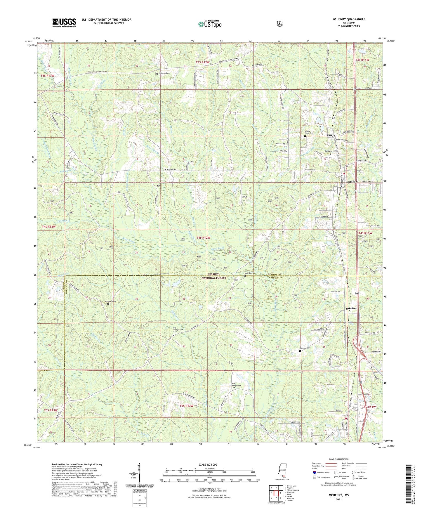
McHenry Mississippi US Topo Map
Couldn't load pickup availability
Also explore the McHenry Forest Service Topo of this same quad for updated USFS data
2024 topographic map quadrangle McHenry in the state of Mississippi. Scale: 1:24000. Based on the newly updated USGS 7.5' US Topo map series, this map is in the following counties: Stone, Harrison. The map contains contour data, water features, and other items you are used to seeing on USGS maps, but also has updated roads and other features. This is the next generation of topographic maps. Printed on high-quality waterproof paper with UV fade-resistant inks.
Quads adjacent to this one:
West: Silver Run
Northwest: Browns Lake
North: Wiggins
Northeast: Whites Crossing
East: Airey
Southeast: Success
South: Wortham
Southwest: Sellers
This map covers the same area as the classic USGS quad with code o30089f2.
Contains the following named places: Andrew Branch, Bay Branch, Beaver Dam Branch, Biloxi District Ranger Station, Bond Cemetery, Burned Weed Brake, Byrd Reed Brake, Crooked Creek, D C Wedgeworth Cemetery, Dan O'Neal Lake Dam, Diamond Cemetery, Ditch Branch, Doss Wedgeworth Cemetery, Edwards Lake Dam, Faithview Baptist Church, Harris Creek, Harrison County Fire Rescue Station Number 8, Hickman Cemetery, Horse Creek, Howison, Indian Turner Branch, Little Biloxi State Wildlife Management Area, McHenry, McHenry First Baptist Church, McHenry Post Office, McHenry Volunteer Fire Department, Mill Creek, Millview, Oak Lawn Cemetery, Parker Lake Dam, Pecan Grove Recreational Vehicle Park, Perry, Pine Forest Regional Library - McHenry Library, Race Path Branch, Rawhide, Saucier, Saucier Community Center, Saucier Elementary School, Saucier First Baptist Church, Saucier Post Office, Saucier United Methodist Church, Summers Lake Dam, Sunlight Baptist Church, Topisaw Watershed Structure Y-27-3 Dam, Turkey Creek, West McHenry Branch, Yellow Fever Cemetery, ZIP Code: 39561