MyTopo
Gulfport NW Mississippi US Topo Map
Couldn't load pickup availability
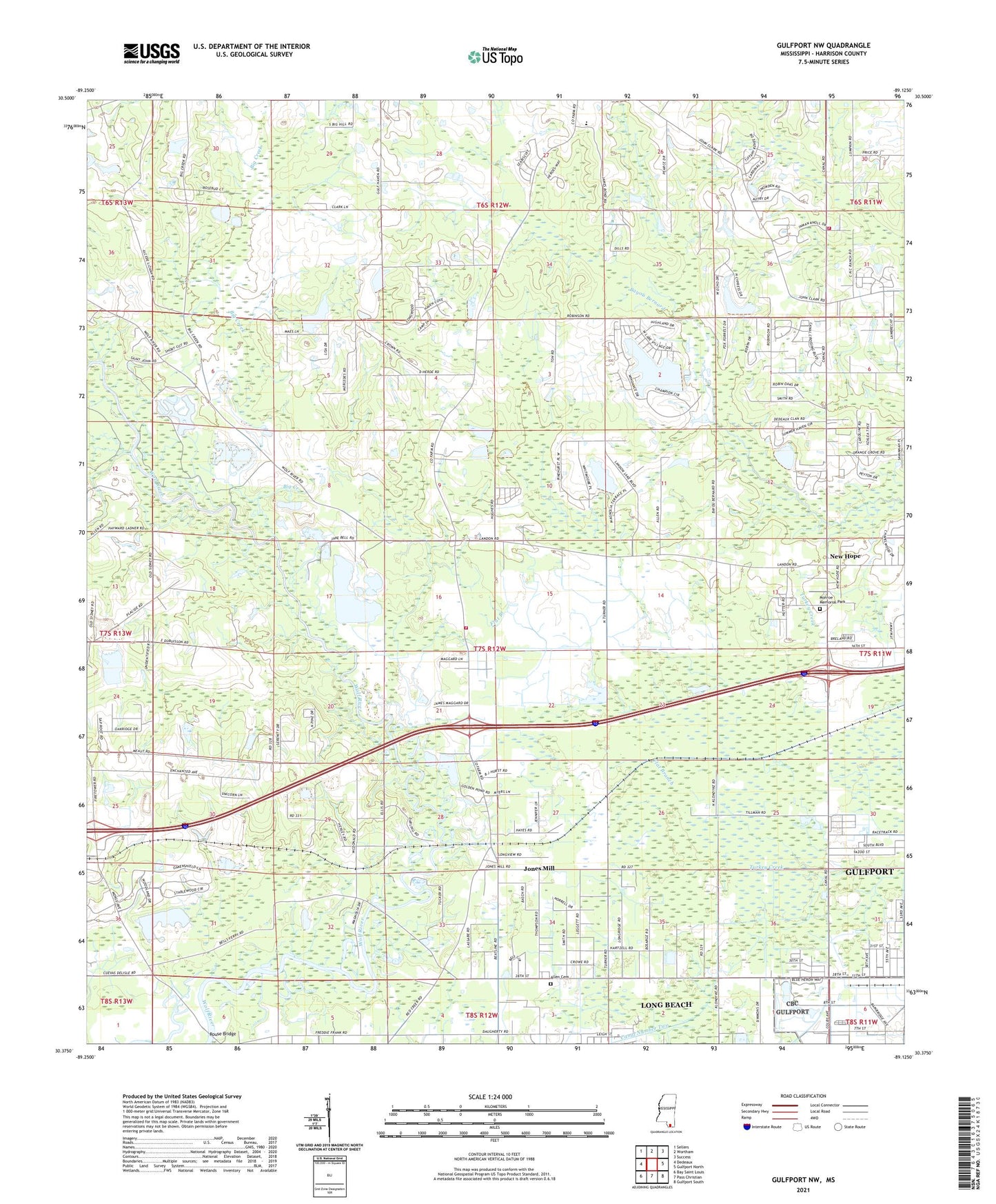
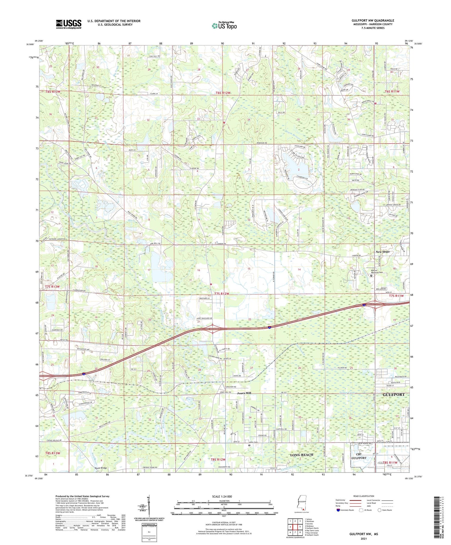
2024 topographic map quadrangle Gulfport NW in the state of Mississippi. Scale: 1:24000. Based on the newly updated USGS 7.5' US Topo map series, this map is in the following counties: Harrison. The map contains contour data, water features, and other items you are used to seeing on USGS maps, but also has updated roads and other features. This is the next generation of topographic maps. Printed on high-quality waterproof paper with UV fade-resistant inks.
Quads adjacent to this one:
West: Dedeaux
Northwest: Sellers
North: Wortham
Northeast: Success
East: Gulfport North
Southeast: Gulfport South
South: Pass Christian
Southwest: Bay Saint Louis
This map covers the same area as the classic USGS quad with code o30089d2.
Contains the following named places: Adams Mobile Home Park, Allen Cemetery, Bay Berry Recreational Vehicle Park, Bell Ferry, Bible Fellowship Church, Big Creek, Canal Number Two, Clyde Woodfields Lake Dam, Dedeaux Lake Dam, Dolan's Mobile Home Park, Faith Baptist Church, Five Star Recreational Vehicle Park, Flat Branch, Gingles Lake Dam, Gulf Coast Worship Center, Gulf Haven Church, Harrison County Farm, Harrison County Fire Rescue Station Number 3, Harrison County Fire Rescue Station Number 4, James Laird Lake Dam, Jones Mill, Kingdom Hall of Jehovahs Witnesses, Lyman, Michael Memorial Baptist Church, Monroe Memorial Park, Mount Calvary Baptist Church, New Covenant Christian Academy Church, New Hope, New Hope Baptist Church, New Life Church, North Long Beach Baptist Church, Our Lady of Mercy Church, Pecan Ridge Mobile Home Park, Pine Bayou Golf Course, Ridge Crest Estates Mobile Home Park, River of Life Church of God, Robinson Road Baptist Church, Rouse Bridge, Spanish Oaks Trail Mobile Home Park, Ton Lake Dam, Travis Lott Mobile Home Park, Windance Country Club, Woodfield Lake Dam, ZIP Codes: 39503, 39560