MyTopo
Wortham Mississippi US Topo Map
Couldn't load pickup availability
Also explore the Wortham Forest Service Topo of this same quad for updated USFS data
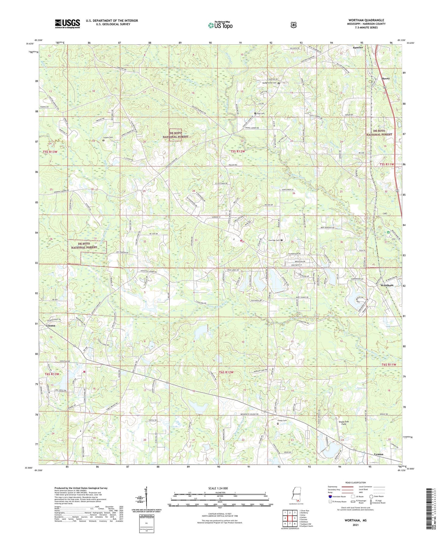
2024 topographic map quadrangle Wortham in the state of Mississippi. Scale: 1:24000. Based on the newly updated USGS 7.5' US Topo map series, this map is in the following counties: Harrison. The map contains contour data, water features, and other items you are used to seeing on USGS maps, but also has updated roads and other features. This is the next generation of topographic maps. Printed on high-quality waterproof paper with UV fade-resistant inks.
Quads adjacent to this one:
West: Sellers
Northwest: Silver Run
North: McHenry
Northeast: Airey
East: Success
Southeast: Gulfport North
South: Gulfport NW
Southwest: Dedeaux
This map covers the same area as the classic USGS quad with code o30089e2.
Contains the following named places: Advance School, Big Biloxi Recreation Area, Big Hill Mobile Home Park, Bully Creek, Cal Maine Lake Dam, Campground Baptist Church, Cedar Dale Church, Central School, Crow Creek, Dye Cemetery, Extended Hands Assembly of God Church, Finley Cemetery, Full Gospel Mission Church, Fulton Pond Dam, Galilee Church, Harrison County Fairgrounds, Harrison County Farm Lake Dam, Harrison County Fire Rescue Station Number 1, Harrison County Fire Rescue Station Number 2, Harrison County Fire Services Administration, Hickory Creek, Homestead Mobile Home Park, Honey Branch, Hovey, Ladner Lake Dam, Lakeview Independent Baptist Church, Live Oak Cemetery, Living Word Church of Saucier, Lizana Baptist Church, Lizana Cemetery, Lizana Elementary School, Lyman Census Designated Place, Morgan Lake Dam, Morris Lake Dam, Paul McGill Lake Dam, Pleasant Hill Church, Redmonds Crossing, Riverline Lake, Riverline Lake Dam, Saint Ann Church, Saucier Census Designated Place, Scarborough Lake Dam, Shade Tree Field, Supervisor District 2, Trinity Creek, Wedgeworth Cemetery, Windy Hill Lake Dam, Wortham