MyTopo
Tribbett Mississippi US Topo Map
Couldn't load pickup availability
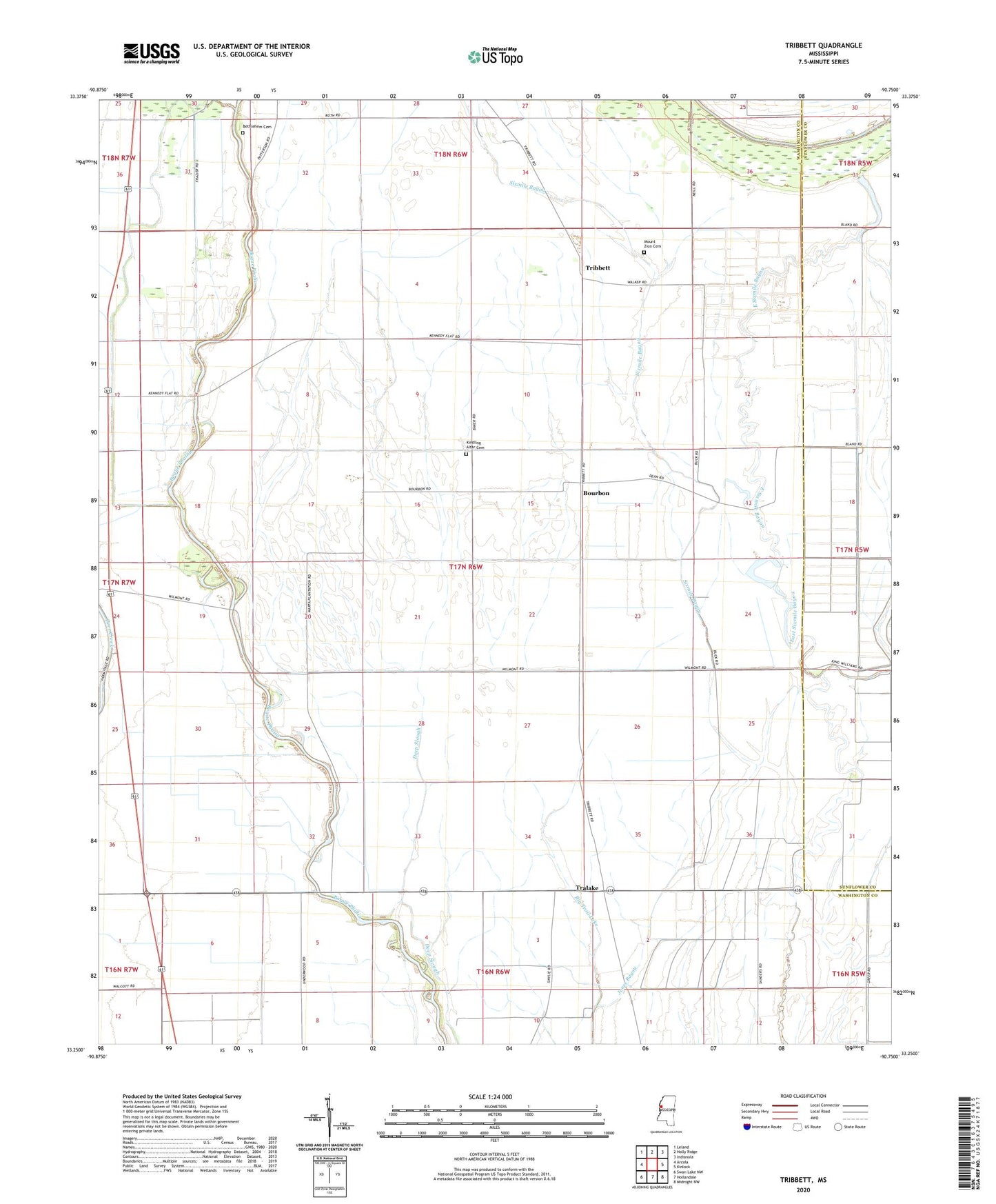
2020 topographic map quadrangle Tribbett in the state of Mississippi. Scale: 1:24000. Based on the newly updated USGS 7.5' US Topo map series, this map is in the following counties: Washington, Sunflower. The map contains contour data, water features, and other items you are used to seeing on USGS maps, but also has updated roads and other features. This is the next generation of topographic maps. Printed on high-quality waterproof paper with UV fade-resistant inks.
Quads adjacent to this one:
West: Arcola
Northwest: Leland
North: Holly Ridge
Northeast: Indianola
East: Kinlock
Southeast: Midnight NW
South: Hollandale
Southwest: Swan Lake NW
Contains the following named places: Bear Lake, Bethlehem Cemetery, Bethlehem Church, Big Trail Lake, Bourbon, Brown Lake Dam, East Sixmile Bayou, J M Dean Pond, Kindling Altar Cemetery, Kindling Altar Church, King Solomon Church, Manhattan, McGrath, Mount Avery Church, Mount Zion Cemetery, Mount Zion Church, New Town, Osseola, Pilgrims Rest Church, Randolph, Saint James Church, Saint John Church, Saint Paul Church, Tralake, Tribbett