MyTopo
Hollandale Mississippi US Topo Map
Couldn't load pickup availability
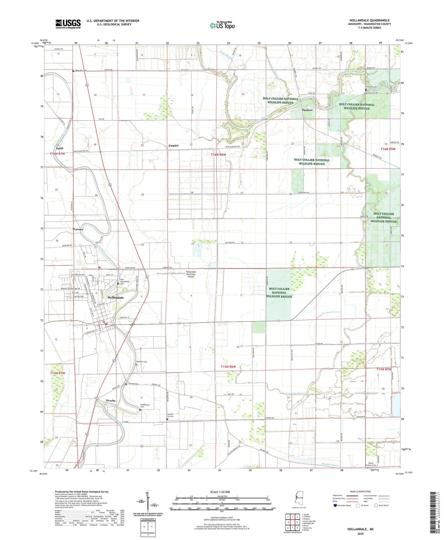
2024 topographic map quadrangle Hollandale in the state of Mississippi. Scale: 1:24000. Based on the newly updated USGS 7.5' US Topo map series, this map is in the following counties: Washington. The map contains contour data, water features, and other items you are used to seeing on USGS maps, but also has updated roads and other features. This is the next generation of topographic maps. Printed on high-quality waterproof paper with UV fade-resistant inks.
Quads adjacent to this one:
West: Swan Lake NW
Northwest: Arcola
North: Tribbett
Northeast: Kinlock
East: Midnight NW
Southeast: Richey
South: Delta City
Southwest: Percy
This map covers the same area as the classic USGS quad with code o33090b7.
Contains the following named places: Bellamy Cemetery, Belmont Church, Bucker Catfish Pond Dam, Bucker Catfish Ponds Dam, City of Hollandale, Cletonia, Clitonia Cemetery, Darlove, Darlove Church, Dave Jones Catfish Ponds Dam, Deep Slough, Empire, Estill, Evergreen Church, First Baptist Church, Fourmile Bayou, Fourmile Cemetery, Grier Brothers Lake Dam, Hollandale, Hollandale Baptist Church, Hollandale Municipal Airport, Hollandale Police Department, Hollandale Post Office, Hollandale School, Hollandale United Methodist Church, Hollandale Volunteer Fire Department, Holt Collier National Wildlife Refuge, Huddleston Cemetery, Immaculate Conception Church, J H Collie Catfish Ponds Dam, Jones Bayou, Little Rock Church, Magruder Cemetery, Mount Gideon Cemetery, Mount Olive Church, Mount Zion Church, New Foundation Baptist Church, New Foundation Cemetery, New Foundation Church, New Hope Baptist Church, Overby, Pleasant Grove Church, Rosehill Church, Saint Luke Church, Section 16 Cemetery, Simmons Elementary School, Sixmile Bayou, South Washington County Hospital, Supervisor District 5, Warsaw