
MyTopo
Whites Crossing Mississippi US Topo Map
Couldn't load pickup availability
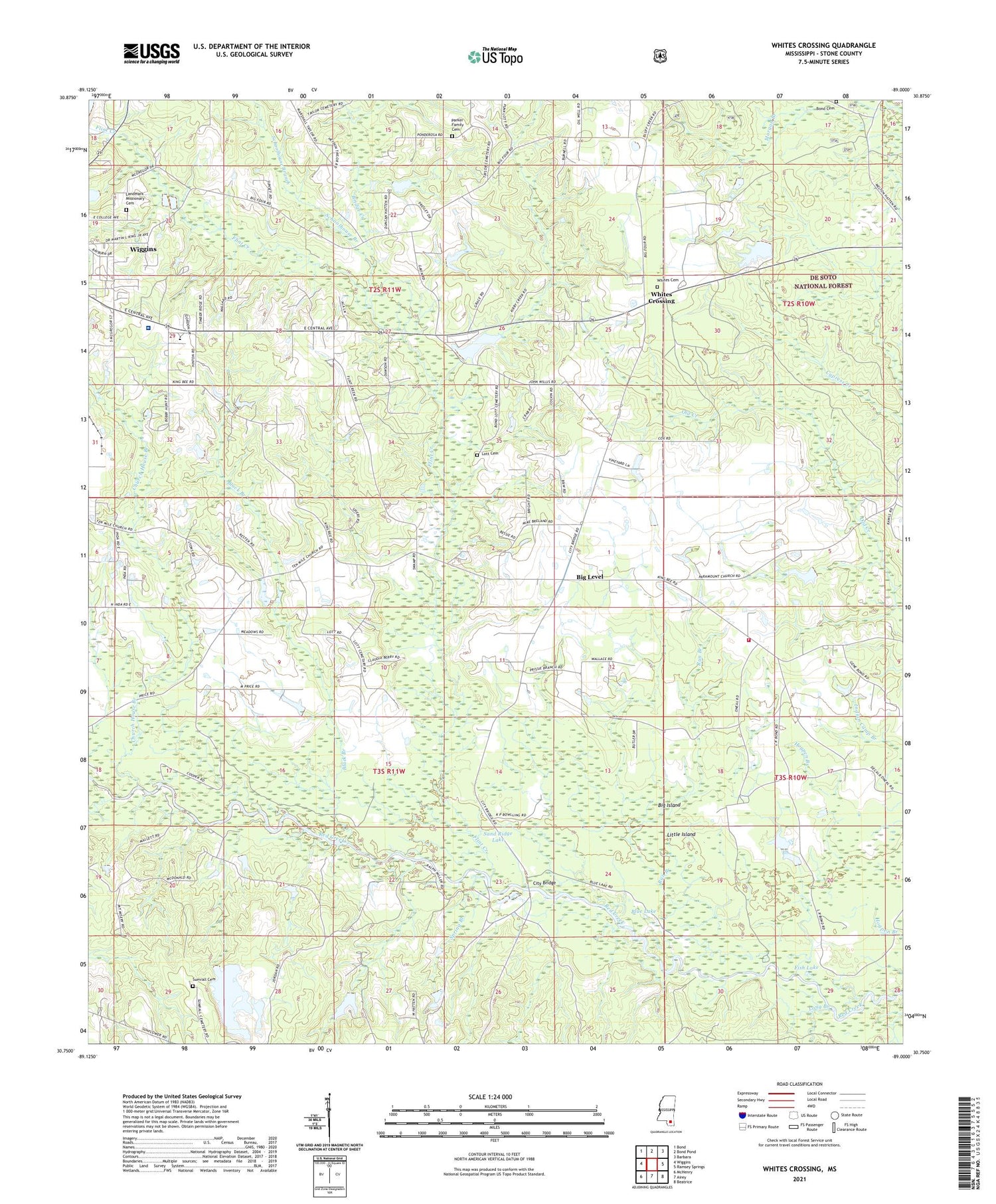
2021 topographic map quadrangle Whites Crossing in the state of Mississippi. Scale: 1:24000. Based on the newly updated USGS 7.5' US Topo map series, this map is in the following counties: Stone. The map contains contour data, water features, and other items you are used to seeing on USGS maps, but also has updated roads and other features. This is the next generation of topographic maps. Printed on high-quality waterproof paper with UV fade-resistant inks.
Quads adjacent to this one:
West: Wiggins
Northwest: Bond
North: Bond Pond
Northeast: Barbara
East: Ramsey Springs
Southeast: Beatrice
South: Airey
Southwest: McHenry
Contains the following named places: A and V Lake Dam, Bethel Baptist Church, Big Island, Big Level, Big Level Baptist Church, Big Level Volunteer Fire Department, Black Branch, Blue Lake, Bond Cemetery, Bond Lake Dam, Bridge Creek, Calvary Faithway Missionary Church, Church House Branch, City Bridge, Fairley Lake Dam, Faith Tabernacle Baptist Church, Fish Lake, Flint Creek, Flint Creek Reservoir Dam, Hall Lake Dam, Hatten Lake Dam, India, John Willis Chapel, Kirby Creek, Lake-A-Way Dam, Landmark Missionary Cemetery, Liberty Hill Church, Little Island, Long Branch, Lott Cemetery, Merts Bond Lake Dam, Morgan Branch, Morning Star Church, Red Branch, Red Creek Boat Ramp, Run Branch, Sand Ridge Lake, Schoolhouse Branch, Spring Branch, Stone County, Stone County Hospital, Stone Elementary School, Stone Lookout Tower, Sumrall Cemetery, Ten Mile Church, Vocational High School, Whites Cemetery, Whites Crossing


