MyTopo
Woodland Mississippi US Topo Map
Couldn't load pickup availability
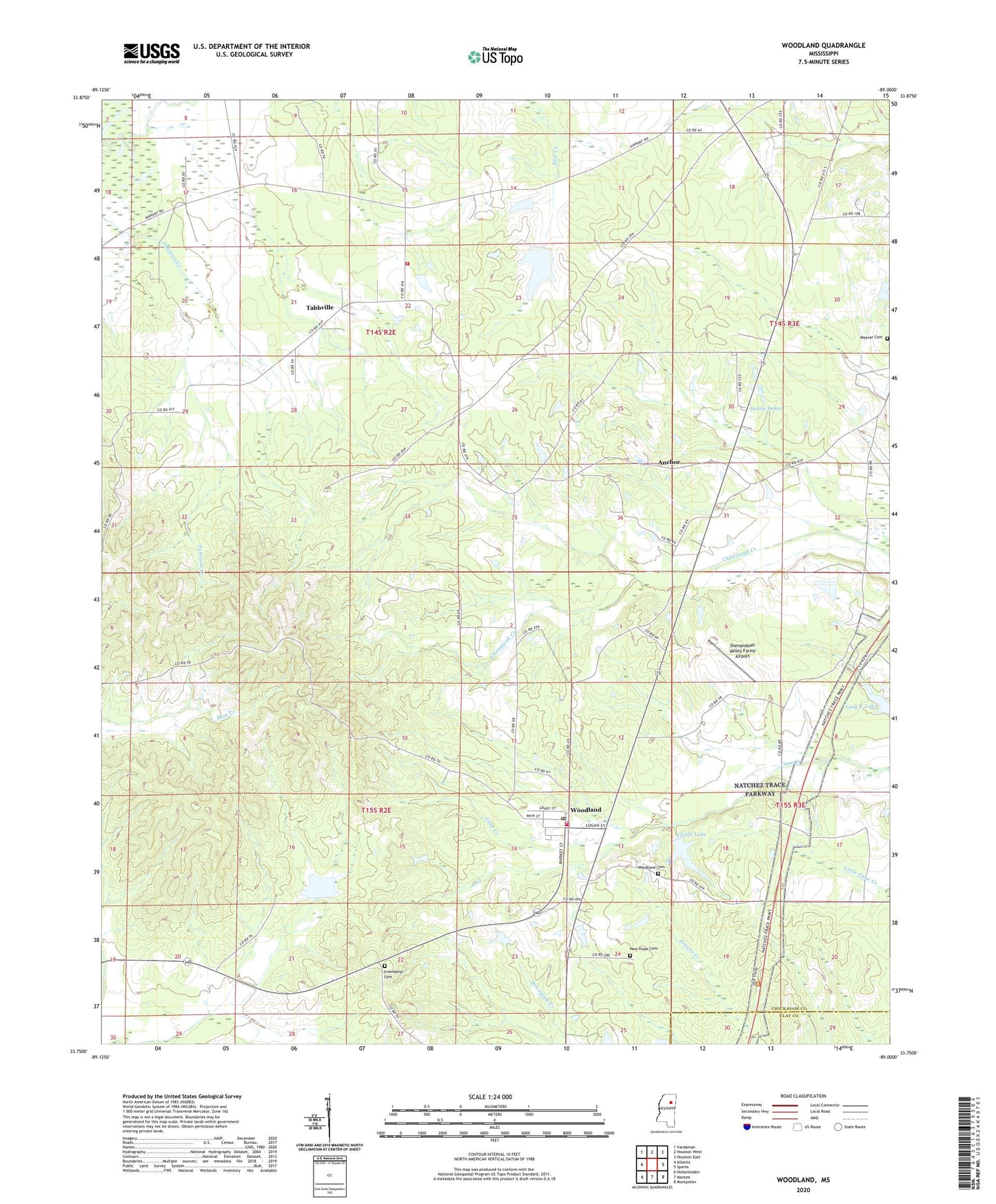
2020 topographic map quadrangle Woodland in the state of Mississippi. Scale: 1:24000. Based on the newly updated USGS 7.5' US Topo map series, this map is in the following counties: Chickasaw, Clay. The map contains contour data, water features, and other items you are used to seeing on USGS maps, but also has updated roads and other features. This is the next generation of topographic maps. Printed on high-quality waterproof paper with UV fade-resistant inks.
Quads adjacent to this one:
West: Atlanta
Northwest: Vardaman
North: Houston West
Northeast: Houston East
East: Sparta
Southeast: Montpelier
South: Mantee
Southwest: Hohenlinden
Contains the following named places: Anchor, Bethel, Bethel Baptist Church, Calahan Church, Childs Lake, Childs Lake Dam, Congress, Dobbs Lakes, Eland Lake Dam, Friendship Cemetery, Friendship Methodist Church, Friendship School, Hill School, King Lake Dam, Kings Hill School, Lazy K Lake, New Hope Cemetery, New Hope Missionary Baptist Church, New Prospect Church, New Zion Baptist Church, Oakland Church, Pine Ridge Church, Pleasant Ridge Baptist Church, Pleasant Ridge School, Rhodes Chapel, Rhodes Chapel Volunteer Fire Department Station 1, Scarbrough Lake, Scarbrough Lake Dam, Shenandoah Valley Farms Airport, Supervisor District 2, Tabbville, Upper Toposhaw Structure Y-27-1 Dam, Village of Woodland, Weaver Cemetery, Woodland, Woodland Baptist Church, Woodland Cemetery, Woodland Grammar School, Woodland High School, Woodland Lookout Tower, Woodland Post Office, Woodland Volunteer Fire Department Station 1, WTVA-TV (Tupelo), ZIP Code: 39776