MyTopo
Mantee Mississippi US Topo Map
Couldn't load pickup availability
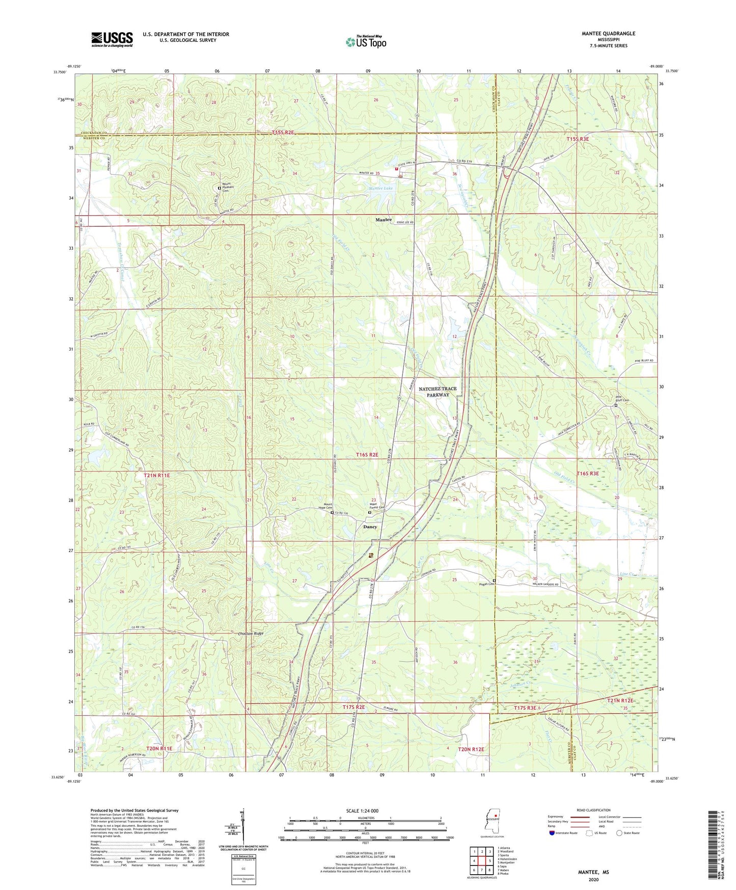
2024 topographic map quadrangle Mantee in the state of Mississippi. Scale: 1:24000. Based on the newly updated USGS 7.5' US Topo map series, this map is in the following counties: Webster, Clay, Chickasaw. The map contains contour data, water features, and other items you are used to seeing on USGS maps, but also has updated roads and other features. This is the next generation of topographic maps. Printed on high-quality waterproof paper with UV fade-resistant inks.
Quads adjacent to this one:
West: Hohenlinden
Northwest: Atlanta
North: Woodland
Northeast: Sparta
East: Montpelier
Southeast: Pheba
South: Maben
Southwest: Sapa
This map covers the same area as the classic USGS quad with code o33089f1.
Contains the following named places: Antioch Church, Choctaw Ridge, Dalton, Dancy, Davis Store, Dixie, Harrington Lake Dam, Kirby, Mantee, Mantee Baptist Church, Mantee Lake, Mantee Lake Dam, Mantee Post Office, Mantee Volunteer Fire Department, Mount Hope Cemetery, Mount Hope Church, Mount Pleasant Baptist Church, Mount Pleasant Cemetery, Old Carlson Church, Old Cumberland, Pine Bluff, Pine Bluff Baptist Church, Pine Bluff Cemetery, Pisgah Cemetery, Pisgah Methodist Church, Sheba, Talley Post Office, Union Valley, Village of Mantee, Wake Forest Cemetery, Wake Forest Church, ZIP Code: 39751