MyTopo
Wyatte Mississippi US Topo Map
Couldn't load pickup availability
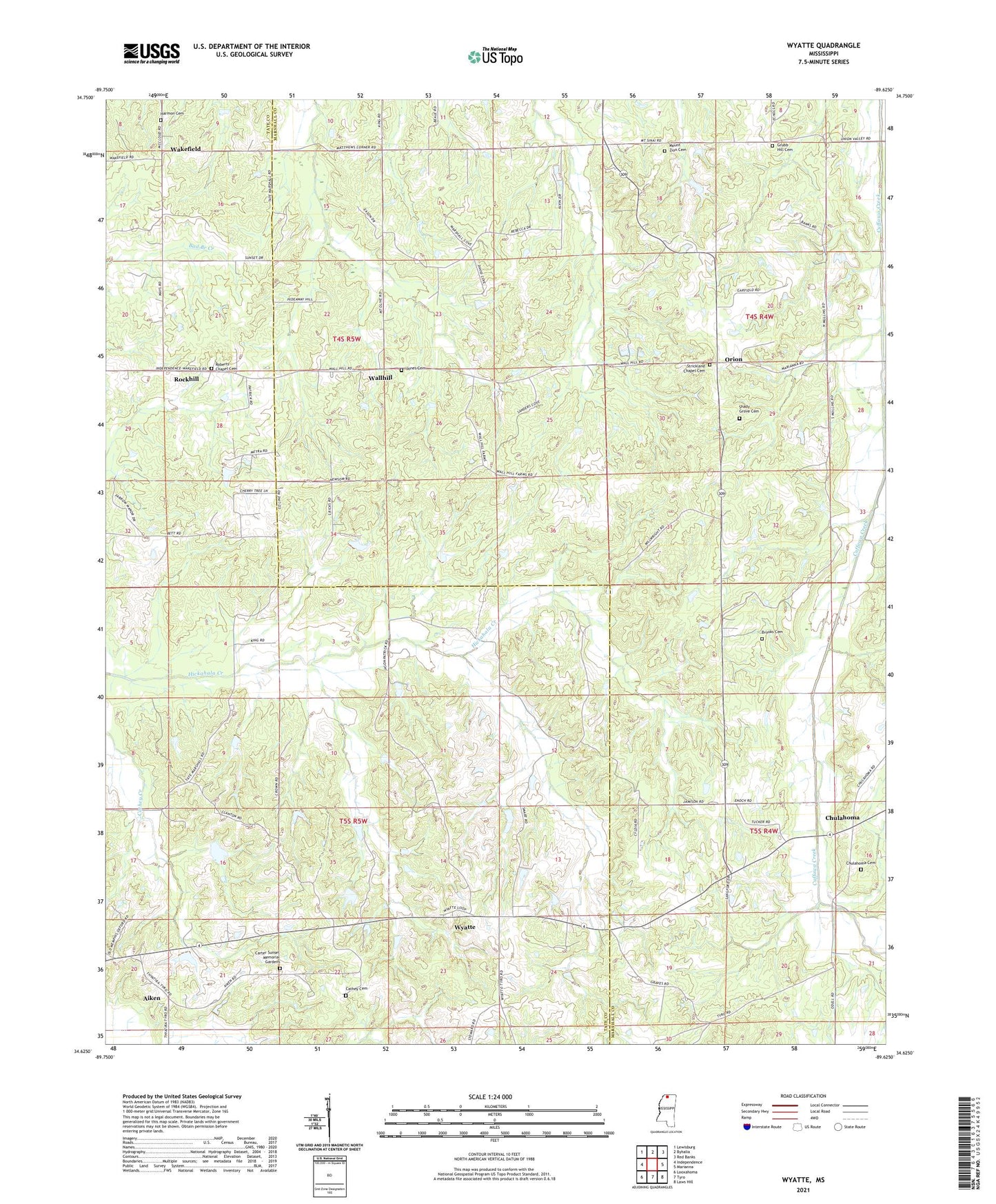
2024 topographic map quadrangle Wyatte in the state of Mississippi. Scale: 1:24000. Based on the newly updated USGS 7.5' US Topo map series, this map is in the following counties: Marshall, Tate. The map contains contour data, water features, and other items you are used to seeing on USGS maps, but also has updated roads and other features. This is the next generation of topographic maps. Printed on high-quality waterproof paper with UV fade-resistant inks.
Quads adjacent to this one:
West: Independence
Northwest: Lewisburg
North: Byhalia
Northeast: Red Banks
East: Marianna
Southeast: Laws Hill
South: Tyro
Southwest: Looxahoma
This map covers the same area as the classic USGS quad with code o34089f6.
Contains the following named places: Aiken, Bowen Lake Dam, Brooks Cemetery, Callis Lake Dam, Carter Sunset Memorial Gardens, Cathey Cemetery, Chulahoma, Chulahoma Cemetery, Chulahoma Church, Church of Christ, Dry Fork Creek, Ellis Chapel School, Grubb Hill Cemetery, Grubb Hill Church, Harmon Cemetery, Hickahala Creek Watershed Y-6-11 Dam, Hickahala Creek Watershed Y-6-15 Dam, Hickahala Creek Watershed Y-6-16 Dam, Hickahala Creek Watershed Y-6-3 Dam, Hickahala Creek Watershed Y-6-4 Dam, Hickahala Creek Watershed Y-6-5 Dam, Hickahala Creek Watershed Y-6-6 Dam, Jamieson Chapel, Jones Cemetery, Lee School, Mount Olive Church, Mount Zion Cemetery, Mount Zion Church, Mullins School, New Travel Church, Orion, Phillips School, Pigeon Roost Watershed Y-5-122 Dam, Roberts Chapel, Roberts Chapel Cemetery, Rockhill, Rockhill School, Saint Josephs Church, Saint Josephs School, Shady Grove Cemetery, Shady Grove Church, Shady Grove School, Stickland Chapel Cemetery, Strickland Chapel Cemetery, Strickland Chapel Church, Thyatira Church, Wakefield, Wallhill, Worrier School, Wyatte, Wyatte Baptist Church, Wyatte School