MyTopo
Marianna Mississippi US Topo Map
Couldn't load pickup availability
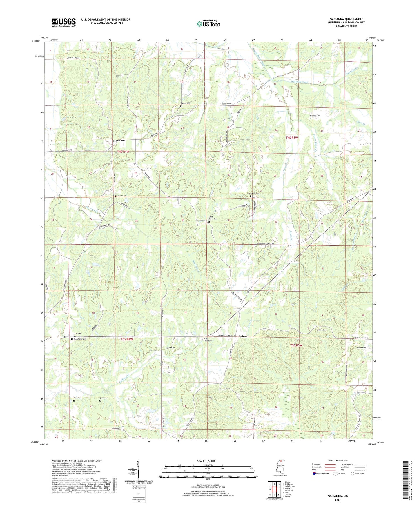
2024 topographic map quadrangle Marianna in the state of Mississippi. Scale: 1:24000. Based on the newly updated USGS 7.5' US Topo map series, this map is in the following counties: Marshall. The map contains contour data, water features, and other items you are used to seeing on USGS maps, but also has updated roads and other features. This is the next generation of topographic maps. Printed on high-quality waterproof paper with UV fade-resistant inks.
Quads adjacent to this one:
West: Wyatte
Northwest: Byhalia
North: Red Banks
Northeast: Holly Springs
East: Waterford
Southeast: Malone
South: Laws Hill
Southwest: Tyro
This map covers the same area as the classic USGS quad with code o34089f5.
Contains the following named places: Brewer Cemetery, Brooks Cemetery, Chew Creek, Chulahoma Church, Chulahoma Missionary Baptist Church Cemetery, Cox Cemetery, Dean Cemetery, Galena, Galena School, J K Hurdle Lake Dam, Jones Cemetery, Jones Creek, Jones School, Marianna, Marvel Cemetery, Marvin Church, McCarley School, McIntyre Church, McIntyre School, Mount Gillie Cemetery, Mount Gillie Church, Mount Marie School, Mount Moriah Church, Mount Peel Missionary Baptist Church, Nunnally Cemetery, Nunnally Creek, Shiloh Hill School, Smith Grove Cemetery, Smith Grove Church, Street Hill Church, Supervisor District 4, Union Valley Church, Union Valley School, Wilkins Cemetery, Wilkins Chapel, Wilkins Church, Wilkins Creek, Wilkins School, Yarbrough Cemetery, Yarbrough Chapel Christian Methodist Episcopal Church, Yarbrough Church, Yarbrough School