MyTopo
Mound Louisiana US Topo Map
Couldn't load pickup availability
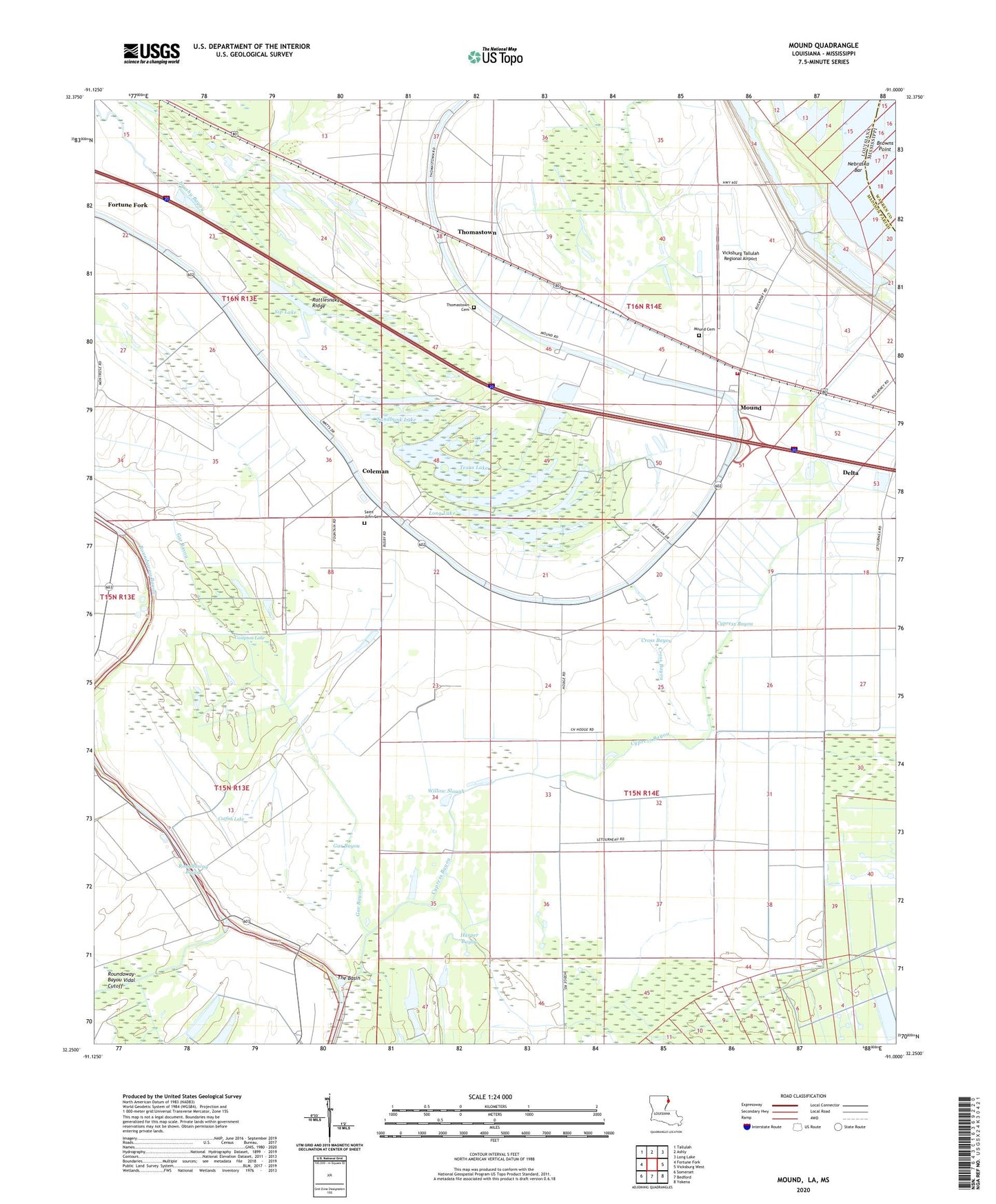
2024 topographic map quadrangle Mound in the states of Louisiana, Mississippi. Scale: 1:24000. Based on the newly updated USGS 7.5' US Topo map series, this map is in the following counties: Madison, Warren. The map contains contour data, water features, and other items you are used to seeing on USGS maps, but also has updated roads and other features. This is the next generation of topographic maps. Printed on high-quality waterproof paper with UV fade-resistant inks.
Quads adjacent to this one:
West: Fortune Fork
Northwest: Tallulah
North: Ashly
Northeast: Long Lake
East: Vicksburg West
Southeast: Yokena
South: Bedford
Southwest: Somerset
Contains the following named places: Alcadone Plantation, Big Lake, California Plantation, Cape Plantation, Catfish Lake, Christmas Lake, Coleman, Compton Lake, Cross Bayou, Crystal Springs Plantation, Cypress Bayou, Dry Lake, Gar Bayou, Harper Bayou, Harrison Lake, K C Ranch Landing Strip, Killarney Church, Killarney Planatation, Long Lake, Mexico Store, Mound, Mound Cemetery, Mound Fire District 1, Mound Plantation, Mount Abbey Church, Mount Moriah Church Number 1, Mount Moriah Church Number 2, Mount Pilgrim Church, Mount Zilla Church, Nebraska Bar, Nebraska Landing, Rattlesnake Ridge, Red Beard Dusting Service Airport, Roundaway-Bayou Vidal Cutoff, Saint James Church, Saint John Cemetery, Saint John Church, Sandbank Lake, Shady Grove Church, Sip Lake, Solomon Temple, Solomons Temple Church, Texas Lake, Texas Plantation, The Basin, Thomas Chapel, Thomastown, Thomastown Cemetery, Thomastown School, Thompson Church, Trinidad Plantation, Vicksburg Tallulah Regional Airport, Village of Mound, Walnut Bayou, Ward One, Willow Slough, Yerger Lake, Yerger Landing Strip, Youngs Landing