MyTopo
Auburn Missouri US Topo Map
Couldn't load pickup availability
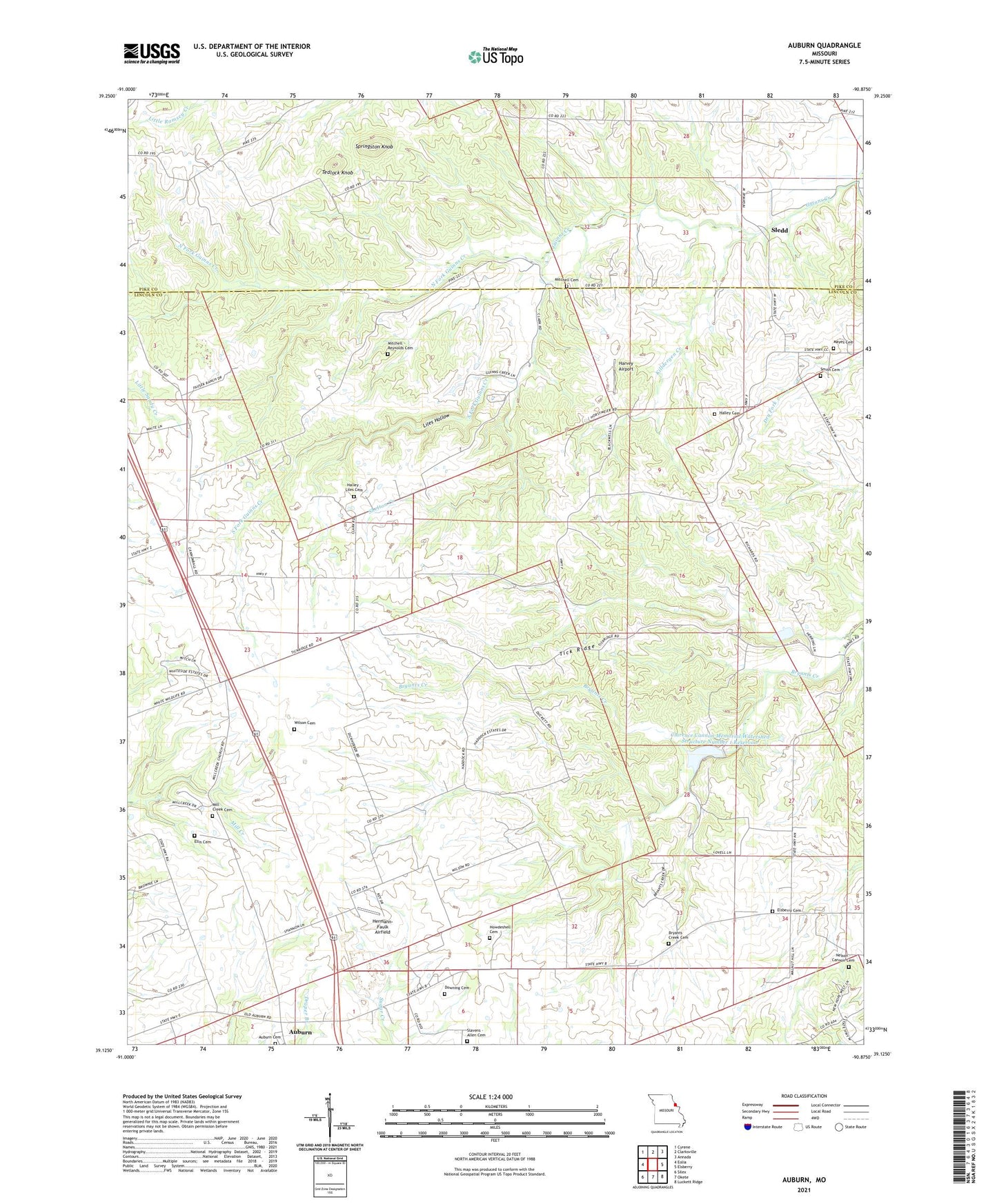
2021 topographic map quadrangle Auburn in the state of Missouri. Scale: 1:24000. Based on the newly updated USGS 7.5' US Topo map series, this map is in the following counties: Lincoln, Pike. The map contains contour data, water features, and other items you are used to seeing on USGS maps, but also has updated roads and other features. This is the next generation of topographic maps. Printed on high-quality waterproof paper with UV fade-resistant inks.
Quads adjacent to this one:
West: Eolia
Northwest: Cyrene
North: Clarksville
Northeast: Annada
East: Elsberry
Southeast: Luckett Ridge
South: Okete
Southwest: Silex
Contains the following named places: Auburn, Auburn Cemetery, Auburn School, Bryants Creek Cemetery, Cannon School, Clarence Cannon Memorial Watershed Dam Number 15, Clarence Cannon Memorial Watershed Dam Number 8, Clarence Cannon Memorial Watershed Structure Number 1 Dam, Clarence Cannon Memorial Watershed Structure Number 1 Reservoir, Clarence Cannon Memorial Watershed Structure Number 11 Dam, Clarence Cannon Memorial Watershed Structure Number 4 Dam, Downing Cemetery, Ebenezer Church, Ellis Cemetery, Elsberry Cemetery, Fagg School, Halley - Liles Cemetery, Halley Cemetery, Harvey Airport, Hermann-Faulk Airfield, Howdeshell Cemetery, Jeans School, Killdergen Creek, Last Chance School, Liles Hollow, Mayes Cemetery, Mill Creek Cemetery, Mill Creek Church, Mill Creek School, Mitchell - Reynolds Cemetery, Mitchell Cemetery, Nelson - Cannon Cemetery, North Fork Guinns Creek, Number 769 Dam, Shelton Creek, Slavens - Allen Cemetery, Sledd, Sledd Post Office, Sledd School, Smith Cemetery, Smith Chapel, Smith School, Souls Chapel, South Fork Guinns Creek, Springston Knob, Tedlock Knob, Tick Ridge, White Swan School, Wilson Cemetery