MyTopo
Silex Missouri US Topo Map
Couldn't load pickup availability
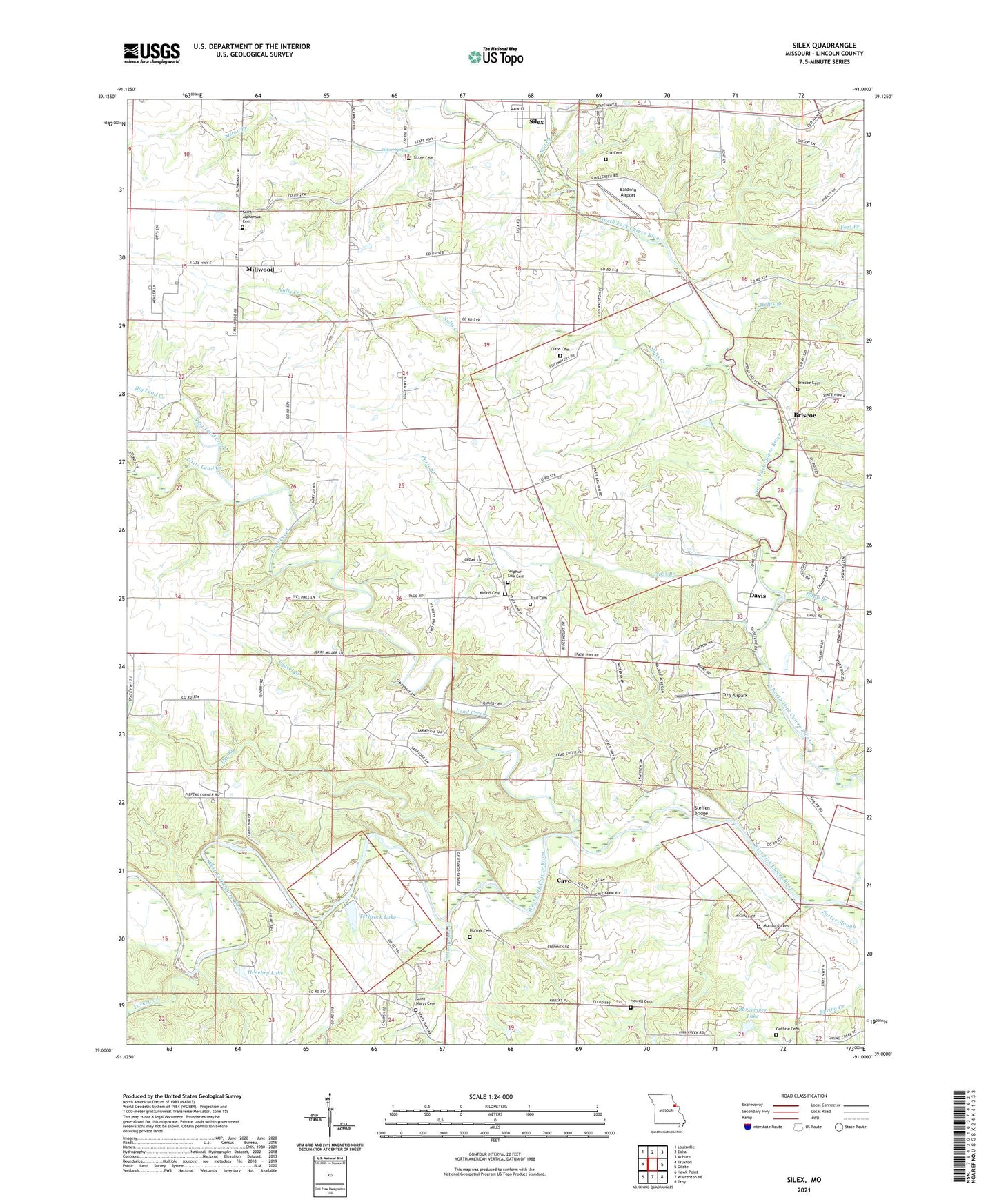
2021 topographic map quadrangle Silex in the state of Missouri. Scale: 1:24000. Based on the newly updated USGS 7.5' US Topo map series, this map is in the following counties: Lincoln. The map contains contour data, water features, and other items you are used to seeing on USGS maps, but also has updated roads and other features. This is the next generation of topographic maps. Printed on high-quality waterproof paper with UV fade-resistant inks.
Quads adjacent to this one:
West: Truxton
Northwest: Louisville
North: Eolia
Northeast: Auburn
East: Okete
Southeast: Troy
South: Warrenton NE
Southwest: Hawk Point
This map covers the same area as the classic USGS quad with code o39091a1.
Contains the following named places: Baldwin Airport, Barnable School, Big Lead Creek, Bohmer School, Briscoe, Briscoe Cemetery, Burkemper Lake, Burkemper Lake Dam, Cave, Clare Cemetery, Cottonwood Branch, Cox Cemetery, Davis, Dry Branch, Elliot School, Famous, Famous Post Office, Forest Gem School, Fort Branch, Guthrie Cemetery, Helps Branch, Henebry Lake, Henebry Lake Dam, Howell Cemetery, Hunter Cemetery, Hupp Branch, Keithey School, Kinion Cemetery, Lead Creek, Little Lead Creek, Mackville, Mackville Post Office, Mashek, Mashek Church, Mill Creek, Millwood, Millwood School, Mumford Cemetery, Nulls Creek, Owen School, Paris Branch, Peasel Branch, Saint Alphonsus Cemetery, Saint Alphonsus Parish, Saint Marys Cemetery, Silex, Sitton Branch, Sitton Cemetery, Sitton Spring, Spring Creek Community Center, Steffen Bridge, Stepanek Crossing, Sulphur Lick Cemetery, Terbrock Lake, Terbrock Lake Dam, Town of Cave, Township of Bedford, Township of Millwood, Trail Cemetery, Troy Airpark, Turkey Creek, Wommacks Ford, ZIP Code: 63377