MyTopo
Clarksville Missouri US Topo Map
Couldn't load pickup availability
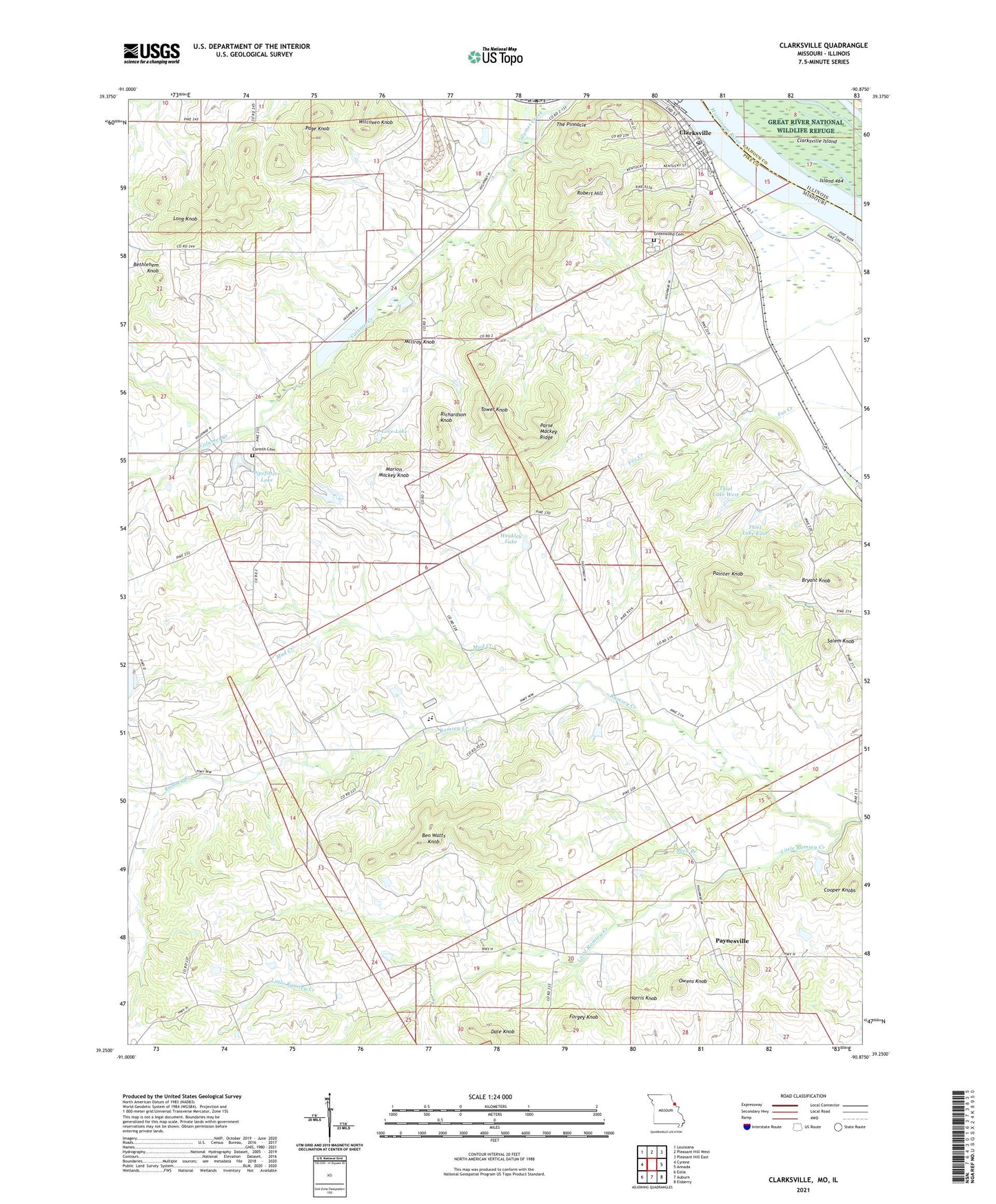
2021 topographic map quadrangle Clarksville in the states of Missouri, Illinois. Scale: 1:24000. Based on the newly updated USGS 7.5' US Topo map series, this map is in the following counties: Pike, Calhoun. The map contains contour data, water features, and other items you are used to seeing on USGS maps, but also has updated roads and other features. This is the next generation of topographic maps. Printed on high-quality waterproof paper with UV fade-resistant inks.
Quads adjacent to this one:
West: Cyrene
Northwest: Louisiana
North: Pleasant Hill West
Northeast: Pleasant Hill East
East: Annada
Southeast: Elsberry
South: Auburn
Southwest: Eolia
This map covers the same area as the classic USGS quad with code o39090c8.
Contains the following named places: Aberdeen, Aberdeen Post Office, Akers School, Ben Watts Knob, Bethlehem Knob, Bryant Knob, Buck Branch, City of Clarksville, Clarksville, Clarksville Island, Clarksville Post Office, Clarksville Volunteer Fire Department, Cooper Knobs, Corinth Cemetery, Corinth Church, Corinth School, Dale Knob, Farris School, Forgey Knob, Greenwood Cemetery, Harris Knob, Island 464, Joseph Keeven Dam, Little Ramsey Creek, Lockard Lake Dam, Long Knob, Love Lake, Love Lake Dam, Malvern B. Clopton Elementary School, Malvern B. Clopton Junior Senior High School, Marion Mackey Knob, Mcllroy Knob, Mud Creek, Owens Knob, Page Knob, Painter Knob, Parse Mackey Ridge, Paynesville, Pipefitters Dam, Pipefitters Lake, Ramsey Creek Church, Ramsey School, Richardson Knob, Ripple Lake Dam, Robert Hill, Salem Knob, Salem School, The Pinnacle, Thiel Lake East, Thiel Lake East Dam, Thiel Lake West, Thiel Lake West Dam, Tower Knob, Township of Calumet, Turpin, Village of Paynesville, Weakley Lake, Wilcoxen Knob, William B Weakley Dam, ZIP Code: 63336