MyTopo
Eolia Missouri US Topo Map
Couldn't load pickup availability
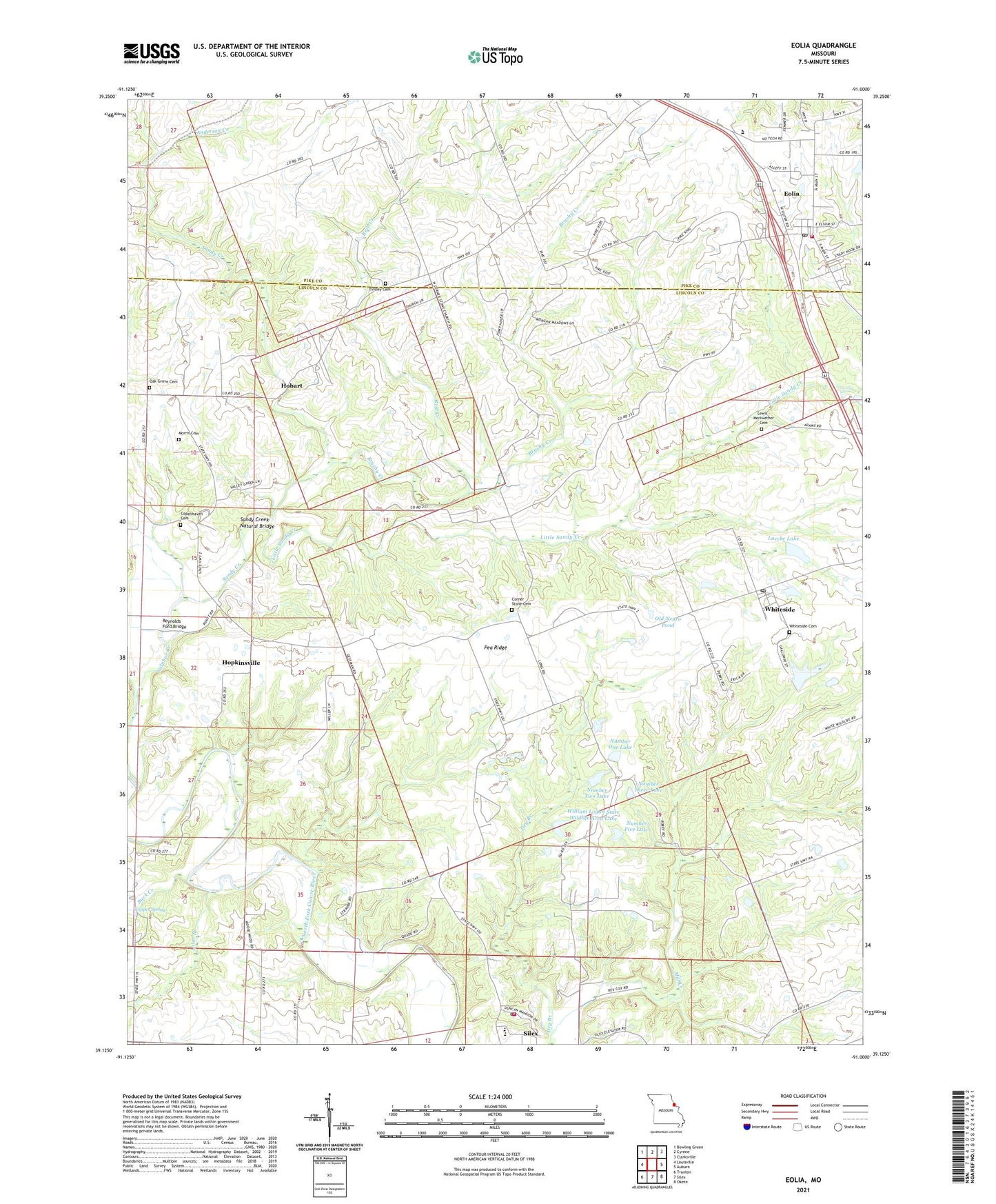
2021 topographic map quadrangle Eolia in the state of Missouri. Scale: 1:24000. Based on the newly updated USGS 7.5' US Topo map series, this map is in the following counties: Lincoln, Pike. The map contains contour data, water features, and other items you are used to seeing on USGS maps, but also has updated roads and other features. This is the next generation of topographic maps. Printed on high-quality waterproof paper with UV fade-resistant inks.
Quads adjacent to this one:
West: Louisville
Northwest: Bowling Green
North: Cyrene
Northeast: Clarksville
East: Auburn
Southeast: Okete
South: Silex
Southwest: Truxton
This map covers the same area as the classic USGS quad with code o39091b1.
Contains the following named places: Anderson Creek, Brushy Creek, Buck Creek, Copenhaven Cemetery, Copper Spring, Corner Stone Cemetery, Corner Stone Church, Dry Branch, Eolia, Eolia Community Fire Protection District, Eolia Post Office, Hobart, Hopkinsville, Lewis - Meriwether Cemetery, Liles Hall School, Little Sandy Creek, Lolar Branch, Luecke Lake, Luecke Lake Dam, Morris Cemetery, Northwest Fire Protection District, Number Five Lake, Number Four Lake, Number One Lake, Number Three Lake, Number Two Lake, Oak Grove Cemetery, Oak Grove Church, Oak Grove School, Old Negro Pond, Pea Ridge, Pea Ridge School, Pike-Lincoln Technical Center, Prairie Flower School, Reid Creek, Reynolds Ford Bridge, Saint Johns Church, Sandy Creek, Sandy Creek Natural Bridge, Silex Elementary School, Silex High School, Silex Post Office, Sulphur Creek, Tinsley Cemetery, Township of Union, Village of Eolia, Village of Silex, Village of Whiteside, Vonaventure State Memorial Forest And, White Memorial Area Section 16 Lake Dam, White Memorial State Wildlife Area, Whiteside, Whiteside Cemetery, Whiteside Post Office, Whiteside School, William Logan State Wildlife Area, William Logan State Wildlife Area Lake, William Logan State Wildlife Area Lake Number 4 Dam, ZIP Codes: 63344, 63387