MyTopo
Axtell Missouri US Topo Map
Couldn't load pickup availability
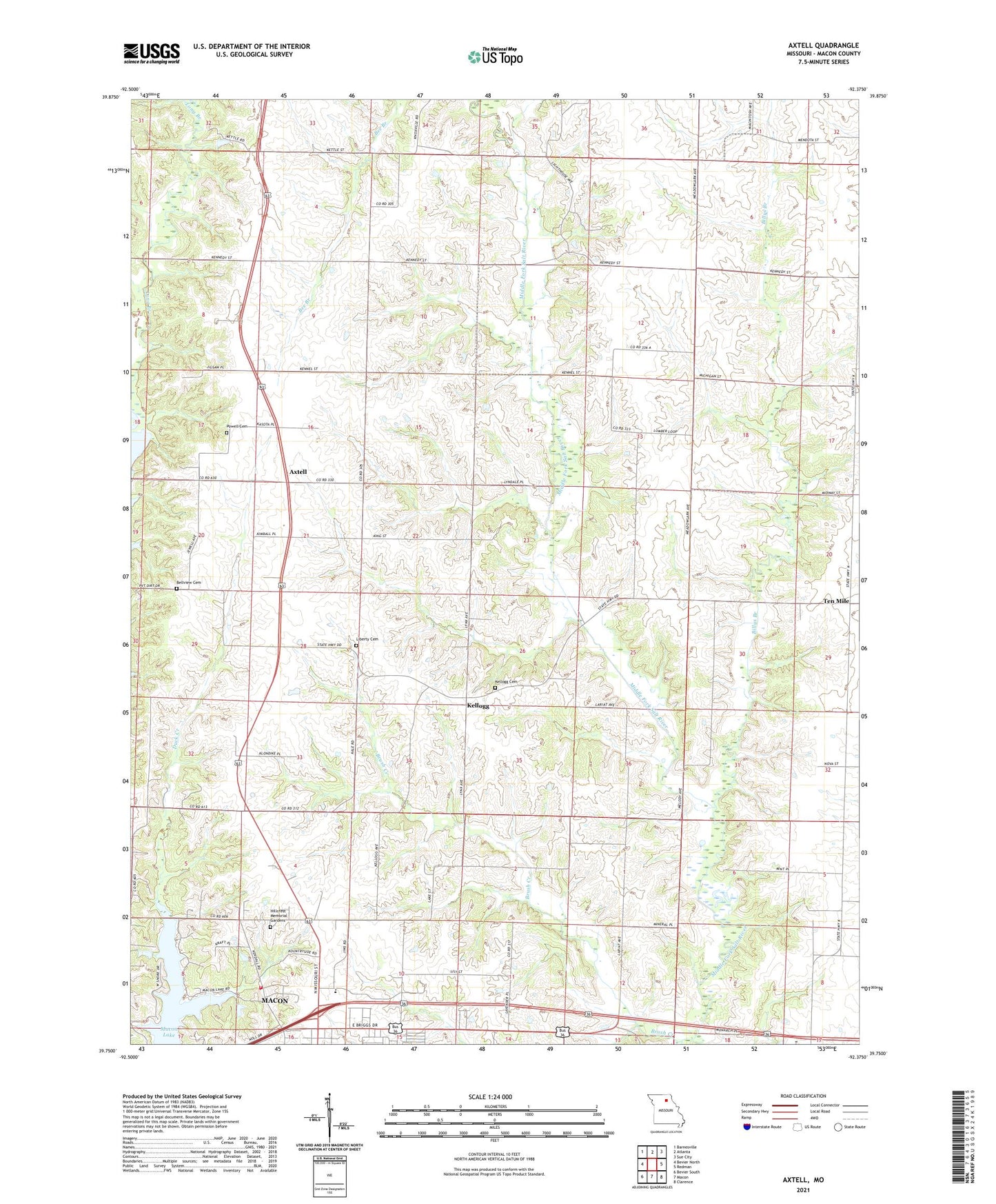
2021 topographic map quadrangle Axtell in the state of Missouri. Scale: 1:24000. Based on the newly updated USGS 7.5' US Topo map series, this map is in the following counties: Macon. The map contains contour data, water features, and other items you are used to seeing on USGS maps, but also has updated roads and other features. This is the next generation of topographic maps. Printed on high-quality waterproof paper with UV fade-resistant inks.
Quads adjacent to this one:
West: Bevier North
Northwest: Barnesville
North: Atlanta
Northeast: Sue City
East: Redman
Southeast: Clarence
South: Macon
Southwest: Bevier South
Contains the following named places: Axtell, B Thieman Dam, Bellview Cemetery, Billys Branch, Browns School Number 2, Browns School Number 5, Brush Creek, Crossroads Church, Duck Creek School, Eagle School, Fairview Church, Hickory Grove School, Hillcrest Memorial Gardens, Kellogg, Kellogg Cemetery, La Porta School, Larson Lake Dam, Liberty Cemetery, Liberty Church, Lyda, Lyda Post Office, Macon Lake, Macon Plaza, Macon Rural Fire Department, Mechlin Lake Dam, Missouri State Highway Patrol Troop B, Number 22 Dam, Oakwood School, Plainview Church, Pleasant Grove School, Pleasant Valley School, Powell Cemetery, Sewer Creek, Ten Mile, Township of Eagle, Van Vleet School, Wardell School, Whiteoak School, ZIP Code: 63552