MyTopo
Clarence Missouri US Topo Map
Couldn't load pickup availability
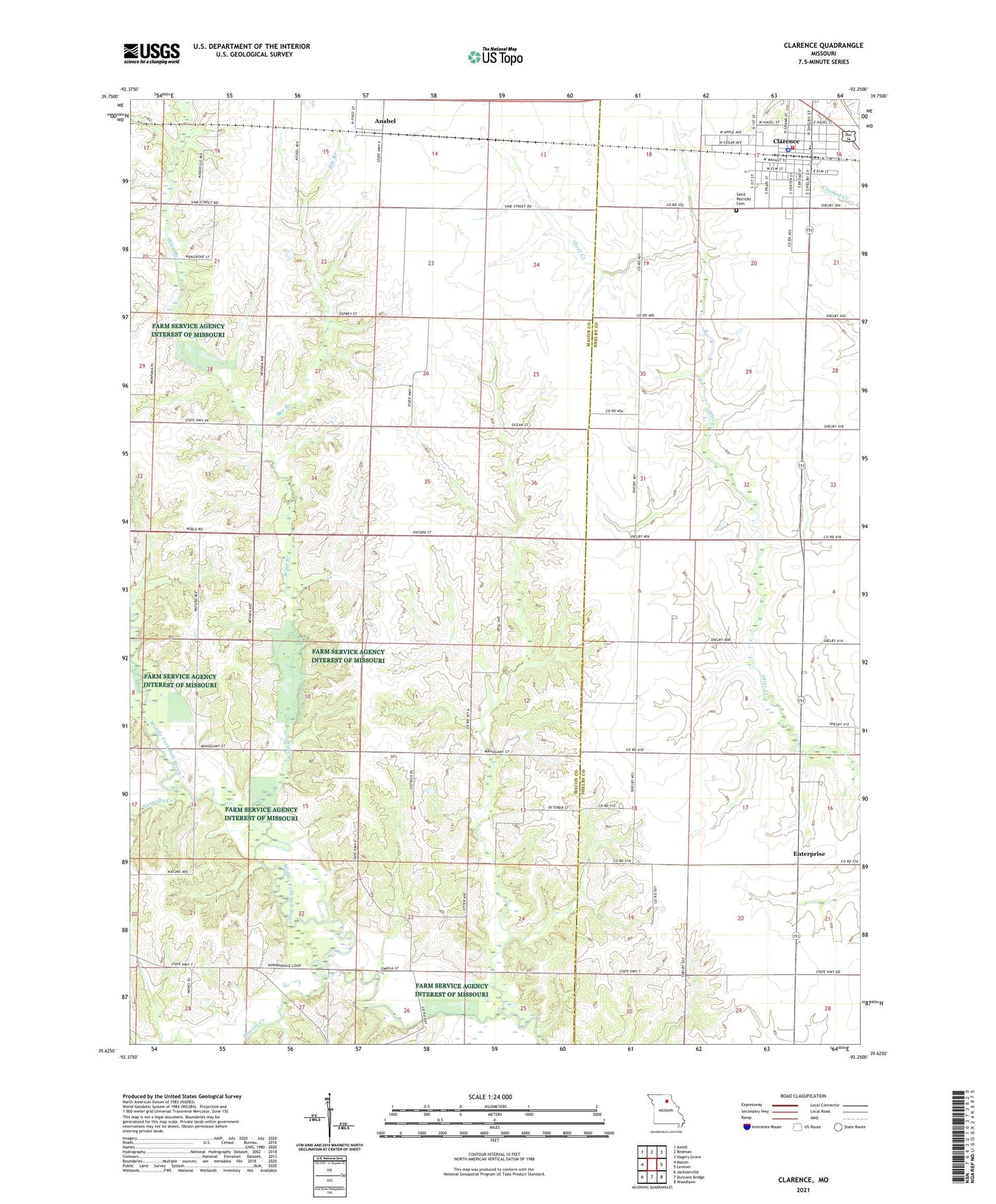
2021 topographic map quadrangle Clarence in the state of Missouri. Scale: 1:24000. Based on the newly updated USGS 7.5' US Topo map series, this map is in the following counties: Macon, Shelby. The map contains contour data, water features, and other items you are used to seeing on USGS maps, but also has updated roads and other features. This is the next generation of topographic maps. Printed on high-quality waterproof paper with UV fade-resistant inks.
Quads adjacent to this one:
West: Macon
Northwest: Axtell
North: Redman
Northeast: Hagers Grove
East: Lentner
Southeast: Woodlawn
South: Duncans Bridge
Southwest: Jacksonville
This map covers the same area as the classic USGS quad with code o39092f3.
Contains the following named places: Anabel, Bee Branch, Bethlehem Church, Bohannon School, Church of God, City of Clarence, Clarence, Clarence City Fire Department, Clarence Police Department, Clarence Post Office, Enterprise, Graves Chapel, Hoover Creek, Lily Dale School, Longville, Narrows Creek, Prairie View School, Saint Patricks Cemetery, Saint Patricks Roman Catholic Church, Sale School, Taylor School, Township of Middle Fork, Township of Round Grove, Union Church, Waddell School, Wilson and Evans Mill, Winn Branch, Zion Methodist Church, ZIP Code: 63431