MyTopo
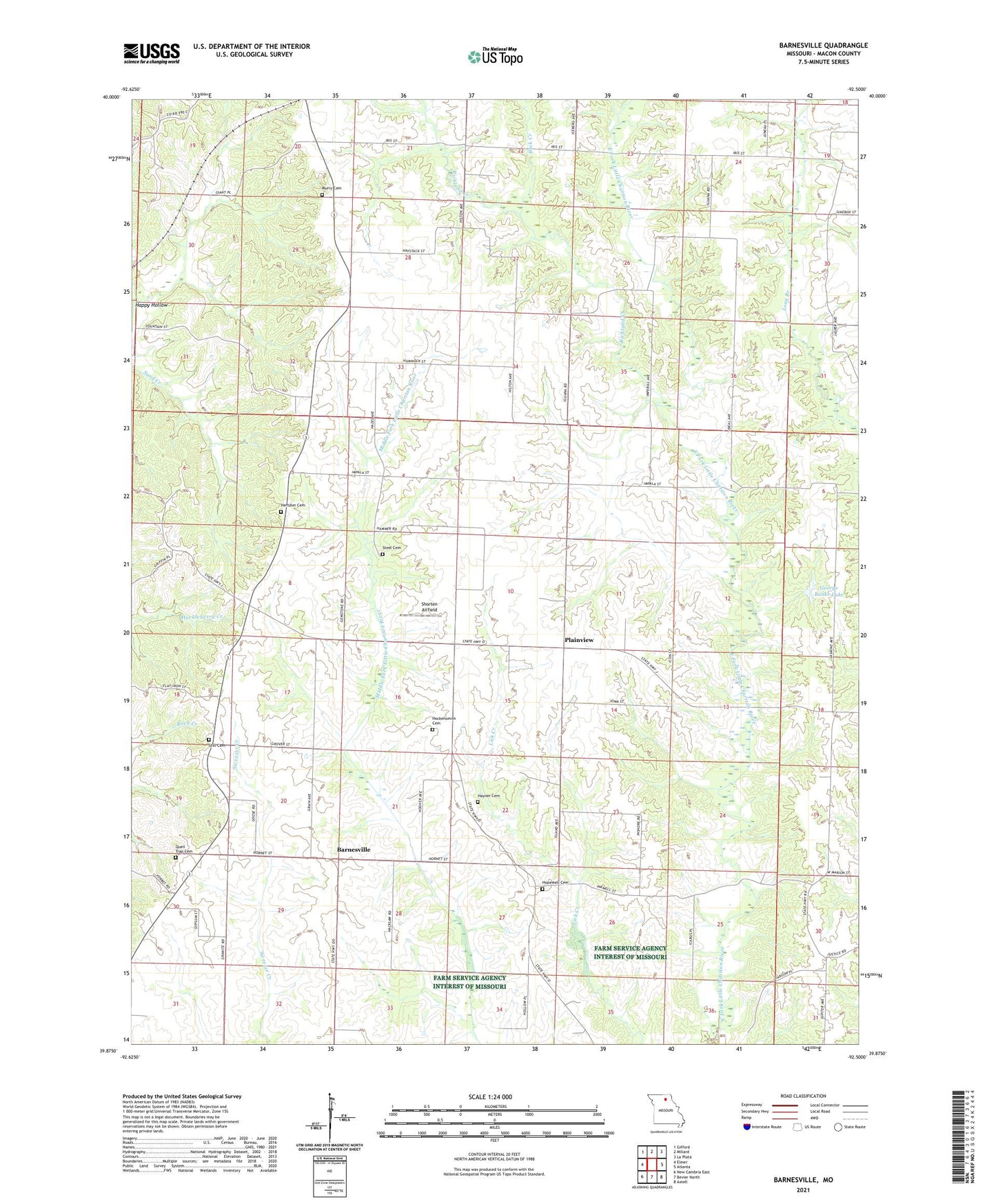
Barnesville Missouri US Topo Map
Couldn't load pickup availability
2021 topographic map quadrangle Barnesville in the state of Missouri. Scale: 1:24000. Based on the newly updated USGS 7.5' US Topo map series, this map is in the following counties: Macon. The map contains contour data, water features, and other items you are used to seeing on USGS maps, but also has updated roads and other features. This is the next generation of topographic maps. Printed on high-quality waterproof paper with UV fade-resistant inks.
Quads adjacent to this one:
West: Elmer
Northwest: Gifford
North: Millard
Northeast: La Plata
East: Atlanta
Southeast: Axtell
South: Bevier North
Southwest: New Cambria East
This map covers the same area as the classic USGS quad with code o39092h5.
Contains the following named places: Atlanta State Wildlife Area, Atterberry School, Barnesville, Buck Creek, Bunch School, Chariton Ridge Church, Cottage, Cottage Post Office, George Baake Dam, George Baake Lake, Happy Hollow, Hayner Cemetery, Hertzler Cemetery, Hockensmith Cemetery, Hopewell Cemetery, Hopewell School, Little Zion Church, McNeely School, Murry Cemetery, Murry School, Nash School, Osborne School, Plainview, Quail Trap Cemetery, Richland Creek, Shorten Airfield, Steel Cemetery, Steel School, Still Cemetery, Township of Independence, Township of Richland, Union Ridge School