MyTopo
Redman Missouri US Topo Map
Couldn't load pickup availability
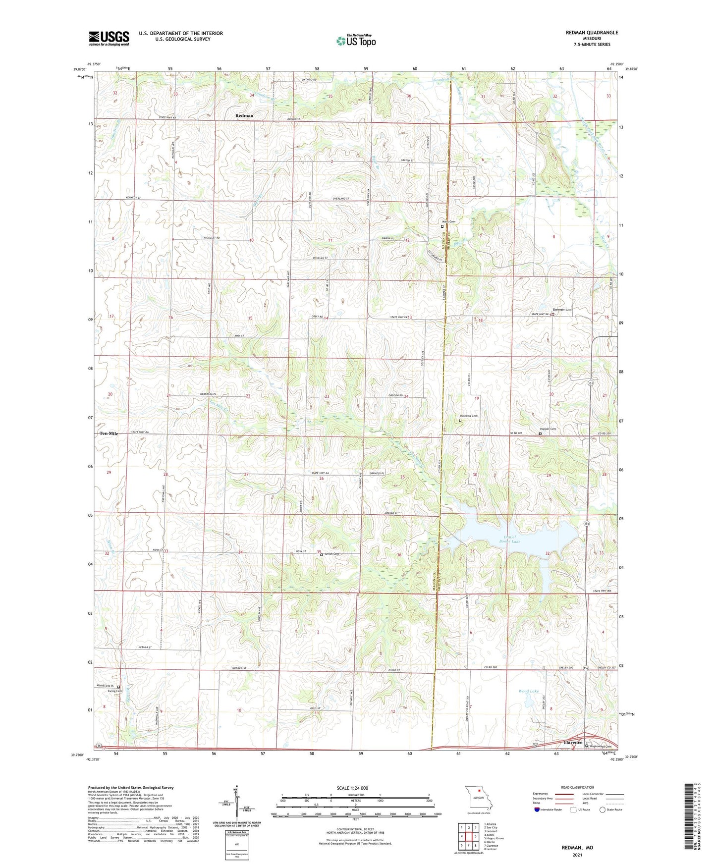
2021 topographic map quadrangle Redman in the state of Missouri. Scale: 1:24000. Based on the newly updated USGS 7.5' US Topo map series, this map is in the following counties: Macon, Shelby. The map contains contour data, water features, and other items you are used to seeing on USGS maps, but also has updated roads and other features. This is the next generation of topographic maps. Printed on high-quality waterproof paper with UV fade-resistant inks.
Quads adjacent to this one:
West: Axtell
Northwest: Atlanta
North: Sue City
Northeast: Leonard
East: Hagers Grove
Southeast: Lentner
South: Clarence
Southwest: Macon
This map covers the same area as the classic USGS quad with code o39092g3.
Contains the following named places: Amish Cemetery, Anabel School, Bethel Church, Byar Branch, Daniel Boone Lake, David R Wilson Dam, Ebenezer Cemetery, Ebenezer Church, Ewing Cemetery, Goodson Branch, Hawkins Cemetery, Hickory Grove School, Hopper Cemetery, Hopper School, Independence School, Jack Wood Dam, Locust Grove School, Maplewood Cemetery, Mitts Cemetery, Mount Zion Church, Old Channel North Fork Salt River, Redman, Redman School, Redman State Wildlife Area, Riley School, Schwanda School, Ten Mile Church, Tenmile School, Township of Ten Mile, West Bethany Church, Wilson South Lake Dam, Wood Lake