MyTopo
Azen Missouri US Topo Map
Couldn't load pickup availability
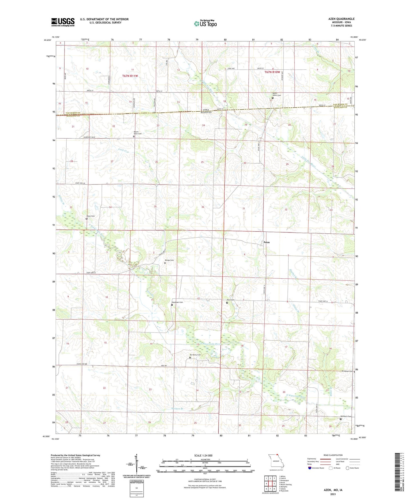
2021 topographic map quadrangle Azen in the states of Missouri, Iowa. Scale: 1:24000. Based on the newly updated USGS 7.5' US Topo map series, this map is in the following counties: Scotland, Van Buren. The map contains contour data, water features, and other items you are used to seeing on USGS maps, but also has updated roads and other features. This is the next generation of topographic maps. Printed on high-quality waterproof paper with UV fade-resistant inks.
Quads adjacent to this one:
West: Brock
Northwest: Milton
North: Cantril
Northeast: Keosauqua
East: Mount Sterling
Southeast: Wyaconda
South: Arbela
Southwest: Memphis
Contains the following named places: Ansen Lake Dam, Azen, Azen School, Billups Cemetery, Clay Point School, Cook Creek, Daggs Branch, Elm Grove School, Fairview School, Hixon Cemetery, Lawn Ridge, Lawn Ridge Church, Mc Henry Cemetery, Miller Branch, Morgan Branch, Mount Olive Cemetery, Needham Cemetery, North Upton Cemetery, Penn Cemetery, Prairieview Church, Providence Baptist Church, Rathburn Cemetery, South Upton School, Union Grove School, Willow Branch, ZIP Code: 52542