MyTopo
Arbela Missouri US Topo Map
Couldn't load pickup availability
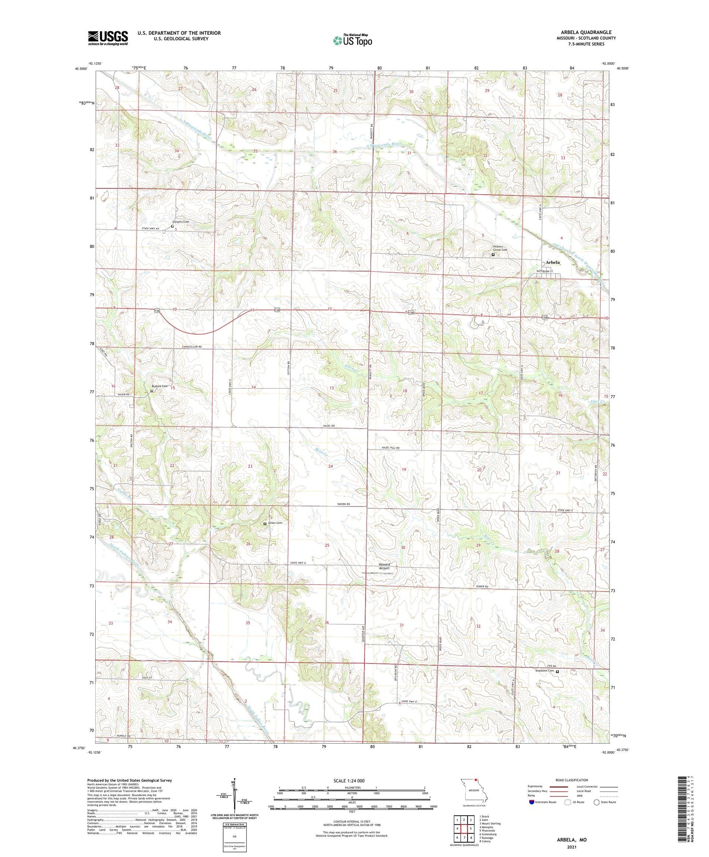
2021 topographic map quadrangle Arbela in the state of Missouri. Scale: 1:24000. Based on the newly updated USGS 7.5' US Topo map series, this map is in the following counties: Scotland. The map contains contour data, water features, and other items you are used to seeing on USGS maps, but also has updated roads and other features. This is the next generation of topographic maps. Printed on high-quality waterproof paper with UV fade-resistant inks.
Quads adjacent to this one:
West: Memphis
Northwest: Brock
North: Azen
Northeast: Mount Sterling
East: Wyaconda
Southeast: Colony
South: Rutledge
Southwest: Greensburg
This map covers the same area as the classic USGS quad with code o40092d1.
Contains the following named places: A-2 Lake, Arbela, Bear Creek Watershed Dam A-2, Buskirk Cemetery, Cedar Grove School, Conyers Cemetery, Conyers Church, Conyers School, Gunns Branch, Hazel Hill School, Hickory Grove Cemetery, Hickory Grove Church, Howard Airport, Morning View School, North Mount Pleasant School, Oak Ridge School, Plum College School, Round Grove School, Salem School, Shacklett Cemetery, Town of Arbela, Township of Thomson, Union Cemetery, Union Church, Union School, Wileys Air Strip