MyTopo
Mount Sterling Iowa US Topo Map
Couldn't load pickup availability
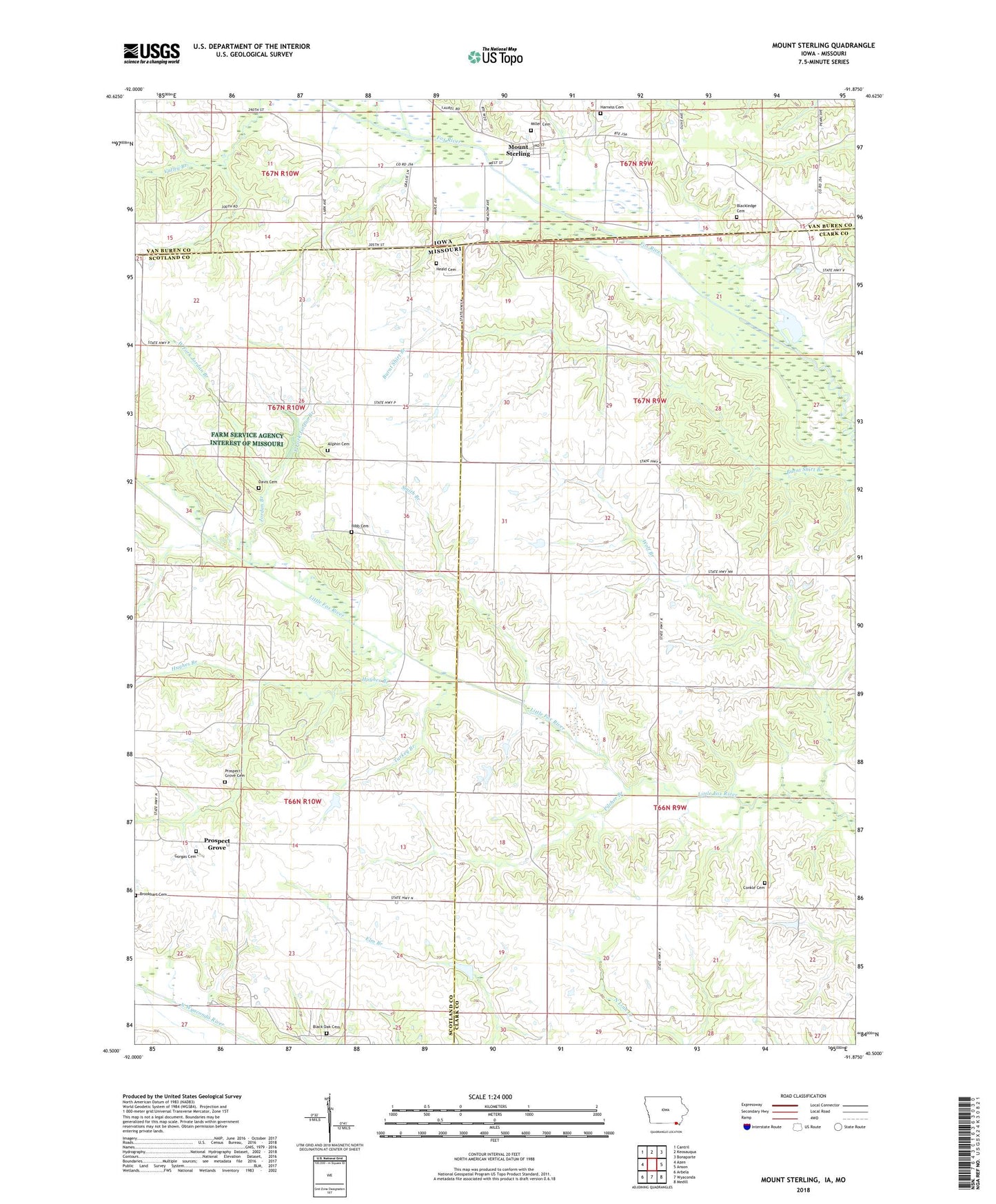
2022 topographic map quadrangle Mount Sterling in the states of Missouri, Iowa. Scale: 1:24000. Based on the newly updated USGS 7.5' US Topo map series, this map is in the following counties: Van Buren, Clark, Scotland. The map contains contour data, water features, and other items you are used to seeing on USGS maps, but also has updated roads and other features. This is the next generation of topographic maps. Printed on high-quality waterproof paper with UV fade-resistant inks.
Quads adjacent to this one:
West: Azen
Northwest: Cantril
North: Keosauqua
Northeast: Bonaparte
East: Anson
Southeast: Medill
South: Wyaconda
Southwest: Arbela
Contains the following named places: Allphin Cemetery, Asbury Church, Bibb Cemetery, Black Oak Cemetery, Black Oak Church, Black Oak School, Blackledge Cemetery, Brookhart Cemetery, Canaan School, Charlie Heath State Forest and Memorial Wildlife Area, City of Mount Sterling, Cochenour Lake Dam, Conkle Cemetery, Davis Cemetery, East Fork Jordan Branch, Fairplay School, Fox River, Gorgas Cemetery, Harness Cemetery, Heald Cemetery, Hughes Branch, Jordan Branch, Jordan School, Miller Cemetery, Mount Sterling, Mount Sterling Census Designated Place, Mount Sterling Post Office, Pilcher Branch, Prospect Grove, Prospect Grove Cemetery, Prospect Grove School, Seaver Lake Dam, Smith Branch, Township of Folker, Township of Johnson, Turkey Branch, Union School, West Fork Jordan Branch, Wolf Branch