MyTopo
Brock Missouri US Topo Map
Couldn't load pickup availability
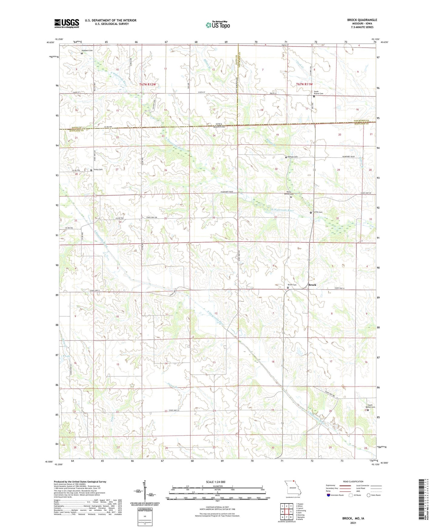
2021 topographic map quadrangle Brock in the states of Missouri, Iowa. Scale: 1:24000. Based on the newly updated USGS 7.5' US Topo map series, this map is in the following counties: Scotland, Davis, Van Buren. The map contains contour data, water features, and other items you are used to seeing on USGS maps, but also has updated roads and other features. This is the next generation of topographic maps. Printed on high-quality waterproof paper with UV fade-resistant inks.
Quads adjacent to this one:
West: Kilwinning
Northwest: Pulaski
North: Milton
Northeast: Cantril
East: Azen
Southeast: Arbela
South: Memphis
Southwest: Downing
This map covers the same area as the classic USGS quad with code o40092e2.
Contains the following named places: 1 B Lake, Bechtel Dam, Billups Branch, Billups Cemetery, Brock, Brock Cemetery, Brock School, Center Point School, Cone School, Curtiss Cemetery, Hubbard Cemetery, Leeper School, North Bethel Cemetery, Pleasant Hill School, Poe School, South Bethel Cemetery, South Prairie Cemetery, Township of Union, Trinity Cemetery, Trinity Methodist Episcopal Church, Wilson School