MyTopo
Bardley Missouri US Topo Map
Couldn't load pickup availability
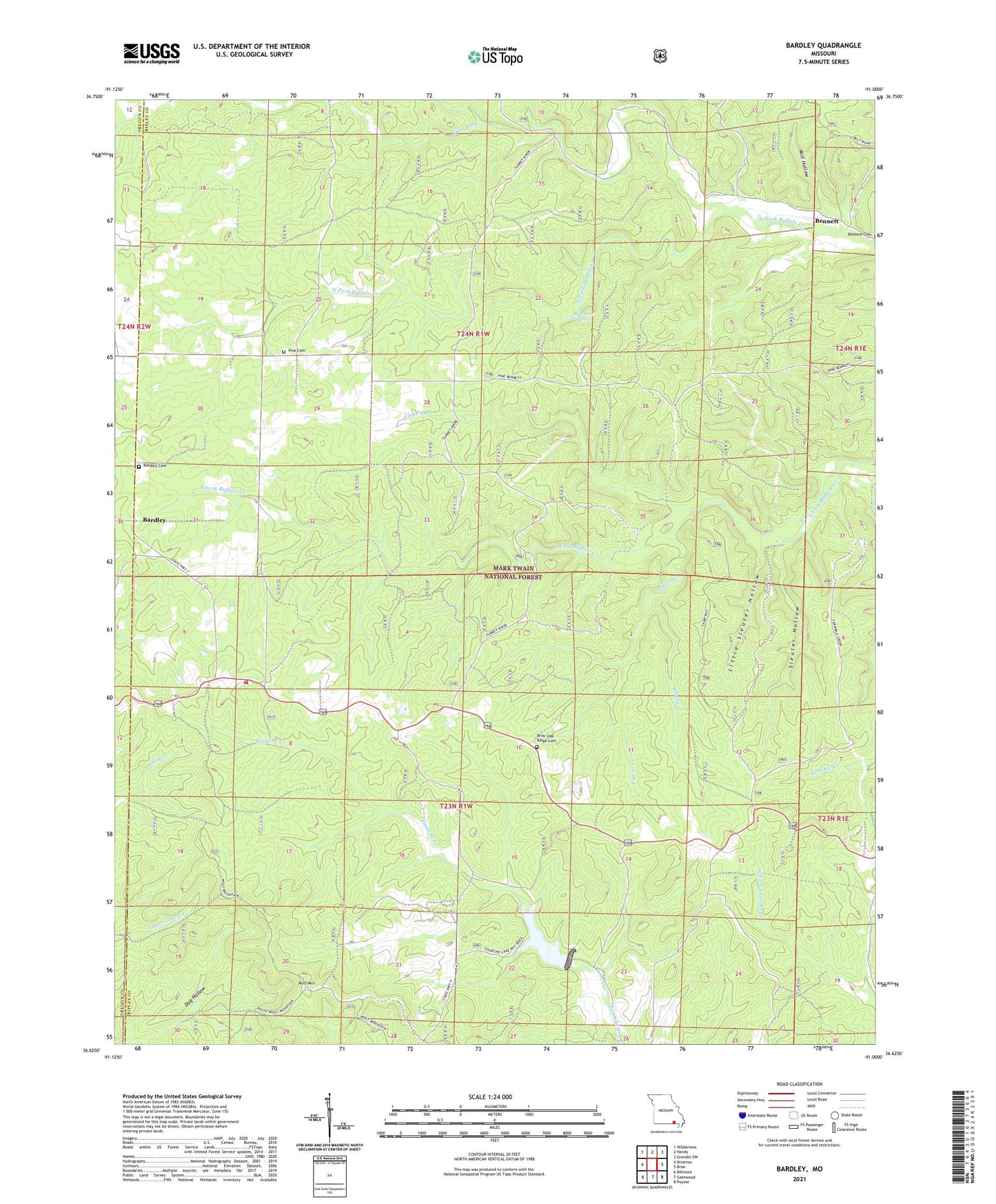
2021 topographic map quadrangle Bardley in the state of Missouri. Scale: 1:24000. Based on the newly updated USGS 7.5' US Topo map series, this map is in the following counties: Ripley, Oregon. The map contains contour data, water features, and other items you are used to seeing on USGS maps, but also has updated roads and other features. This is the next generation of topographic maps. Printed on high-quality waterproof paper with UV fade-resistant inks.
Quads adjacent to this one:
West: Riverton
Northwest: Wilderness
North: Handy
Northeast: Grandin SW
East: Briar
Southeast: Poynor
South: Gatewood
Southwest: Billmore
Contains the following named places: Bardley, Bardley Cemetery, Bardley Church, Bennett, Bennett Church, Bennett School, Blue Hole Spring, Briar Lookout Tower, Brushy Creek, Buffalo Creek Campground, Buffalo School, Camp Roy, Cave Fork, Clear Fork, Dunn School, Fourche Creek Dam, Fourche Lake, Fourche Lake Boat Access, Little Sleuter Hollow, Mill Hollow, Oak Ridge Church, Pigeon Creek, Pine, Pine Bradley Volunteer Fire Department, Pine Grove Missionary Baptist Church, Pine School, Sleuter Hollow, South Buffalo School, Township of Pine, Wolf Mountain