MyTopo
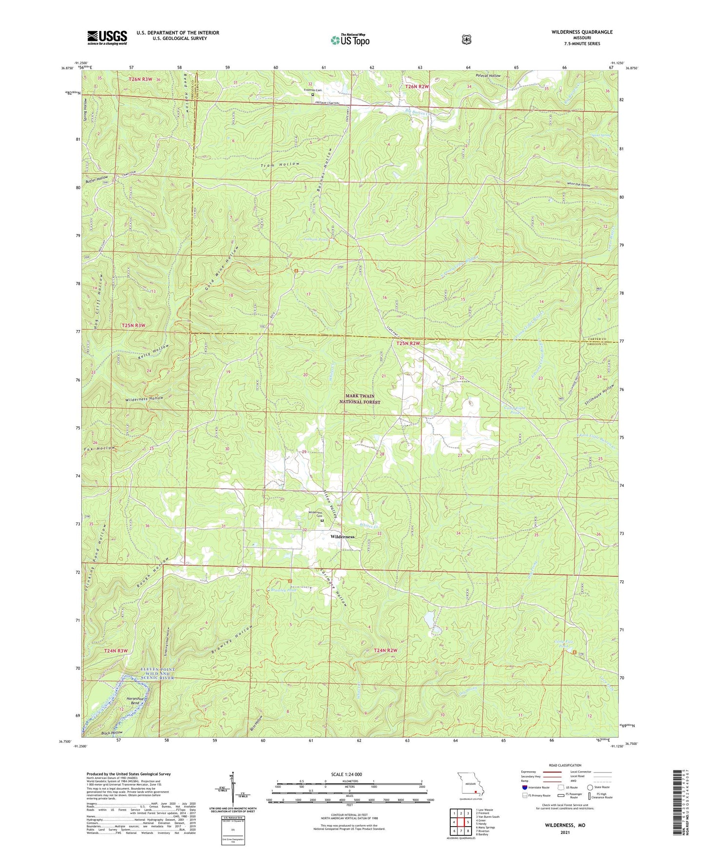
Wilderness Missouri US Topo Map
Couldn't load pickup availability
Also explore the Wilderness Forest Service Topo of this same quad for updated USFS data
2021 topographic map quadrangle Wilderness in the state of Missouri. Scale: 1:24000. Based on the newly updated USGS 7.5' US Topo map series, this map is in the following counties: Oregon, Carter. The map contains contour data, water features, and other items you are used to seeing on USGS maps, but also has updated roads and other features. This is the next generation of topographic maps. Printed on high-quality waterproof paper with UV fade-resistant inks.
Quads adjacent to this one:
West: Greer
Northwest: Low Wassie
North: Fremont
Northeast: Van Buren South
East: Handy
Southeast: Bardley
South: Riverton
Southwest: Many Springs
This map covers the same area as the classic USGS quad with code o36091g2.
Contains the following named places: Barnes Hollow, Black Hollow, Brawley Hollow, Brawley Pond, Camp Eight Pond, Camp Five Pond, Camp Nine Pond, Cotham Pond, Dry Prong, East Prong Cedar Bluff Creek, Freeman Cemetery, Gold Mine Hollow, Gum Spring School, Hog Cliff Hollow, Horseshoe Bend, Larimore Hollow, North Prong Cedar Bluff Creek, Pine Grove School, Polecat Hollow, Rough Hollow, Sinking Creek Lookout Tower, Sitton Valley, South Prong Cedar Bluff Creek, Spout Spring, Taylor Lake Dam, Township of King, Tram Hollow, Tumbling Shoal Hollow, Wilderness, Wilderness Hollow, Winona - Doniphan - Van Buren Ranger Districts