MyTopo
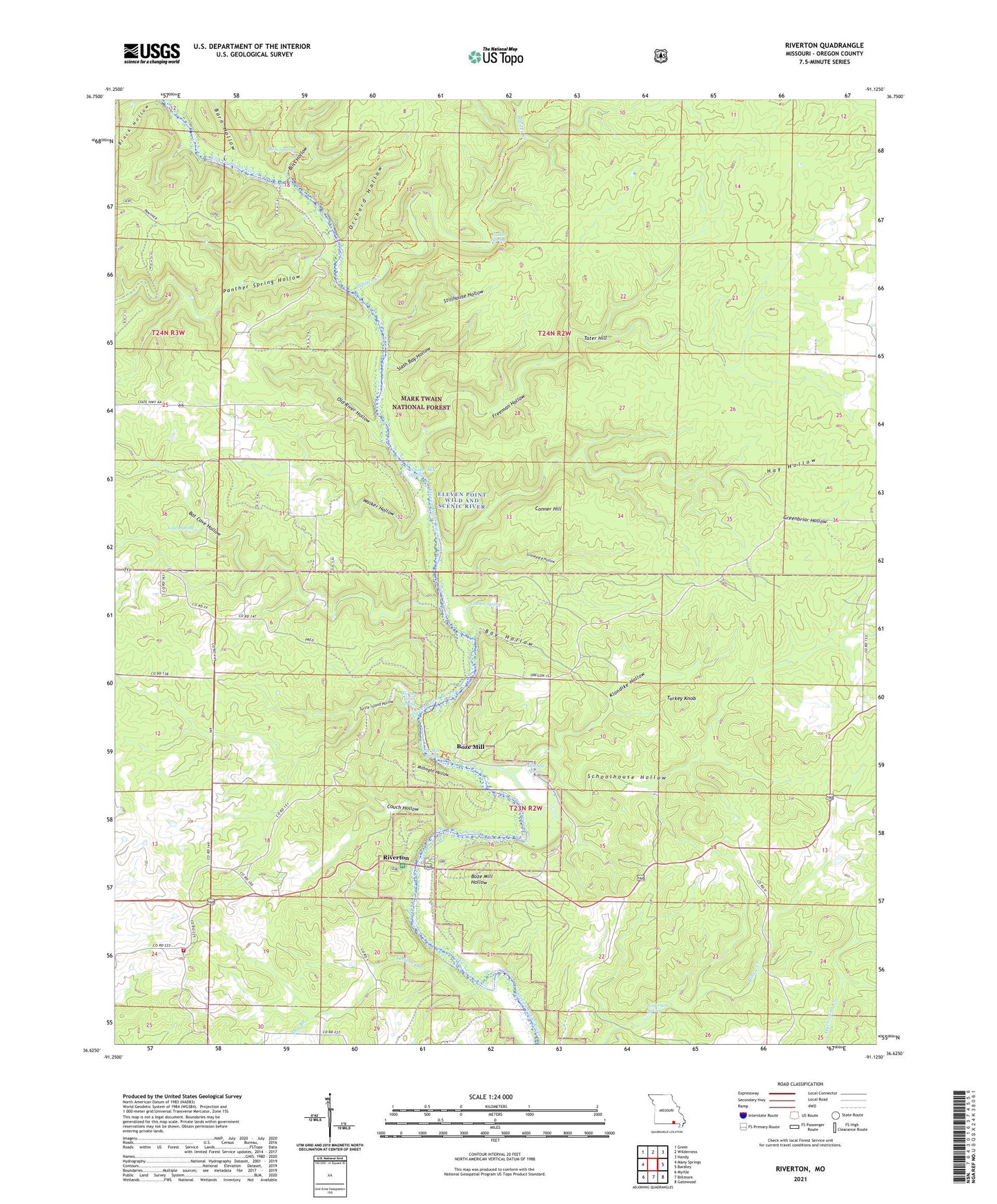
Riverton Missouri US Topo Map
Couldn't load pickup availability
Also explore the Riverton Forest Service Topo of this same quad for updated USFS data
2021 topographic map quadrangle Riverton in the state of Missouri. Scale: 1:24000. Based on the newly updated USGS 7.5' US Topo map series, this map is in the following counties: Oregon. The map contains contour data, water features, and other items you are used to seeing on USGS maps, but also has updated roads and other features. This is the next generation of topographic maps. Printed on high-quality waterproof paper with UV fade-resistant inks.
Quads adjacent to this one:
West: Many Springs
Northwest: Greer
North: Wilderness
Northeast: Handy
East: Bardley
Southeast: Gatewood
South: Billmore
Southwest: Myrtle
This map covers the same area as the classic USGS quad with code o36091f2.
Contains the following named places: Anderson Spring, Barn Hollow, Barn Hollow Float Camp, Bat Cave Hollow, Bay Hollow, BB Road Volunteer Fire Department, Bliss Hollow, Bliss Spring, Bliss Spring Campground, Boze Mill, Boze Mill Float Camp, Boze Mill Hollow, Boze Mill Spring, C C C Camp, Charter Oak School, Coin, Coin Post Office, Conner Hill, Conner Spring, Couch Hollow, Dry Branch, Fiddler Spring, Freeman Hollow, Graveyard Hollow, Greenbriar Float Camp, Greenbriar Hollow, Hay Hollow, Hollow Branch, Irish Wilderness, Jones Spring, Klondike Hollow, Lost Pond, Midnight Hollow, Mitchell School, Mitchell Spring, Morgan School, Negro Hill School, Old River Hollow, Orchard Hollow, Panther Spring Hollow, Powder Mill Spring, Riverton, Riverton Access Ramp and Canoe Dock, Riverton Church, Riverton West Picnic Area, Schoolhouse Hollow, Slash Bay Hollow, Stillhouse Hollow, Tater Hill, Township of Johnson, Township of Ozark, Turkey Knob, Turtle Island Hollow, Turtle Island Spring, Walker Hollow, Whites Creek, Whites Creek Float Camp, Whitten Access, Whitten Church, Whitten School, Windy Lookout Tower