MyTopo
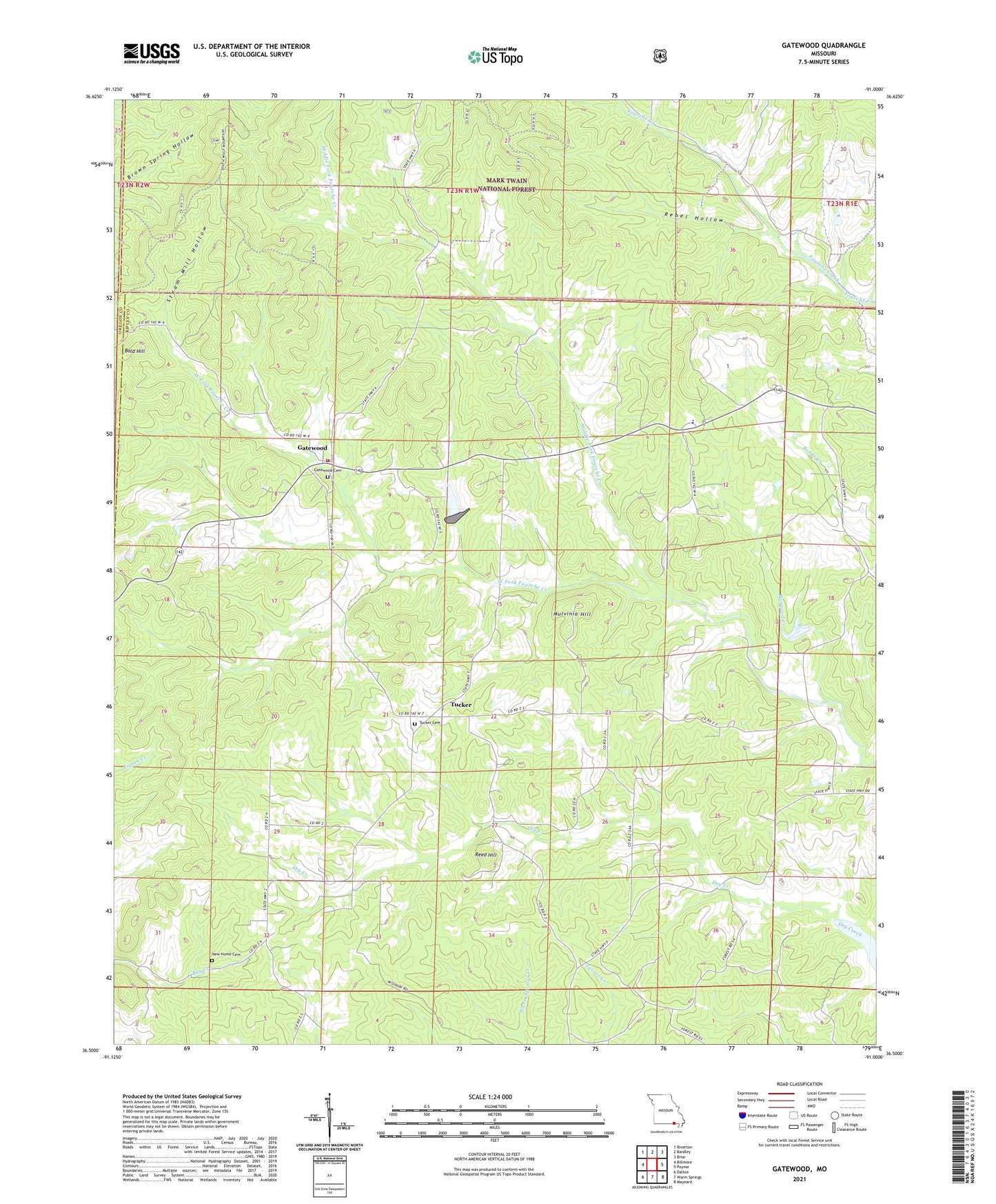
Gatewood Missouri US Topo Map
Couldn't load pickup availability
Also explore the Gatewood Forest Service Topo of this same quad for updated USFS data
2021 topographic map quadrangle Gatewood in the state of Missouri. Scale: 1:24000. Based on the newly updated USGS 7.5' US Topo map series, this map is in the following counties: Ripley, Oregon. The map contains contour data, water features, and other items you are used to seeing on USGS maps, but also has updated roads and other features. This is the next generation of topographic maps. Printed on high-quality waterproof paper with UV fade-resistant inks.
Quads adjacent to this one:
West: Billmore
Northwest: Riverton
North: Bardley
Northeast: Briar
East: Poynor
Southeast: Maynard
South: Warm Springs
Southwest: Dalton
This map covers the same area as the classic USGS quad with code o36091e1.
Contains the following named places: Bald Hill, Bennett School, Celynda, Celynda Post Office, Cuba School, Gatewood, Gatewood Census Designated Place, Gatewood Volunteer Fire Department Station 1, Gatewood Volunteer Fire Department Station 3, Haygood Creek, Johnson Chapel, Lebanon Church, Middle Fork Fourche Creek, Mount Pisgah School, Mulvinia Hill, Mulvinia Lookout Tower, New Home Church, Postoak School, Rebel Hollow, Reed Hill, School R-3, Spain School, Steam Mill Hollow, Township of Gatewood, Tucker, Tucker Church, ZIP Code: 63942