MyTopo
Bearcreek Missouri US Topo Map
Couldn't load pickup availability
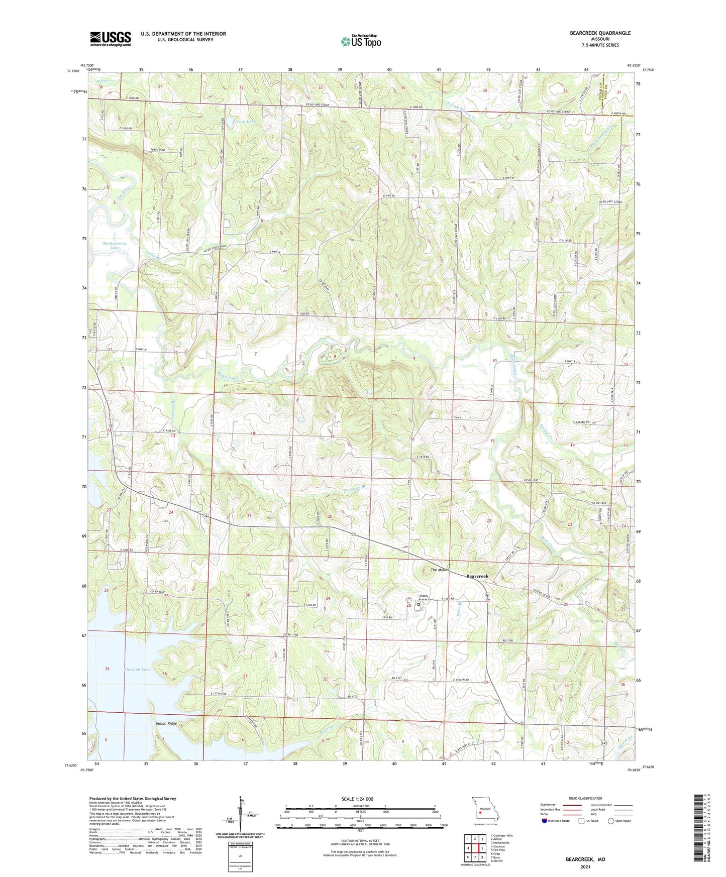
2021 topographic map quadrangle Bearcreek in the state of Missouri. Scale: 1:24000. Based on the newly updated USGS 7.5' US Topo map series, this map is in the following counties: Cedar, Polk. The map contains contour data, water features, and other items you are used to seeing on USGS maps, but also has updated roads and other features. This is the next generation of topographic maps. Printed on high-quality waterproof paper with UV fade-resistant inks.
Quads adjacent to this one:
West: Stockton
Northwest: Caplinger Mills
North: Arnica
Northeast: Humansville
East: Fair Play
Southeast: Aldrich
South: Bona
Southwest: Crisp
This map covers the same area as the classic USGS quad with code o37093f6.
Contains the following named places: Alder Branch, Alder Church, Alder School, Antioch Church, Bear Creek, Bearcreek, Crabtree Branch, El Dorado School, Forest Home Church, Friendship Community Hall, High Point Church, High Point School, Indian Ridge, Lindley Prairie Cemetery, Lindley Prairie Church, Mollie, Montgomery Lake, Montgomery School, Mountain Grove Church, Owens Mill, Price Branch, Red Hill School, Sand Hill Church, Spring Creek, The Mound, Township of Jefferson, Truitt Lake, Truitt Lake Dam