MyTopo
Stockton Missouri US Topo Map
Couldn't load pickup availability
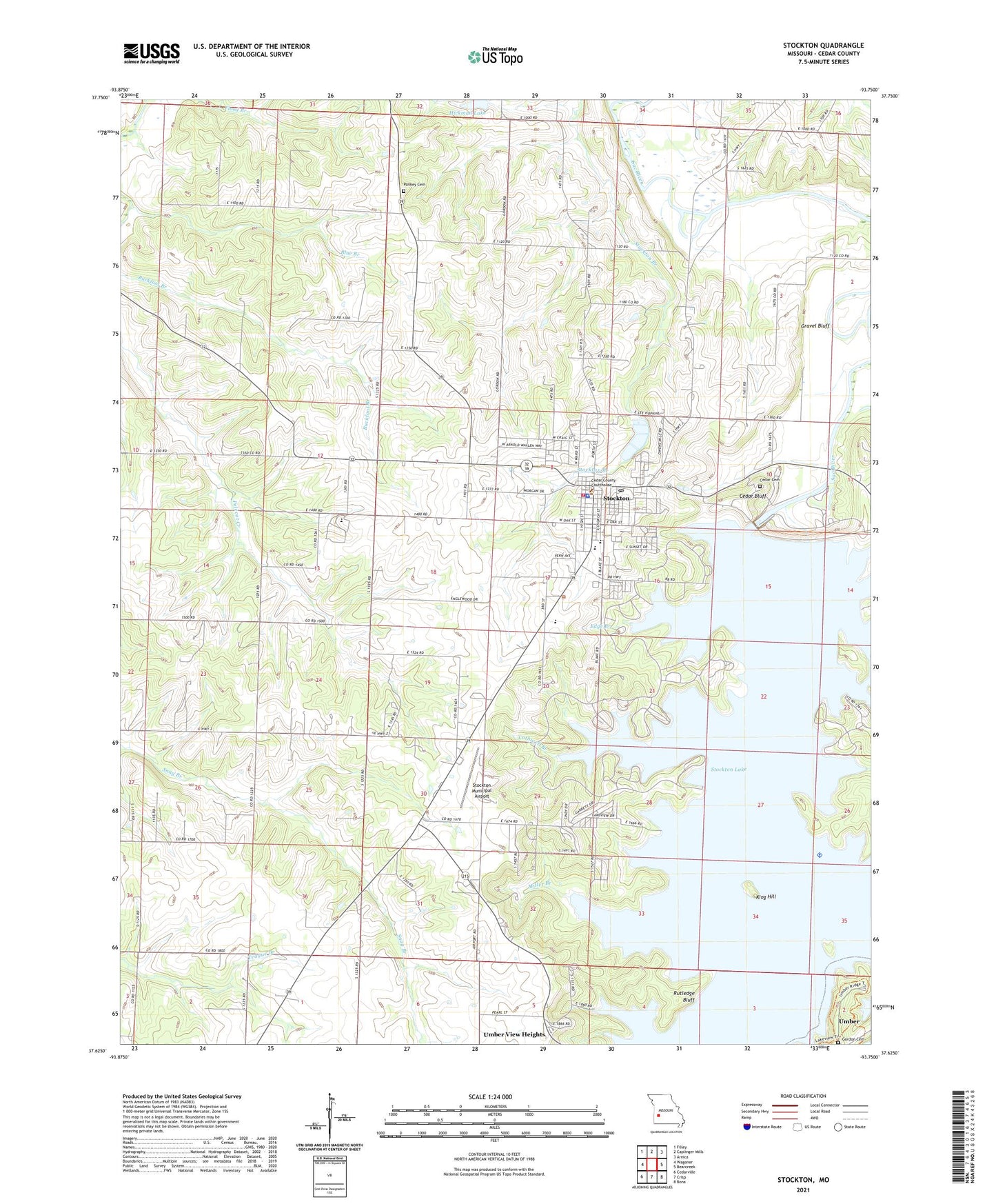
2021 topographic map quadrangle Stockton in the state of Missouri. Scale: 1:24000. Based on the newly updated USGS 7.5' US Topo map series, this map is in the following counties: Cedar. The map contains contour data, water features, and other items you are used to seeing on USGS maps, but also has updated roads and other features. This is the next generation of topographic maps. Printed on high-quality waterproof paper with UV fade-resistant inks.
Quads adjacent to this one:
West: Wagoner
Northwest: Filley
North: Caplinger Mills
Northeast: Arnica
East: Bearcreek
Southeast: Bona
South: Crisp
Southwest: Cedarville
This map covers the same area as the classic USGS quad with code o37093f7.
Contains the following named places: Blue Branch, Cedar Bluff, Cedar Cemetery, Cedar County, Cedar County Sheriff's Office, Center School, City of Stockton, Cothwell Branch, Crabtree Cove Public Use Area, Edge Branch, Excelsior Church, Excelsior School, Gordon Cemetery, Gravel Bluff, Gum Springs Church, Gum Springs School, Hawker Branch, Hickman Lake, King Hill, Little Sac River, Miller Branch, Old Mill Public Use Area, Orleans Trail Public Use Area, Pankey Cemetery, Prairie Valley Church, Prairie Valley School, Rose Hill School, Rutledge Bluff, Stockton, Stockton Country Club, Stockton Elementary School, Stockton Fire Department, Stockton High School, Stockton Lake Dam, Stockton Middle School, Stockton Municipal Airport, Stockton Police Department, Stockton Post Office, Stockton Public Use Area, Township of Linn, ZIP Code: 65785