MyTopo
Belgrade Missouri US Topo Map
Couldn't load pickup availability
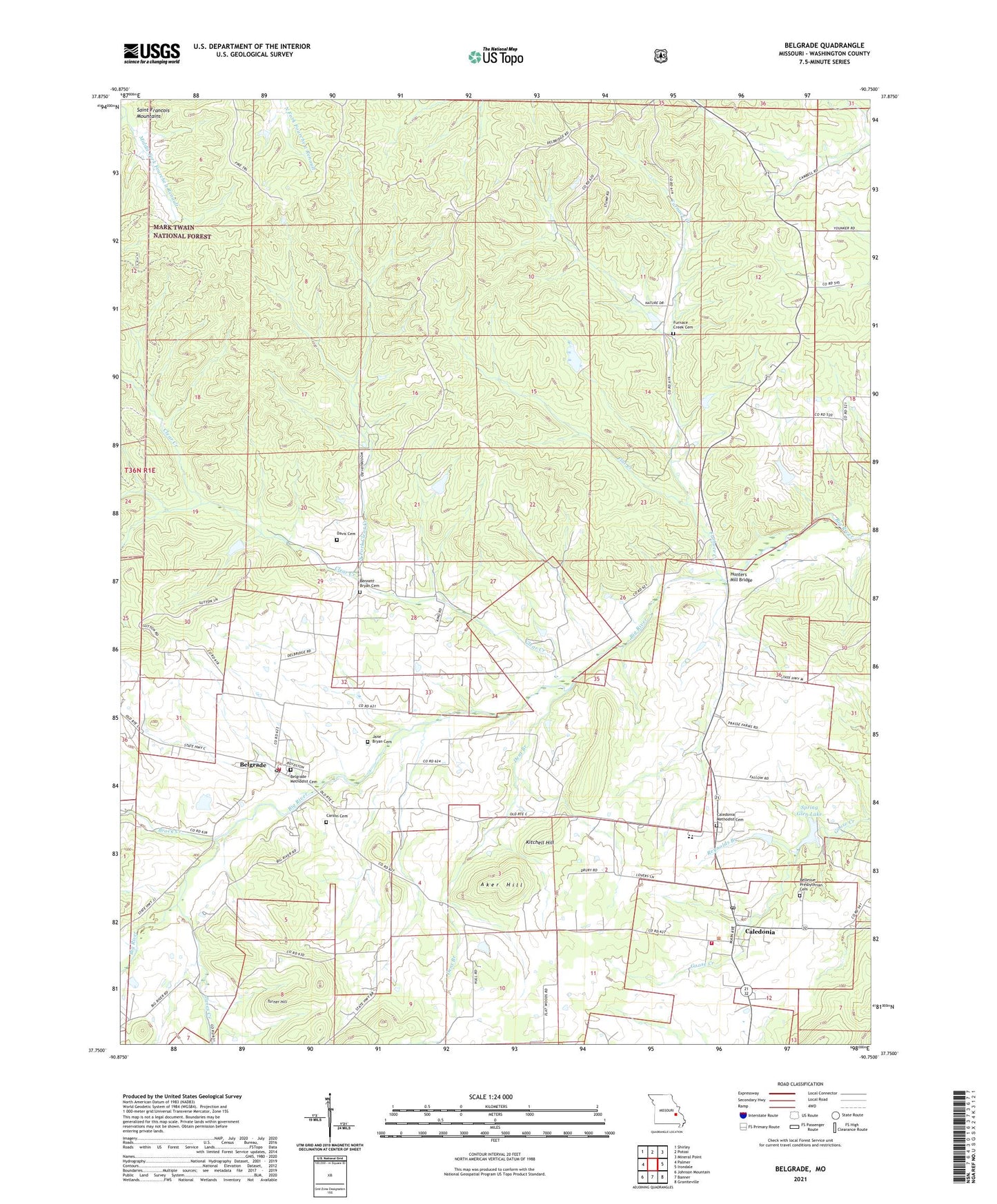
2021 topographic map quadrangle Belgrade in the state of Missouri. Scale: 1:24000. Based on the newly updated USGS 7.5' US Topo map series, this map is in the following counties: Washington. The map contains contour data, water features, and other items you are used to seeing on USGS maps, but also has updated roads and other features. This is the next generation of topographic maps. Printed on high-quality waterproof paper with UV fade-resistant inks.
Quads adjacent to this one:
West: Palmer
Northwest: Shirley
North: Potosi
Northeast: Mineral Point
East: Irondale
Southeast: Graniteville
South: Banner
Southwest: Johnson Mountain
Contains the following named places: Aker Hill, Belgrade, Belgrade Dam, Belgrade Methodist Cemetery, Belgrade Post Office, Belgrade School, Belgrade Volunteer Fire Department, Belleview Collegiate Institution, Belleview Presbyterian Church, Bellevue Presbyterian Cemetery, Bennett Bryan Cemetery, Breckenridge School, Bressie Lake Dam, Brock Creek, Bryan Gristmill, Caledonia, Caledonia Fire Protection District, Caledonia Methodist Cemetery, Caledonia Post Office, Carson Cemetery, Church of God, Clear Creek, Davis Cemetery, Dent Branch, Deslodge Land, Dry Bone Shaft, Farquaher Lead Diggings, Flat Creek, Furnace Creek, Furnace Creek Cemetery, Furnace Creek School, Hunters Mill, Hunters Mill Bridge, Jane Bryan Cemetery, Janes Creek, Jumbo Shaft, Kitchell Hill, Lake Loomis Dam, Nicholson Iron Bank, North Fork Clear Creek, Number 267 Dam, Pleasant Grove Church, Pleasant Grove School, Podorski Lake Dam, Reynolds Branch, Rieffer Lake Dam, Short-N-Ruff Airport, Sloan School, Spring Glen Lake, Spring Glen Lake Dam, Turner Hill, Valley High School, Village of Caledonia, ZIP Code: 63631