MyTopo
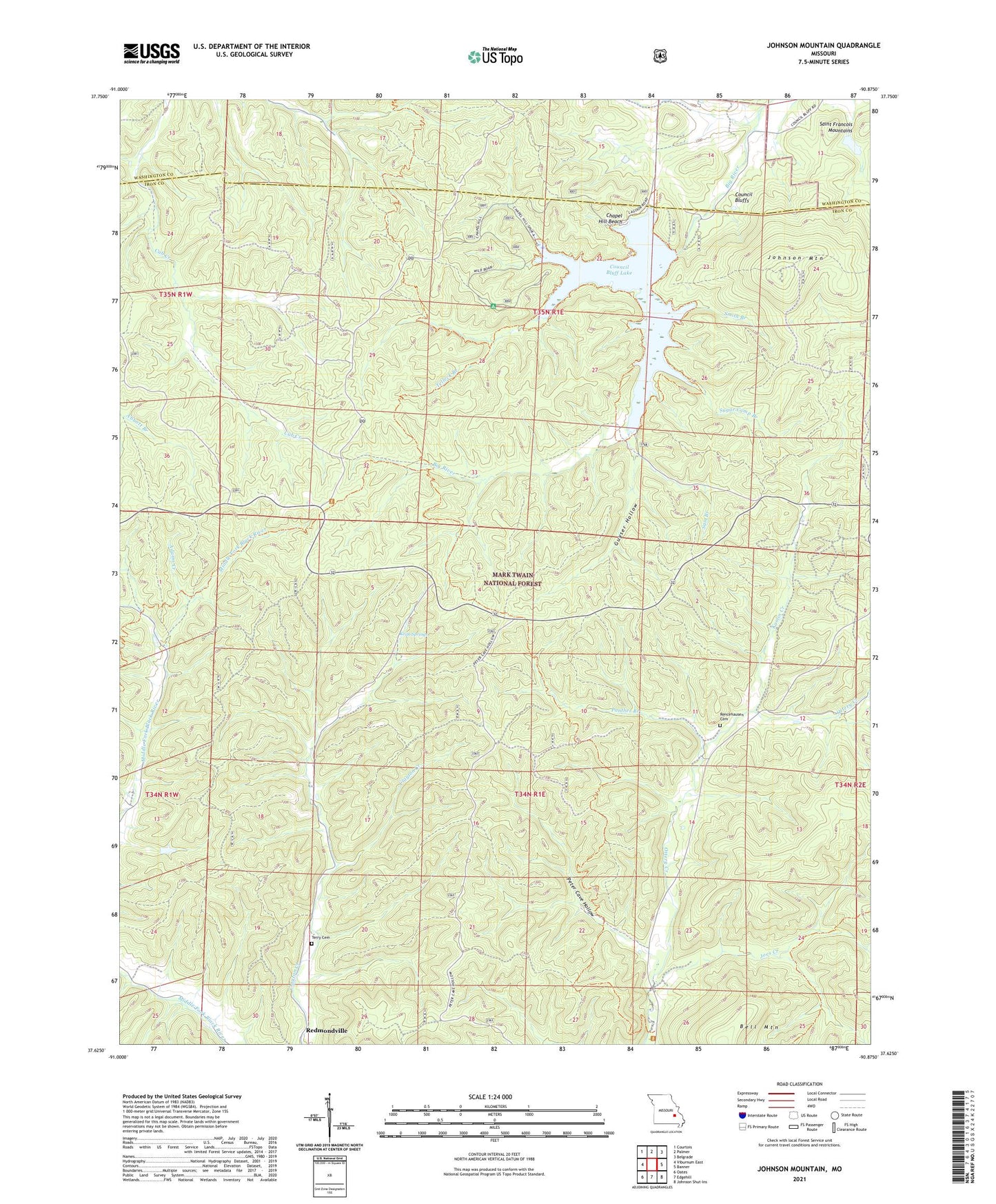
Johnson Mountain Missouri US Topo Map
Couldn't load pickup availability
Also explore the Johnson Mountain Forest Service Topo of this same quad for updated USFS data
2021 topographic map quadrangle Johnson Mountain in the state of Missouri. Scale: 1:24000. Based on the newly updated USGS 7.5' US Topo map series, this map is in the following counties: Iron, Washington. The map contains contour data, water features, and other items you are used to seeing on USGS maps, but also has updated roads and other features. This is the next generation of topographic maps. Printed on high-quality waterproof paper with UV fade-resistant inks.
Quads adjacent to this one:
West: Viburnum East
Northwest: Courtois
North: Palmer
Northeast: Belgrade
East: Banner
Southeast: Johnson Shut-Ins
South: Edgehill
Southwest: Oates
This map covers the same area as the classic USGS quad with code o37090f8.
Contains the following named places: Adams Creek, Bells School, Beulah Land Church, Chapel Hill Beach, Council Bluff Church, Council Bluff Dam, Council Bluff Lake, Council Bluffs, Cub Creek School, Enough, Enough Boat Launch, Guyser Hollow, Joes Creek, Johnson Mountain, Kaolin Creek, Keith Springs, Keith Springs Picnic Area, Maxwells Mill, Mitchell Lake Dam, Montana School, Mountainville Store, Ottery Church, Panther Branch, Peter Cave Hollow, Redmondville, Redmondville School, Rencehausen Cemetery, Sam Branch, Shepard, Smith Branch, Sugar Camp Branch, Telleck Branch, Terry Cemetery, Township of Kaolin, Walnut Grove Missionary Baptist Church, Wild Boar Hollow Boat Launch, Wild Boar Ridge Campground, ZIP Code: 63623