MyTopo
Irondale Missouri US Topo Map
Couldn't load pickup availability
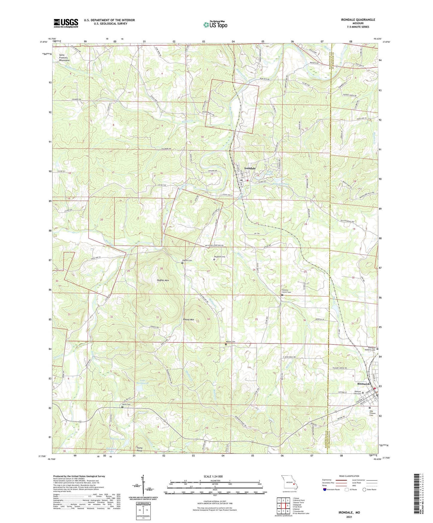
2021 topographic map quadrangle Irondale in the state of Missouri. Scale: 1:24000. Based on the newly updated USGS 7.5' US Topo map series, this map is in the following counties: Washington, St. Francois. The map contains contour data, water features, and other items you are used to seeing on USGS maps, but also has updated roads and other features. This is the next generation of topographic maps. Printed on high-quality waterproof paper with UV fade-resistant inks.
Quads adjacent to this one:
West: Belgrade
Northwest: Potosi
North: Mineral Point
Northeast: Bonne Terre
East: Flat River
Southeast: Iron Mountain Lake
South: Graniteville
Southwest: Banner
This map covers the same area as the classic USGS quad with code o37090g6.
Contains the following named places: Adams Property, Alum Cave Methodist Church, Alum Cave School, Big River Cemetery, Bismarck Fire Department, Bismarck Masonic Cemetery, Bismarck Rural Fire Protection Association, Blay Creek, Camp Irondale, Cates Lake Dam, Cedar Creek, City of Irondale, Davis Cemetery, Dry Creek, Eaton Iron Bank, Evans Mine, Eversole Mine, Goose Creek, Hayden Creek, Hayden Creek Mine, Hazel Glen School, Hickory Grove Cemetery, Hickory Grove Church, Hickory Grove School, Hill View Lake Dam South, Hillview Lake, Hillview Lake Dam, Hopewell Creek, Hughes Cemetery, Hughes Creek, Hughes Mill, Hughes Mountain, Irondale, Irondale Community Volunteer Fire Department, Irondale Lake, Irondale Mine, Irondale Post Office, Kirkpatrick Iron Bank, Lake Apache, Lake Apache Dam, Lake Cherokee, Lake Cherokee Dam, Lake Sacajawea, Lost Creek, Maryden, McCormack Ford, Mill Creek, Red Rock, Rock Spring School, Round Mountain, Scott Iron Bank, Sherlock School, Township of Bellevue, Township of Concord, Wallen Cemetery, Wallen Creek, Yacovelli Lake Dam, ZIP Codes: 63624, 63648