MyTopo
Belton Missouri US Topo Map
Couldn't load pickup availability
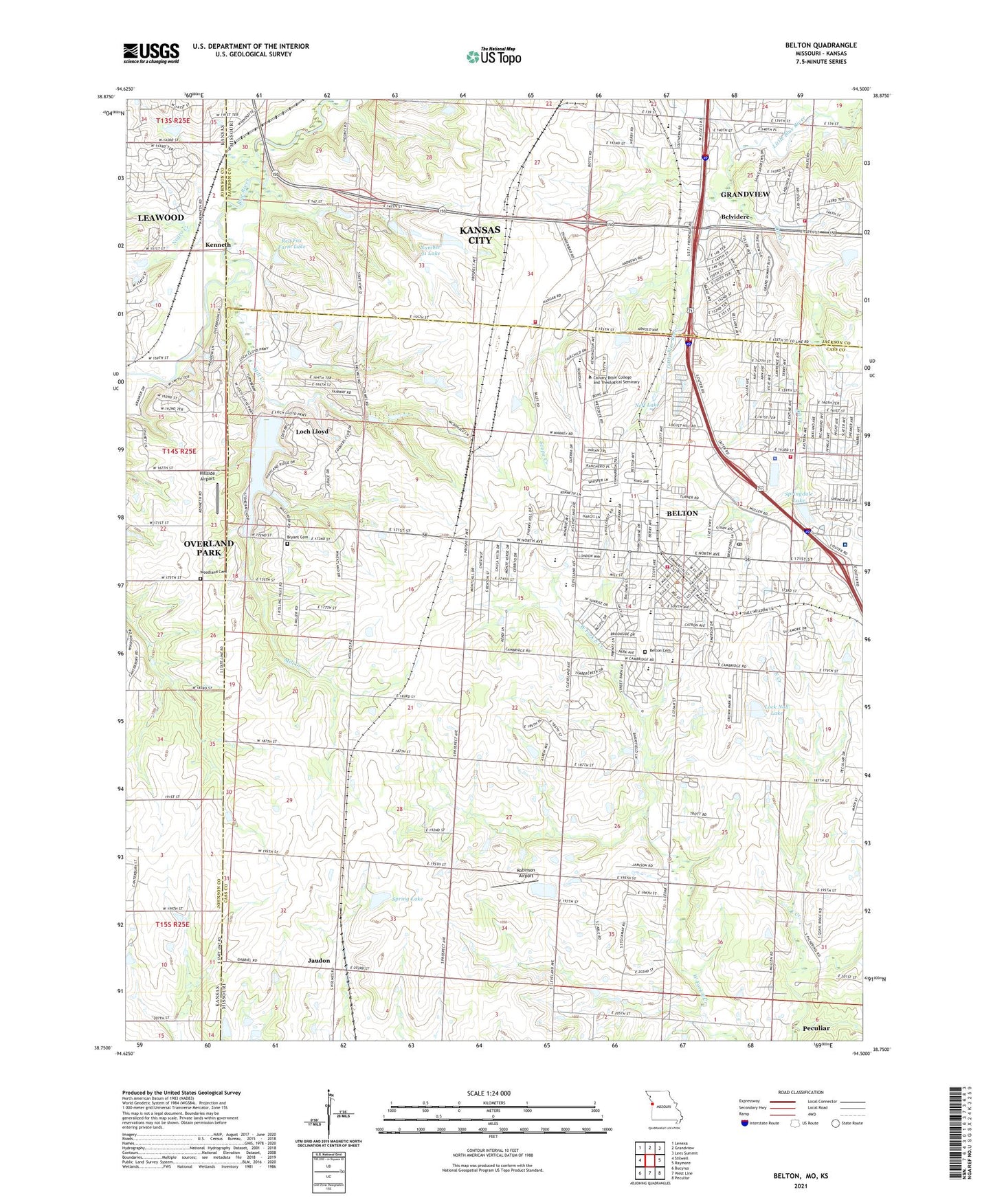
2021 topographic map quadrangle Belton in the states of Missouri, Kansas. Scale: 1:24000. Based on the newly updated USGS 7.5' US Topo map series, this map is in the following counties: Cass, Jackson, Johnson. The map contains contour data, water features, and other items you are used to seeing on USGS maps, but also has updated roads and other features. This is the next generation of topographic maps. Printed on high-quality waterproof paper with UV fade-resistant inks.
Quads adjacent to this one:
West: Stilwell
Northwest: Lenexa
North: Grandview
Northeast: Lees Summit
East: Raymore
Southeast: Peculiar
South: West Line
Southwest: Bucyrus
Contains the following named places: Bauman Dam, Bel-Ray Plaza, Belton, Belton - Ozanam Southland Cooperative School, Belton Academy, Belton Cemetery, Belton Fire Department Station 1, Belton Fire Department Station 2, Belton High School, Belton High School Freshman Center, Belton Police Department, Belton Post Office, Belton Regional Medical Center, Belvidere, Belvidere Elementary School, Bi - State Business Park, Blue Ridge Christian School South, Bryant Cemetery, Butcher - Greene Elementary School, Cambridge Elementary School, Camden Woods Center, Cedar Tree Square, Christ Community Church Leawood Campus, City of Belton, Gladden Elementary School, Grace Early Childhood Care and Education Center, Grandview Fire Department Station 2, Heartland High School and Academy, High Blue School, Hillcrest Elementary School, Hillside Airport, Jaudon, Johnson County Blue River District Number 1 Wastewater Plant, Kansas City Missouri Fire Department Station 1, Kansas City Urban Region, Kemper Dam, Kenneth, Knoche Oil Field, Loch Lloyd, Lock Noll Lake, Lock Noll Lake Dam, Marine Corps Reserve Support Command Kansas City, Meadows Shopping Center, Mill Creek, Mill Creek Upper Elementary School, Mount Pleasant School, Neff Lake, Neff Lake Dam, Negro Creek, North Cass Shopping Center, Number 683 Dam, Number 91 Lake, Oasis Mobile Home Park, Oil Creek, Olson Acres, Pinnacle Career Institute, Red Fox Farm Lake, Research Belton Hospital Heliport, Rhoden Investment Dam, Richards - Gebaur Airport, Richards-Gebaur Air Force Base, Robinson Airport, Scope Creek, Scott Elementary School, Spring Lake, Spring Lake Dam, Springdale Lake, Springdale Lake Dam, Strang Line Barn Museum, Township of Kaw, Township of Mount Pleasant, Twin Oaks Shopping Center, Village of Loch Lloyd, Villnave Airport, West Belton, Westover School, Williams Lake Dam, Woodland Cemetery, Yeokum Middle School, ZIP Codes: 64012, 64145, 64147